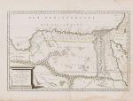
Sanson d'Abbeville, Royme, et Desert de Barca et 'L'Egypte Divisee en ses douze
Royme, et Desert de Barca et ‘L’Egypte Divisee en ses douze Cassifs, ou Gouvernemens.
Original hand-coloured engraving. Paris, Chez P. Mariette, 1655. Plate Size: 52.5 cm x 34.1 cm. Sheet Size: 58 cm x 44.5 cm. Original map. In good condition. Signs of browning and staining to map margins. Minor tear to margins along centre fold.
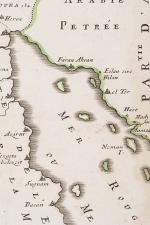
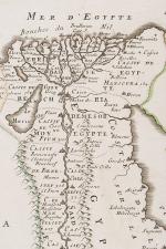
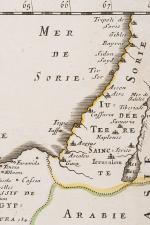
A richly detailed map showing the North African and Mediterranean coastlines, from the kingdom of Tripoli in the west, across the ‘Royaume de Barca’ in Libya, along the Egyptian coast and up to the shores of modern-day Israel and Lebanon. A portion of the Arabian Peninsula can also be seen and the Red Sea, the Dead Sea and Sea of Galilee are also included on the map. The Nile river is shown running from the lower part of the map in Nubia, past Cairo, to its estuary at Alexandria on Egypt’s coast. The Atlas Mountains are shown pictorially as are the other mountains and hills. Oases, such as those near Sabia and Alguechet and Gorham, are also depicted pictorially, breaking up the otherwise desolate-looking expanse of the Libyan desert. The pyramids at Giza are marked as three triangles. Jerusalem can be seen in the top right of the map, where the costal cities of ‘Tir’ (Tyre), ‘Bayrut’ (Beirut) and Jaffa can also be located. In La Grande Syrte (Gulf of Sidra) a treacherous-looking ‘Senocha Syrtes is highlighted. The Tropic of Cancer runs the breath of the map’s lower section.
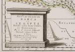
The ornamental plinth title cartouche in the lower left corner of the map is accompanied by two pyraminds. A scalebar is also included.
Nicolas Sanson (20 December 1600 – 7 July 1667) was a French cartographer, termed by some the creator of French geography, in which he’s been called the “father of French cartography.” The French school of Geography was unprecedented in its attention to precision and scientific detail and discarded much of the decorative embellishments of previous maps as irrelevant. From Sanson’s time in the second half of the seventeenth century until the latter part of the eighteenth century, French geographical conceptions were more influential than those put forward by any other nation. He was tutor to Louis XIII and Louis XIV. Sanson published over 300 maps. In 1692 Hubert Jaillot collected Sanson’s maps in an Atlas nouveau. (Wikipedia)
- Keywords: 17th Century · Africa · Africa, North · Cartography · Catalogue No.5 – Maps of the World · Egypt · French · Library & Collection Building · Libya · Map · Map, African · Mediterranean · Middle East · Nile · North Africa · Original Engraving · Original Map · Original Maps · Rare Map Africa · Rare Map Egypt · Rare Maps Collection – Africa · Vintage Map
- Inventory Number: 200045AG
© 2024 Inanna Rare Books Ltd. | Powered by HESCOM-Software


