5655. Payne, John / Zachariah Jackson [Dublin Printer].
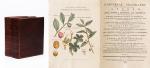
Universal Geography – Formed Into A New And Entire System; Describing Asia, Africa, Europe And America ; With Their Subdivision Of Empires, Kingdoms, States And Republics : The Extend, Boundaries, and remarkable Appearances of each Country ; Cities, Towns, and Curiosities of Nature and Art. Also giving A general Account of the Fossil and Vegetable Production of the Earth, and of every Species of Animal : The History of Man, In all Climates, Regions, And Conditions ; Customs, Manners, Laws, Governments, And Religions : The State of Arts, Sciences, Commerce, Manufactures, And Knowledge : Sketches of the Ancient and Modern History of each Nation and People. To which is added, A Short View of Astronomy, As Connected With Geography ; Of The Planetary System to which the Earth belongs ; And of the Universe in General. With a Set of Maps, drawn from the best Materials, every one of which is very neatly coloured ; And a great Variety of Copper-Plates ; Descriptive of the most Remarkable Curiosities in the World. [This Edition with all three Volumes but only with 14 Maps, 3 Colour-Engravings and 5 Black-and-White Engravings (see detailed listing of these Maps and Engravings at the end of this Bibliography)].
Two Volumes in Three Parts (bound in Two Volumes). Dublin, Printed by Zachariah Jackson, 1793 – 1794 Quarto (23 cm wide x 28 cm high). Pagination: Volume I: Hand-coloured Frontispiece, VI [Subscribers], XIII, 894 pages [page 555 misprinted as 454] [Stating “The End” at the end of the Volume] with Four Maps and Three engravings (including Frontispiece) / Volume II: Hand-coloured Frontispiece, 792 pages [Stating “End Of The Second Volume” at the end of Volume II] with Ten Maps and One Engraving (Frontispiece) / [Volume III] is Bound to the rear of Volume II and is falsely ending with “End of The Second Volume” even though it is the “Continuation of Book IV” and in all other listings of this book internationally is accepted to be Volume III. Pagination of [Volume III]: Hand-coloured Frontispiece, [No separate titlepage], 416 pages, XXXIII pages of an Index, 1 page “Directions to the Binder”, 10 pages “A Chronological Table of Remarkable Events, Discoveries and Inventions”, with Four Engravings (including Frontispiece). Hardcover / Modern Binding in the style of the 18th century. Full leather with gilt lettering on spine. Very minor signs of neglectable, minimal wormhole-damage. Obviously this work was robbed of many of the maps but those which remain have the original hand-colouring in stunning condition (see description). Overall near Fine condiiton of this extremely rare set, with only minor signs of wear. Page 199/200 of Volume II with longer cut (Text not effected). All the engravings and maps without defects.







![[Richard Parker] - Die schwimmende Republik. ['The Floating Republic']](/images/thumbnails/29237AB.jpg)












![Parsons, Lone Star Living - Texas Homes and Ranches [Signed / Inscribed by PhotographerJack Parsons].](/images/thumbnails/32176AB.jpg)



![Boris Pasternak - Doktor Zhivago. [Rare Original Russian Edition]](/images/thumbnails/29201AB.jpg)


![Daniel Paterson & Edward Mogg - Paterson's Roads [1831/1832 Edition (18th Edition) with 12 Maps]](/images/thumbnails/31251AB.jpg)





![Patterson, The Harp and Irish Music [Article in Journal of the Ivernian Society Volume III - January - March]](/images/thumbnails/101157AB.jpg)

![[Pattison, Sister Dora - A Biography [of english nurse Dorothy W. Pattison].](/images/thumbnails/29221AB.jpg)
![[Paul de Man] Weinrich, Positionen der Negativität.](/images/thumbnails/29813AB.jpg)























![Klaus Stopp - The printed birth and baptismal certificates of the German Americans [Pennsylvania Germans]](/images/thumbnails/31173AB.jpg)