


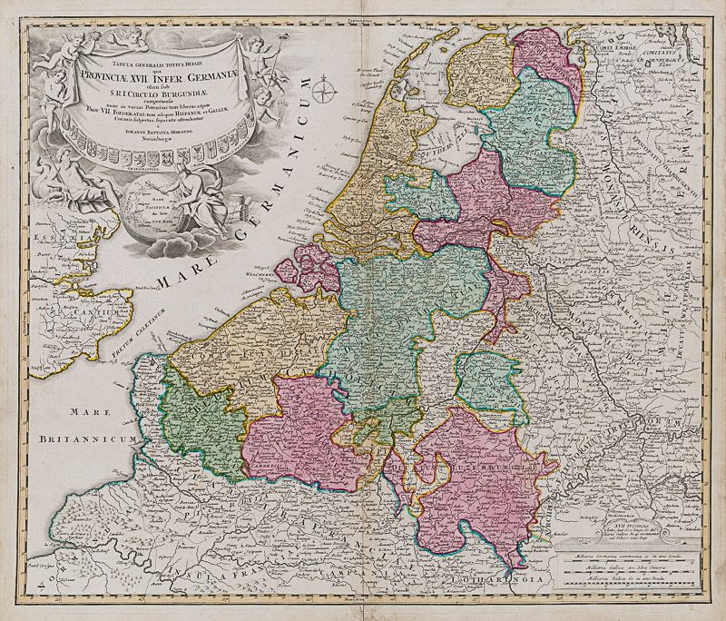
Homann, Tabula Generalis Totius Belgii qua Provinciae, XVII. Infer. Germaniae ol
Tabula Generalis Totius Belgii qua Provinciae, XVII. Infer. Germaniae olim sub S. R.I. Circulo Burgundiae comprehensae nunc in Varias Potentias tum liberas utpote Prov. VII Foederaras, tum reliquas Hispaniae et Gakkiae, Coronis Subjectas, seperate ostencluntur.
Original hand-coloured engraving. Nuremburg, Homann, [c.1720]. Plate Size: 57.2 cm x 48.4 cm. Sheet Size: 60.2 cm x 52.4 cm. Original map. In very good condition. Clean and crisp. Repaired tears to centre-fold. Slight hint of glue-staining along centre-fold. Faintest trace of browning to outer margins only.
[Heijden, Nederlanden 245/1].
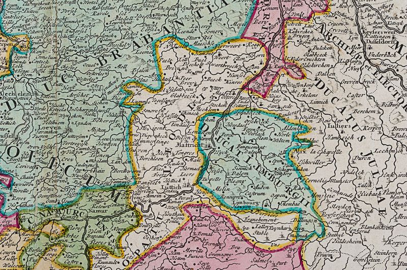
Very interesting map of the Low Countries – the modern countries of Luxembourg, Belgium and the Netherlands – in eye-catching detail. The region is dominated by the Seine River emptying into the ‘Mare Britannicum’ in the south, the Rhine and Meuse in the centre and the River Ems discharging into the Dollart Bay in the right top corner of the map. The political subdivisions are clearly identified with the Provinces clearly outlined: from Comit Artesiae (Artois) in the south to Respublica Groningana (Groningen) in the North. Relief given pictorially and place names appear in Latin. The great Dutch trading ports of Amsterdam, Rotterdam and Antwerp are all identifiable as are Brussels, Louvain, Maastricht and Liege.
In the lower part of the map lies the north of France while the patchwork of the German duchies, bishoprics, electorates and statelets of the Holy Roman Empire lie to the east. Across the narrow ‘Fretum Caletanum’ (Strait of Dover) is Britain. The sandbars of the shallow Zuyder Zee are also shown on the map.
A beautifully elaborate title cartouche with 17 coats of arms, an ornate allegorical maritime scene featuring winged putti, a reclining Neptune and Mercury pointing to a globe oriented to the ‘Mare Pacificum das stille Sud Meer’ (Pacific Ocean) and naming Japan, the Philippines, Nova Hollandia (Australia), Nova Zeelandia, Molluca (Spice Islands), Java and Mexico, and Peru. The nomenclature used is suggestive of Dutch influence in the region. The prized Java and the Spice Islands would remain part of the Dutch colonial empire until the 20th Century.
A compass rose lies just off the well-described Dutch coastline. In the lower right corner of the map are three milliaria scale bars.
Johann Baptist Homann (1663-1724) was a mapmaker who founded the famous Homann Heirs publishing company. He spent his life
in Bavaria, especially in Nuremberg. Initially, Johann trained to become a priest before converting to Protestantism and working as a notary. In 1702, Homann founded a publishing house that specialized in engravings. The firm flourished, becoming the leading map publisher in Germany and an important player in the European map market. In 1715, Johann was named Imperial Geographer to the Holy Roman Empire by Charles VI and made a member of the Prussian Academy of Sciences. Most significantly for his business, his reputation and contacts gained him Imperial printing privileges which protected his publications and recommended him to customers. Johann is best known for this Grosser Atlas ueber die ganze Welt, or the Grand Atlas of the World, published in 1716.
After Johann died in 1724, the business passed to his son, Christoph (1703-1730). Upon Christoph’s early death, the company passed to subsequent heirs, with the name of the company changing to Homann Erben, or Homann Heirs. The firm continued operating until 1848.
- Keywords: 18th Century · 18th Century Map · Belgium · Burgund · Cartography · Catalogue No.5 – Maps of the World · Europe · Holland · Low Countries · Map · Original Map · Original Maps · Rare Map – Holland · Rare Map – The Netherlands · Rare Map Europe · Rare Map of Burgundy · Vintage Map
- Inventory Number: 200036AG
EUR 375,--
We ship per DHL Express


Contact
Inanna Rare Books Ltd.
Woodley House
Castletownshend Road
P81 D262 Skibbereen, County Cork
Ireland
Phone: ++353 - (0) 87 - 102 5412
E-Mail: info@inannararebooks.com
Internet: https://www.inannararebooks.com
Online Bookshop specialized in rare
and secondhand books.
Newsletter and E-Catalogue Sign Up
Payment Options


© 2025 Inanna Rare Books Ltd. | Powered by HESCOM-Software

