Inanna Rare Books

Inanna Rare Books

Inanna Rare Books

    • Home
    • About us
    • Shipping Information
    • Search File
    • Contact
    • Cart
    • Rare Book Room
      • Books on Books
      • History - Politics - Law
      • Literature
      • Philosophy & Religion
      • Social Sciences - Education
      • Medicine
      • The Arts
      • Travel & Exploration
      • Mathematics
      • Science & Technology
      • Farming - Fishing - Hunting
      • Natural History
      • Games - Sport
      • Complete Catalogue
    • Art & Map Gallery
      • Art Gallery
      • Rare Maps & Cartography
    • Manuscripts
      • Manuscripts - Literature
      • Manuscripts - History
      • Manuscripts - Travel
      • Manuscripts - Food
      • Manuscripts - Music
      • Manuscripts - Secret Knowledge
      • Manuscript Letters/Autographs
      • Manuscripts - Art
      • Manuscripts - Philosophy
    • Gift Ideas / New Arrivals
      • New Arrivals
      • Gift Ideas for Collectors
      • Gift Wrapping Available
      • Handmade Paper
      • Gift Wrapping Available
    • Inanna Publishing
    • Libraries & Collections
      • African Maps Collection
      • Henry David Aiken - Collection
      • Samuel Beckett - Collection
      • Walter Benjamin - Collection
      • Alexander Calder Collection
      • Castlefreke - Collection
      • Alice Curtayne Collection
      • Fly Fishing / Angling Collection
      • Vere Foster - Collection
      • William Daniel Gill Collection
      • John Minihan Collection
      • David (Dave) Naylor - Collection
      • Roger O'Connor Collection
      • David Puttnam Collection
      • Savigny Collection
      • Eric Ravilious Collection SOLD
    • Catalogues
    • News / Events
  • Advanced Search
  • List
    • Terms & Conditions
    • Contract Withdrawal
    • Cancellation Policy
    • Privacy Policy
    • Shipping Information
    • Imprint
INANNA MODERNWest Cork Reading Holidays
We ship per DHL Express

We ship per DHL Express

Advanced Search
  • Rare Book Room
    • Books on Books
    • History - Politics - Law
    • Literature
    • Philosophy & Religion
    • Social Sciences - Education
    • Medicine
    • The Arts
    • Travel & Exploration
    • Mathematics
    • Science & Technology
    • Farming - Fishing - Hunting
    • Natural History
    • Games - Sport
    • Complete Catalogue
  • Art & Map Gallery
    • Art Gallery
    • Rare Maps & Cartography
  • Manuscripts
    • Manuscripts - Literature
    • Manuscripts - History
    • Manuscripts - Travel
    • Manuscripts - Food
    • Manuscripts - Music
    • Manuscripts - Secret Knowledge
    • Manuscript Letters/Autographs
    • Manuscripts - Art
    • Manuscripts - Philosophy
  • Gift Ideas / New Arrivals
    • New Arrivals
    • Gift Ideas for Collectors
    • Gift Wrapping Available
    • Handmade Paper
    • Gift Wrapping Available
  • Inanna Publishing
  • Libraries & Collections
    • African Maps Collection
    • Henry David Aiken - Collection
    • Samuel Beckett - Collection
    • Walter Benjamin - Collection
    • Alexander Calder Collection
    • Castlefreke - Collection
    • Alice Curtayne Collection
    • Fly Fishing / Angling Collection
    • Vere Foster - Collection
    • William Daniel Gill Collection
    • John Minihan Collection
    • David (Dave) Naylor - Collection
    • Roger O'Connor Collection
    • David Puttnam Collection
    • Savigny Collection
    • Eric Ravilious Collection SOLD
  • Catalogues
  • News / Events

Books with Vintage Maps (50 items)

Northern Regions, or a Relation of Uncle Richard's Voyages for the Discovery of a North-West Passage

1. Anonymus [Roorbach, Orville A.]

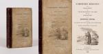
Northern Regions, or a Relation of Uncle Richard’s Voyages for the Discovery of a North-West Passage and an Account of the Overland Journies of other Enterprizing Travellers.

London, J. Harris, 1825. 17.4cm x 11.1cm. XII, 315 pages. With 11 [of 12] beautiful full-page-plates, (each with two engravings) and a fold-out map of the arctic regions from 1825. Original, illustrated Hardcover. Binding a little distorted. The cover-illustration faded. Otherwise in very good condition with only minor signs of external wear. The fold-out map is cleanly torn (now in two parts).

EUR 128,-- 

Show details   Add to cart

Baert-Duholant, Tableau de la Grande-Bretagne, De L'Irlande et des Possessions Angloises dans les quatre parties du Monde.

2. Baert-Duholant, Charles-Alexandre-Balthazar-François de Paule baron de / Jean-Denis Barbié du Bocage.

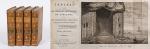
Tableau de la Grande-Bretagne, De L’Irlande et des Possessions Angloises dans les quatre parties du Monde. [With five (5) large, folded Maps by Jean-Denis Barbié du Bocage: Large, oblong folded Map/Plan of Gibraltar / England / Scotland / Ireland / India] / [With four (4) stunning copper-engravings: Grotte de Fingal, Chaussée des Géants / Plan et vue de Gibraltar / Combat de Boxe (Pugilists)] / [With two (2) portraits: 1.Portrait of William Pitt (after William Owen) and 2. Portrait of Charles Jacques Fox (after Karl Anton Hickel)].

Four Volumes (complete set). Paris, Chez H.J.Jansen, L’An 8me [1800]. Octavo (20 cm x 13.5 cm). Collation: Volume I: (8), 459, (1), 11 pages with Eleven (11) copper-engravings of which are: 5 Maps / Plans and 4 Engravings: The folded view of Fingals Cave (″Grotte de Fingal dans l’Ile de Staffa” – (19.5 cm x 31 cm) / “Folded Plate of the Giants Causeway (″Vue occidentale de la Chaussee des Geans et des Caps voisins” (19.5 cm x 31 cm)) / Fantastic, large Map/Plan of Gibraltar by Jean-Denis Barbié du Bocage, with a Birds-Eye-View of the Ville de Gibraltar (19.5 cm x 63.5 cm) [also showing the Ville Irlandaise on Gibraltar] / Scenic View of Gibraltar (″Vue de Gibraltar, prise du cote de l’Espagne” (19.5 cm x 32 cm) / Large Fold-Out-Map of England by Jean-Denis Barbié du Bocage with an Inset-View of Stonehenge (43 cm x 48.5 cm) / Large Fold-Out-Map of Scotland by Jean-Denis Barbié du Bocage, including the Western Isles and Shetland, with a stunning Inset-View of the irish pilgrimage-mountain Croagh Patrick [Craig-Phadrick] in Westport, Ireland (33 cm x 39 cm)/ Large Fold-Out-Map of Ireland with an Inset-View of the Lakes of Killarney (36 cm x 40.5 cm) / Volume II: 532, (1), 12 pages with Large Fold-Out-Map of India (″Possessions Anglaises”) by Jean-Denis Barbié du Bocage – the large India-Map showing areas as far as Tibet, Siam, Sumatra and the Andaman Islands, Ceylon, Burma (53.5 cm x 40.5 cm) / Volume III: 502, 48, (2) pages with two portraits: Guillaume Pitt [William Pitt] & Charles Jacques Fox (each 19.5 cm x 12 cm)/ Volume IV: 486, 22, (2) pages with the very famous Fold-out-Illustration of Pugilists / Boxers at Odiham in Hampshire [″Combats de Boxers a Odiham”] showing a boxing-match between Humphrey and Mendoza (29.5 cm x 19.5 cm). Hardcover / Original, very decorative original half leather bindings with gilt lettering and ornament on spine. All four Volumes in protective Collector’s Mylar. Very good condition with only minor signs of external wear. Very minor wormhole-damage to a few pages.

EUR 1.280,-- 

Show details   Add to cart

Barneby, The New Far West and The Old Far East

3. Barneby, W. Henry.

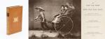
The New Far West and The Old Far East – Being Notes of a Tour in North America, Japan, China, Ceylon, Etc. With Maps and Illustrations. [Including an Appendix on the Supplementary Treaty of Commerce between the United States and Japan].

London, Edward Stanford, 1889. Quarto. Frontispiece, X, 316 pages with three large fold-out-maps in colour and eight illustrations in black-and-white. Hardcover / Stunning 19th century prize-binding in beautiful full tan calf bearing the Arms of Monmouth Grammar School [with their Motto “Serve and Obey”]. Inscription and embossed stamp of Monmouth – Grammar School to endpaper. Dedicated by Headmaster C.M.Roberts to former pupil W.A.Lamb in July 1890. Excellent condition with only minor signs of wear.

EUR 480,-- 

Show details   Add to cart

Barrow, Voyage dans la partie meridionale de l'Afrique

4. Barrow, John.

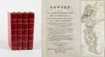
Voyage dans la partie meridionale de l’Afrique; fait dans les années 1797 et 1798; par John Barrow, Ex-Secretaire de Lord Macartney…Contenant des observations sur la géologie, la géographie, l’histoire naturelle de ce continent, et une esquisse du caractère physique et moral des diverses races d’habitans qui environnent l’Etablissement du Cap de Bonne-Espérance. / Accompagné: Nouveau Voyage dans la partie méridionale de l’Afrique; Où l’on examine quelle est l’importance du Cap de Bonne-Espérance pour les différentes puissances de l’Europe, considéré comme station militaire et navale; comme boulevart du commerce et de la domination des Anglais dans l’Inde; comme centre des établissemens pour la pêche de la baleine dans les mers Australes; comme acquisition territoriale, et comme entrepôt commercial en tems de paix. Accompagné d’une description statistique de la colonie rédigée sur les documens les plus hautentiques, enrichi de huit belles cartes, contenat celle de la Côte d’Afrique depuis la baie de la Table jusqu’a la baie de Saldanha, des cartes de la baie de Pletenberg, d’Algola, de Mossel et de False bay; du plan militaire de la péninsule du Cap, et de ceux de la baie de la Table et du Knisna. (2 Volumes).

First French Edition. 4 Volumes [complete set of two works with 2 Volumes each]. Paris, Dentu, 1801-1806. 35.5 cm x 55.8 cm. Collation: complete. Pagination: Volume I: XVI, 403, (1) pages / Volume II: 326, (2) pages including Errata-leaf / Volume III: X, 310 pages / Volume IV: 312 pages. Original contemporary red calf with gilt lettering and ornament to lacquer-polished-spine. The Volumes are numbered consecutively, even though these are two separate works. Excellent condition of the binding and interior of this important publication with very minor signs of foxing only ! All the maps in wonderful condition ! First french edition of “Travels into the Interior of Southern Africa” (Barrow’s journey with Lord Macartney in 1797 to the Cape of Good Hope) plus two further Volumes which describe the second journey in 1801 / 1802 to Saldanha Bay [Saldanhabaai] with an early image of Robben Island. The survey of the Dutch colonies was not only a seminal work on South Africa but the beautifully engraved, large folding map of South Africa was a turning point of african cartography and geographical illustration.

EUR 1.200,-- 

Show details   Add to cart

Bellin / Senex / Ogilby - The Roads through England or Ogilby's Survey. Revised, improved and reduced by Senex. [Enlarged Edition of John Ogilby's 1675 published "Britannia"]

5. [Bellin, Jacques Nicholas / Senex, John / Ogilby, John]

The Roads through England or Ogilby’s Survey. Revised, improved and reduced by Senex. [Enlarged Edition of John Ogilby’s 1675 published “Britannia”] Distinctly laid down on onehundred & one Plates with the addition of some Roads newly drawn and several corrections of more general use to Travellers. [Including an Appendix with Cityplans of London (double-page), Plymouth, Shrewsbury, Yorck (York), Chester, [Scene of Carrick-Fergus (Ireland)], Waterford, Oxford, Leith [Edinburgh], Harwich, Scenery of Edinburgh / Itinéraire de toutes les routes de l ‘Angleterre. Revues corrigées, augmentées & réduites par Senex en 101 Cartes. [Titlepage bilingual in french and english].

Paris, Desnos, 1766. Quarto (30 cm x 22.5 cm). Collation complete: Bilingual titlepage, 12 double-page maps of England, partly beautifully border-coloured, 6 unnumbered pages of Index with distances in miles, one (1) General Map of England (″Carte Generale” of Engand by D’Ogilby), 101 full-page maps of routes/streets, Engraved titlepage for the Appendix, One (1) double-page of explanations for the London-City-Plan, 17 beautiful maps and engravings of a variety of english cities, also with a section on Ireland (Dublin, Waterford, Kinsale, Galway, Limerick). Original 18th-century contemporary calf with gilt lettering on spine and on five raised bands. The Volume is now protected in Collector’s Mylar. Very good+ condition with only minor signs of external wear. Some rubbing and corners slightly bumped but overall excellent. Interior near fine with only the slightest occasional spotting. Extremely Rare and even rarer in this condition !


EUR 2.400,-- 

Show details   Add to cart

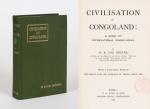
Bourne, Civilisation in Congoland - A Story of International Wrong-Doing.

6. Bourne, H. R. Fox.

Civilisation in Congoland – A Story of International Wrong-Doing. With a prefatory Note by the Right Hon. Sir Charles W. Dilke.

London, P.S.King & Son, 1903. Octavo. XVI, 311 pages with large, coloured, folded map of the Congo: “Congo Land or The Conventional Basin of the Congo”. Original Hardcover with dustjacket in protective Mylar. Endpaper detached. Otherwise in very good condition with only minor signs of external wear. Faint old library stamp of the “Reichsgericht in Berlin” to titlepage.

EUR 128,-- 

Show details   Add to cart

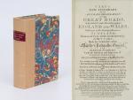
Cary's New Itinerary: Or an Accurate Delineation of the Great Roads, Both Direct and Cross throughout England and Wales: With Many of the Principal Roads in Scotland.

7. Cary, John.

Cary’s New Itinerary: Or an Accurate Delineation of the Great Roads, Both Direct and Cross throughout England and Wales: With Many of the Principal Roads in Scotland. From an Actual Admeasurement by John Cary: Made by Command of his Majesty’s Postmaster General for official purposes: Under the Direction and Inspection of Thomas Hasker Esq., Surveyor and Superintendant of the Mail Coaches. [Including an advertising for Cary’s New Celestial and Terrestrial Globes (with Illustrations of Globes)]. [Subtitle:] This work shows the immediate Route from the Metropolis [London] to all parts of England and Wales: And from Town to Town in every direction, distinguishing also the Cities, Market, Borough and Corporate Towns: And those at which the Assizes are held and gives the time of the Mails, Arrival and Departure from each, Describes the Line of the Navigable Canals and the Course of the Rivers passed over, The Number of Houses and Inhabitants contained in each Town, And those Inns which supply Post Horses and Carriages. Also The Inn’s throughout the Metropolis [London] from which the Mail and Stagecoaches go, their time of departure & the Route they seveerally take. The Noblemen and Gentlemen’s Seats situate near the Roads, A List of the Packet Boats and their time of sailing. Copious Indexes. Maps of the Lot Wight Environs of London, Bath, Brighton, Margate & Cheltenham & a Large Map of England and Wales peculiarly adapted to the Work. – [An Advertisement juxtaposed to the titlepage reads: “This Edition contains the Routes to upwards of Nine Thousand Places, which have never been given in any work of a similar Description; being a complete Directory to every Parish situate out of the Line of the Direct and Cross Roads throughout England and Wales”].

Seventh Edition, with Improvements [complete with all maps as called for]. London, Printed for J. Cary, 1817. Octavo. Pagination: [1], 647 pages plus 7 maps / Detailed pagination see here: [1], Title, Large Folding Map, [121], 6 folded Maps, [526] pages. Modern, recent Hardcover / Very decorative half-leather with marbled-paper-covered boards. Gilt lettering on new sppine-label. New endpapers. Protective Mylar. Only the large folding map with a inor tear (one part of the map deliberately bound separate (geniously folding out to meet th erest of the map). Interior text and maps all in excellent, unusually clean condition !!

EUR 480,-- 

Show details   Add to cart

[Conder, Africa / [in: The Modern Traveller- A Popular Description, Geographical

8. [Conder, Josiah].

Africa / [in: The Modern Traveller- A Popular Description, Geographical, Historical, and Topographical, of the Various Countries of the Globe].

Volume II (of II). London, Printed for James Duncan, 1829. Duodecimo / 9 cm x 14.5 cm. IV, 348 pages. With 6 black and white engravings showing: 1. City of Morocco / 2. Sand-storm on the Desert / 3. Castle of Mourzouk / 4. Tuaricks / 5. Tibboos / 6. Mora, The Capital of Mandara. Original Hardcover, decorative full leather. Full leather with gilted ornaments to outer margins of interior boards. Marbled endpapers and edges. Gilt ornament and raised bands on spine. Very good condition with only minor signs of external wear. Binding rubbed but firm. Upper spine missing. Minor foxing. [The Modern Traveller- Volume 21].

EUR 128,-- 

Show details   Add to cart

[Conder, Arabia, Egypt, Nubia and Abyssinia / [in: The Modern Traveller- A Popul

9. [Conder, Josiah].

Arabia, Egypt, Nubia and Abyssinia / [in: The Modern Traveller- A Popular Description, Geographical, Historical, and Topographical, of the Various Countries of the Globe].

Three Volumes. London, Printed for James Duncan, 1827. Duodecimo / 9 cm x 14.5 cm. Arabia-Volume: IV, 362 pages / Egypt/Abyssinia-Volume I: IV, 366 pages / Egypt/Abyssinia-Volume II: IV, 364 pages. Includes three folded maps and nine black and white illustrations showing: 1. Map of Arabia / 2. Map of Egypt / 3. Map of Nubia and Abyssinia / 4. View of Mount Sinai / 5. Mosques at Mekka and Medinah / 6. View of Moosa / 7. Temple of Apollinopolis / 8. Cataracts of the Nile / 9. View on the River Tacazze / 10. Obelisk and King’s Seat at Axum / 11. View of Cairo / 12. The Pyramids from Old Cairo. Original Hardcover, decorative full leather. Full leather with gilted ornaments to outer margins of interior boards. Marbled endpapers and edges. Gilt ornament to spine. Very good condition with only minor signs of external wear. Binding rubbed but firm. Minor foxing only. [The Modern Traveller- Volume 4-6].

EUR 128,-- 

Show details   Add to cart

[Conder, Birmah, Siam and Anam [in: The Modern Traveller - A Popular Description

10. [Conder, Josiah].

Birmah, Siam and Anam [Burma (Myanmar) / Thailand / Vietnam – in: The Modern Traveller – A Popular Description, Geographical, Historical and Topographical of the various Countries of the Globe.

London, Printed for James Duncan, 1826. Duodecimo / 9 cm x 14.5 cm. IV, 367 pages. With a folded black-and-white map of Indo-China and three black-and-white steel engravings showing: 1. The Imperial Court Ummerapoora / 2. A Woongee & His Wife / A Rhahan or Priest / 3. Cochin (Kochi) – Chinese shipping on the River Taifo (Fai-foo). Original Hardcover. Full leather with gilted ornaments to outer margins of interior boards. Marbled endpapers and edges. Gilt ornament to spine. Spinelabel missing. Binding firm but rubbed. Lower spine with minor damage only. Very good condition of the map and etchings. The rarest Volume in the series. [The Modern Traveller – Volume 11].

EUR 128,-- 

Show details   Add to cart

Page: 1 2 3 4 5
:

Order by: Author · Title · Keyword · Year · Price (up) · Price (down) · Inventory Number · Recent Changes · Relevance

Books per page: 10 · 20 · 50 · 100

Contact

Inanna Rare Books Ltd.
Woodley House
Castletownshend Road
P81 D262 Skibbereen, County Cork
Ireland
Phone: ++353 - (0) 87 - 102 5412
E-Mail: info@inannararebooks.com
Internet: https://www.inannararebooks.com

Online Bookshop specialized in rare
and secondhand books.

Newsletter and E-Catalogue Sign Up

Enter your name and e-mail address to sign up for
our regular newsletter and catalogue service.

Payment Options

Paypal   Master Card   VISA   American Express

Legal Info

  • Terms & Conditions
  • Contract Withdrawal
  • Cancellation Policy
  • Privacy Policy
  • Shipping Information
  • Imprint

© 2026 Inanna Rare Books Ltd. | Powered by HESCOM-Software

Follow Us