Inanna Rare Books

Inanna Rare Books

Inanna Rare Books

    • Home
    • About us
    • Shipping Information
    • Search File
    • Contact
    • Cart
    • Rare Book Room
      • Books on Books
      • History - Politics - Law
      • Literature
      • Philosophy & Religion
      • Social Sciences - Education
      • Medicine
      • The Arts
      • Travel & Exploration
      • Mathematics
      • Science & Technology
      • Farming - Fishing - Hunting
      • Natural History
      • Games - Sport
      • Complete Catalogue
    • Art & Map Gallery
      • Art Gallery
      • Rare Maps & Cartography
    • Manuscripts
      • Manuscripts - Literature
      • Manuscripts - History
      • Manuscripts - Travel
      • Manuscripts - Food
      • Manuscripts - Music
      • Manuscripts - Secret Knowledge
      • Manuscript Letters/Autographs
      • Manuscripts - Art
      • Manuscripts - Philosophy
    • Gift Ideas / New Arrivals
      • New Arrivals
      • Gift Ideas for Collectors
      • Gift Wrapping Available
      • Handmade Paper
      • Gift Wrapping Available
    • Inanna Publishing
    • Libraries & Collections
      • African Maps Collection
      • Henry David Aiken - Collection
      • Samuel Beckett - Collection
      • Walter Benjamin - Collection
      • Alexander Calder Collection
      • Castlefreke - Collection
      • Alice Curtayne Collection
      • Fly Fishing / Angling Collection
      • Vere Foster - Collection
      • William Daniel Gill Collection
      • John Minihan Collection
      • David (Dave) Naylor - Collection
      • Roger O'Connor Collection
      • David Puttnam Collection
      • Savigny Collection
      • Eric Ravilious Collection SOLD
    • Catalogues
    • News / Events
  • Advanced Search
  • List
    • Terms & Conditions
    • Contract Withdrawal
    • Cancellation Policy
    • Privacy Policy
    • Shipping Information
    • Imprint
INANNA MODERNWest Cork Reading Holidays
We ship per DHL Express

We ship per DHL Express

Advanced Search
  • Rare Book Room
    • Books on Books
    • History - Politics - Law
    • Literature
    • Philosophy & Religion
    • Social Sciences - Education
    • Medicine
    • The Arts
    • Travel & Exploration
    • Mathematics
    • Science & Technology
    • Farming - Fishing - Hunting
    • Natural History
    • Games - Sport
    • Complete Catalogue
  • Art & Map Gallery
    • Art Gallery
    • Rare Maps & Cartography
  • Manuscripts
    • Manuscripts - Literature
    • Manuscripts - History
    • Manuscripts - Travel
    • Manuscripts - Food
    • Manuscripts - Music
    • Manuscripts - Secret Knowledge
    • Manuscript Letters/Autographs
    • Manuscripts - Art
    • Manuscripts - Philosophy
  • Gift Ideas / New Arrivals
    • New Arrivals
    • Gift Ideas for Collectors
    • Gift Wrapping Available
    • Handmade Paper
    • Gift Wrapping Available
  • Inanna Publishing
  • Libraries & Collections
    • African Maps Collection
    • Henry David Aiken - Collection
    • Samuel Beckett - Collection
    • Walter Benjamin - Collection
    • Alexander Calder Collection
    • Castlefreke - Collection
    • Alice Curtayne Collection
    • Fly Fishing / Angling Collection
    • Vere Foster - Collection
    • William Daniel Gill Collection
    • John Minihan Collection
    • David (Dave) Naylor - Collection
    • Roger O'Connor Collection
    • David Puttnam Collection
    • Savigny Collection
    • Eric Ravilious Collection SOLD
  • Catalogues
  • News / Events

Books with Vintage Maps (50 items)

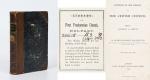
Arthur Penrhyn Stanley - Lectures on the History of the Jewish Church. Part I: Abraham to Samuel - With Maps and Plans of the Mosque at Hebron / Palestine before the Conquest / Migration of Abraham

41. Stanley, Arthur Penrhyn.

Lectures on the History of the Jewish Church. Part I: Abraham to Samuel – With Maps and Plans (Plan of the Mosque at Hebron / Palestine before the Conquest / Migration of Abraham).

London, John Murray, 1863. Octavo. XLI, 523 pages with folded maps and plans. Hardcover / Original Half-leather with gilt lettering on spine. Upper spine slightly damaged. Otherwise in very good condition with some minor signs of wear only.

EUR 128,-- 

Show details   Add to cart

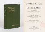
Bourne, Civilisation in Congoland - A Story of International Wrong-Doing.

42. Bourne, H. R. Fox.

Civilisation in Congoland – A Story of International Wrong-Doing. With a prefatory Note by the Right Hon. Sir Charles W. Dilke.

London, P.S.King & Son, 1903. Octavo. XVI, 311 pages with large, coloured, folded map of the Congo: “Congo Land or The Conventional Basin of the Congo”. Original Hardcover with dustjacket in protective Mylar. Endpaper detached. Otherwise in very good condition with only minor signs of external wear. Faint old library stamp of the “Reichsgericht in Berlin” to titlepage.

EUR 128,-- 

Show details   Add to cart

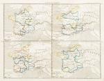
[Roberts, Géographie Physique, Historique et Politique de la France

43. [Roberts, William] [Exlibris Gulielme (sic) Roberts] Bonnechose, Émile de / L.Dussieux (cartographer).

Géographie Physique, Historique et Politique de la France avec dix-huit cartes coloriées représentant la formation successive du Royaume.

Paris, Firmin Didot Frères, 1847. Octavo (14 cm x 23 cm). V, (2), 104 pages, suivies de 18 cartes aux contours colorisés, de la France dans ses états successifs (104 pages plus 18 hand-coloured maps of France by L.Dussieux showing France through its History, with special maps showing historical military events with England etc. Original Softcover. Spine rubbed and slightly damaged. Otherwise in very good condition with only minor signs of wear. Name of preowner William Roberts in pencil on titlepage [being William Roberts of the irish family Westropp-Roberts].

EUR 220,-- 

Show details   Add to cart

Daniel Paterson & Edward Mogg - Paterson's Roads [1831/1832 Edition (18th Edition) with 12 Maps]

44. [Paterson, Daniel] Mogg, Edward.

Paterson’s Roads [1831/1832 Edition (18th Edition)] – Being an entirely original and accurate Description of all the direct and Principal Cross Roads in England and Wales, with part of the roads of Scotland. [Including an “Appendix to the Eighteenth Edition of Paterson’s Roads; being An Accurate Description of the Direct and Principal Cross roads communicating with the Improved Old Passage Ferry, across the River Severn, between Aust and Beachley, near Chepstow. Accompanied by a Map of the Banks of the Wye. To which are added, Course of the Chepstow Steam Packets; and An arranged Tour through Wales, with References to the pages in the Body of the Work, where connection with various lines of Road takes place.”]. The Eighteenth Edition. To which are added Topographical Sketches of the several Cities, Market Towns and remarkable Villages and descriptive accounts of the principal seats of the Nobility and Gentry, the Antiquities, Natural Curiosities and other Remarkable Objects throughout the Kingdom. The whole Remodelled, Augmented and Improved by the Addition of Numerous New Roads and New Admeasurements, and Arranged upon A Plan at once Novel, clear and intelligible, is deduced from the latest and best Authorities: Including a Table of the Heights of Mountains from the Grand Trigonometrical Survey of the Kingdom; Also a Table of the Population, From the Census of 1831; To which is annexed the Arrival and Departure of the Mail, together with the Rates of Postage and An Entirely New Set of Maps.

London, Printed for Longman, Rees, Orme, Brown, Green and Longman, 1831/1832. Octavo (15 cm x 21,5 cm). Fontispiece – Fold-out-Map, 715 pages plus 44 pages of an Appendix. With twelve (12) Maps, including the frontipiece-map and full-page maps throughout the publication. Hardcover / Private half-leather of the early 20th century with gilt lettering on the spine. Some of the maps with visible reapirs but complete. Very good condition with only minor signs of wear. This being the so-called “Best Edition”.

EUR 480,-- 

Show details   Add to cart

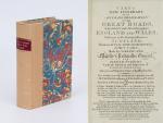
Cary's New Itinerary: Or an Accurate Delineation of the Great Roads, Both Direct and Cross throughout England and Wales: With Many of the Principal Roads in Scotland.

45. Cary, John.

Cary’s New Itinerary: Or an Accurate Delineation of the Great Roads, Both Direct and Cross throughout England and Wales: With Many of the Principal Roads in Scotland. From an Actual Admeasurement by John Cary: Made by Command of his Majesty’s Postmaster General for official purposes: Under the Direction and Inspection of Thomas Hasker Esq., Surveyor and Superintendant of the Mail Coaches. [Including an advertising for Cary’s New Celestial and Terrestrial Globes (with Illustrations of Globes)]. [Subtitle:] This work shows the immediate Route from the Metropolis [London] to all parts of England and Wales: And from Town to Town in every direction, distinguishing also the Cities, Market, Borough and Corporate Towns: And those at which the Assizes are held and gives the time of the Mails, Arrival and Departure from each, Describes the Line of the Navigable Canals and the Course of the Rivers passed over, The Number of Houses and Inhabitants contained in each Town, And those Inns which supply Post Horses and Carriages. Also The Inn’s throughout the Metropolis [London] from which the Mail and Stagecoaches go, their time of departure & the Route they seveerally take. The Noblemen and Gentlemen’s Seats situate near the Roads, A List of the Packet Boats and their time of sailing. Copious Indexes. Maps of the Lot Wight Environs of London, Bath, Brighton, Margate & Cheltenham & a Large Map of England and Wales peculiarly adapted to the Work. – [An Advertisement juxtaposed to the titlepage reads: “This Edition contains the Routes to upwards of Nine Thousand Places, which have never been given in any work of a similar Description; being a complete Directory to every Parish situate out of the Line of the Direct and Cross Roads throughout England and Wales”].

Seventh Edition, with Improvements [complete with all maps as called for]. London, Printed for J. Cary, 1817. Octavo. Pagination: [1], 647 pages plus 7 maps / Detailed pagination see here: [1], Title, Large Folding Map, [121], 6 folded Maps, [526] pages. Modern, recent Hardcover / Very decorative half-leather with marbled-paper-covered boards. Gilt lettering on new sppine-label. New endpapers. Protective Mylar. Only the large folding map with a inor tear (one part of the map deliberately bound separate (geniously folding out to meet th erest of the map). Interior text and maps all in excellent, unusually clean condition !!

EUR 480,-- 

Show details   Add to cart

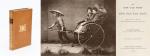
Barneby, The New Far West and The Old Far East

46. Barneby, W. Henry.

The New Far West and The Old Far East – Being Notes of a Tour in North America, Japan, China, Ceylon, Etc. With Maps and Illustrations. [Including an Appendix on the Supplementary Treaty of Commerce between the United States and Japan].

London, Edward Stanford, 1889. Quarto. Frontispiece, X, 316 pages with three large fold-out-maps in colour and eight illustrations in black-and-white. Hardcover / Stunning 19th century prize-binding in beautiful full tan calf bearing the Arms of Monmouth Grammar School [with their Motto “Serve and Obey”]. Inscription and embossed stamp of Monmouth – Grammar School to endpaper. Dedicated by Headmaster C.M.Roberts to former pupil W.A.Lamb in July 1890. Excellent condition with only minor signs of wear.

EUR 480,-- 

Show details   Add to cart

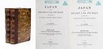
Johannes Justus Rein, Japan nach Reisen und Studien im Auftrage der Königlich Preussischen Regierung dargestellt

47. Rein, J.J. [Johannes Justus] / [Provenienz / Provenance: Max von Baden / Bibliothek Schloss Salem].

Japan nach Reisen und Studien im Auftrage der Königlich Preussischen Regierung dargestellt von J.J. Rein [Johannes Justus Rein], Professor der Geographie in Marburg [an der Lahn]. Erster Band: Natur und Volk des Mikadoreiches. Mit 5 Lichtdruckbildern [Photographien], 12 Holzschnitten, 3 Lithographischen Tafeln und 2 Karten. / Zweiter Band: Land- und Forstwirthschaft, Industrie und Handel. Mit zum Theil farbigen Tafeln, 20 Holzschnitten im Text und 3 Kaertchen.

Erste Ausgabe [First Edition]. Two Volumes. Leipzig, Verlag von Wilhelm Engelmann, 1881 – 1886. Gross-Oktav. Band I: XII, [1], 630 Seiten mit allen Abbildungen und insbesondere der Original-Photographie von Nagasaki aber ohne die “Orographish-hydrographische Karte [Japans]” am Schluss des Bandes. / Band II: XII, 678 Seiten mit den drei Falt-Karten von Japan am Schluss des Bandes . Hardcover / Original 19th century half-leather with gilt lettering and ornament to spine. / Originale Verlags-Leinenbaende. Ehemalige Exemplare der “Bibliothek Salem” und ehemaliges “Eigenthum des Prinzen Wilhelm”, mit zwei dezenten Bibliotheksschildchen der Bibliothek Salem im Innendeckel und dem Stempel des Prinzen Max von Baden [″MB” mit Krone] auf den Titelseiten. Very good condition with only minor signs of wear and only the two folded Maps missing / Sehr guter Zustand des seltenen Werks und mit nur wenigen Stockfleckchen, wie ueblich auf den Rueckseiten des Photo-papiers und Abklatsch auf den Seiten verso. Aus dem Vorwort: “Saemtliche Illustrationen dieses Buchs sind Originale – Bonn, im September 1886 – Der Verfasser”.

EUR 1.000,-- 

Show details   Add to cart

Philip Luckombe, The Compleat Irish Traveller [Luxury Reprint with all of Charles Smith's Illustrations of 18th century Ireland (Munster / Kerry / Waterford) in separate Folder for Framing]

48. [Luckombe, Philip / Smith, Charles].

Luxury Reprint of “The Compleat Irish Traveller” [With high quality Reproductions of the 31 original Plates of detailed Maps of County Cork in the 18th century, County Kerry in the 18th century and Waterford in the 18th century, as well as some of the earliest engravings of Irish Towns here for the first time reproduced as beautiful Artworks for framing and housed in a special, handmade Folder. The publication was just recently enlarged with a detailed, Topographical Index (July 2023)]. Complete Title: “The Compleat Irish Traveller, containing A general Description of the most Noted Cities, Towns, Seats, Buildings, Loughs &c. in the Kingdom of Ireland, Interspersed with Observations on the Manners, Customs, Antiquities, Curiosities and Natural History of that Country. With Elegant Copper Plates”. [With 31 original Plates after Charles Smith, including Frontispiece, this Reprint / Facsimile is the result of 10 years of research and purchase of three (3) original versions of the First Edition from the year 1788. The first Editions known to Inanna Rare Books all had different quantities of Plates and Maps included. This Reprint by Inanna Rare Books has been produced from an extremely clean version of the original and shows the most complete set of illustrations and XL-Size Maps and Artworks we could find in any of the original editions. The publication shows not only Maps of County Cork, County Kerry and County Waterford but also Views of Irish Cities and Towns in these Counties of the Province of Munster and besides the wonderful Historical Plan of Cork City this set also includes the very rare Plan of the “Grand Canal from Dublin to the River Shannon” (see detailed list of all the illustrations present at the end of this description)].

Luxury Limited-Edition-Reprint of the First Edition by Luckombe in 1788. Two Volumes plus extra Folder with 31 Plates reprinted as Artworks for framing. Skibbereen (County Cork), Inanna Rare Books Publishing, 1788. Octavo (13.5 cm x 21 cm). Pagination: Volume I: Frontispiece, engraved Titlepage, XXX, 189 pages plus recently published Index (July, 2023) / Volume II: Engraved Titlepage, 263 pages plus recently published Index (July, 2023). Plus large, bespoke made Folder with thirtyone (31) Reproductions of the Maps, Plans and Illustrations which usually were folded inside this publication and now for the first time have been liberated from the book and were published as the beautiful works of art they are. Textvolume: Volume I and II of the text bound in one beautiful half-leather-volume with gilt lettering on spine, bound in the style of the 18th century / Illustrations-Folder with 31 reprinted illustrations of Towns and Maps of Ireland but mainly of Munster, bound in bespoke made half-cloth with paper-covered boards and pasted Reprint of the original titlepage. Excellent, new condition. One of only 300 printed. [Inanna Rare Books – Reprint & Facsimile – Series].

EUR 2.480,-- 

Show details   Add to cart

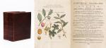
John Payne - Universal Geography - Formed Into A New And Entire System; Describing Asia, Africa, Europe And America

49. Payne, John / Zachariah Jackson [Dublin Printer].

Universal Geography – Formed Into A New And Entire System; Describing Asia, Africa, Europe And America ; With Their Subdivision Of Empires, Kingdoms, States And Republics : The Extend, Boundaries, and remarkable Appearances of each Country ; Cities, Towns, and Curiosities of Nature and Art. Also giving A general Account of the Fossil and Vegetable Production of the Earth, and of every Species of Animal : The History of Man, In all Climates, Regions, And Conditions ; Customs, Manners, Laws, Governments, And Religions : The State of Arts, Sciences, Commerce, Manufactures, And Knowledge : Sketches of the Ancient and Modern History of each Nation and People. To which is added, A Short View of Astronomy, As Connected With Geography ; Of The Planetary System to which the Earth belongs ; And of the Universe in General. With a Set of Maps, drawn from the best Materials, every one of which is very neatly coloured ; And a great Variety of Copper-Plates ; Descriptive of the most Remarkable Curiosities in the World. [This Edition with all three Volumes but only with 14 Maps, 3 Colour-Engravings and 5 Black-and-White Engravings (see detailed listing of these Maps and Engravings at the end of this Bibliography)].

Two Volumes in Three Parts (bound in Two Volumes). Dublin, Printed by Zachariah Jackson, 1793 – 1794 Quarto (23 cm wide x 28 cm high). Pagination: Volume I: Hand-coloured Frontispiece, VI [Subscribers], XIII, 894 pages [page 555 misprinted as 454] [Stating “The End” at the end of the Volume] with Four Maps and Three engravings (including Frontispiece) / Volume II: Hand-coloured Frontispiece, 792 pages [Stating “End Of The Second Volume” at the end of Volume II] with Ten Maps and One Engraving (Frontispiece) / [Volume III] is Bound to the rear of Volume II and is falsely ending with “End of The Second Volume” even though it is the “Continuation of Book IV” and in all other listings of this book internationally is accepted to be Volume III. Pagination of [Volume III]: Hand-coloured Frontispiece, [No separate titlepage], 416 pages, XXXIII pages of an Index, 1 page “Directions to the Binder”, 10 pages “A Chronological Table of Remarkable Events, Discoveries and Inventions”, with Four Engravings (including Frontispiece). Hardcover / Modern Binding in the style of the 18th century. Full leather with gilt lettering on spine. Very minor signs of neglectable, minimal wormhole-damage. Obviously this work was robbed of many of the maps but those which remain have the original hand-colouring in stunning condition (see description). Overall near Fine condiiton of this extremely rare set, with only minor signs of wear. Page 199/200 of Volume II with longer cut (Text not effected). All the engravings and maps without defects.


EUR 2.800,-- 

Show details   Add to cart

[Telemaque] Fenelon, Les Aventures de Telémaque, fils d'Ulysse.

50. [Telemaque] Fenelon, François de Salginac de la Mothe.

Les Aventures de Telémaque, fils d’Ulysse. Avec un petit Dictionnaire Mythologique & Geographique : Nouvelle Edition. Revue exactement sur toutes les precedentes, corrigee avec soin, et Enrichie de Figures en taille-douce. [With 11 engravings and a larger fold-out-map: “Carte des Voyages de Telemaque”].

A Londres [London], Chez Nourse & Vaillant, 1756. Octavo (10.8 cm wide x 18 cm high). Pagination: Frontispiece, XXXII, 386 pages plus 22 unnumbered pages of a Dictionary for Mythology and Geography to the rear of the volume. With ten engravings plus one folded map throughout the Volume [resulting in 11 engravings including Frontispiece plus Map]. Hardcover / Original full leather with gilt lettering on spine-label. Edges of bookblock and binding slightly rubbed. Overall in very good and firm condition with only minor signs of wear. Few dogears. Front free endpaper partially torn, name of pre-owner, Reverend Richard Meade, verso the frontispiece. From the library of Richard Meade (Ballymartle), with his Exlibris / Bookplate loosely inserted.

EUR 780,-- 

Show details   Add to cart

Page: 1 2 3 4 5
:

Order by: Author · Title · Keyword · Year · Price (up) · Price (down) · Inventory Number · Recent Changes · Relevance

Books per page: 10 · 20 · 50 · 100

Contact

Inanna Rare Books Ltd.
Woodley House
Castletownshend Road
P81 D262 Skibbereen, County Cork
Ireland
Phone: ++353 - (0) 87 - 102 5412
E-Mail: info@inannararebooks.com
Internet: https://www.inannararebooks.com

Online Bookshop specialized in rare
and secondhand books.

Newsletter and E-Catalogue Sign Up

Enter your name and e-mail address to sign up for
our regular newsletter and catalogue service.

Payment Options

Paypal   Master Card   VISA   American Express

Legal Info

  • Terms & Conditions
  • Contract Withdrawal
  • Cancellation Policy
  • Privacy Policy
  • Shipping Information
  • Imprint

© 2026 Inanna Rare Books Ltd. | Powered by HESCOM-Software

Follow Us