Inanna Rare Books

Inanna Rare Books

Inanna Rare Books

    • Home
    • About us
    • Shipping Information
    • Search File
    • Contact
    • Cart
    • Rare Book Room
      • Books on Books
      • History - Politics - Law
      • Literature
      • Philosophy & Religion
      • Social Sciences - Education
      • Medicine
      • The Arts
      • Travel & Exploration
      • Mathematics
      • Science & Technology
      • Farming - Fishing - Hunting
      • Natural History
      • Games - Sport
      • Complete Catalogue
    • Art & Map Gallery
      • Art Gallery
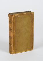
      • Rare Maps & Cartography
    • Manuscripts
      • Manuscripts - Literature
      • Manuscripts - History
      • Manuscripts - Travel
      • Manuscripts - Food
      • Manuscripts - Music
      • Manuscripts - Secret Knowledge
      • Manuscript Letters/Autographs
      • Manuscripts - Art
      • Manuscripts - Philosophy
    • Gift Ideas / New Arrivals
      • New Arrivals
      • Gift Ideas for Collectors
      • Gift Wrapping Available
      • Handmade Paper
      • Gift Wrapping Available
    • Inanna Publishing
    • Libraries & Collections
      • African Maps Collection
      • Henry David Aiken - Collection
      • Samuel Beckett - Collection
      • Walter Benjamin - Collection
      • Alexander Calder Collection
      • Castlefreke - Collection
      • Alice Curtayne Collection
      • Fly Fishing / Angling Collection
      • Vere Foster - Collection
      • William Daniel Gill Collection
      • John Minihan Collection
      • David (Dave) Naylor - Collection
      • Roger O'Connor Collection
      • David Puttnam Collection
      • Savigny Collection
      • Eric Ravilious Collection SOLD
    • Catalogues
    • News / Events
  • Advanced Search
  • List
    • Terms & Conditions
    • Contract Withdrawal
    • Cancellation Policy
    • Privacy Policy
    • Shipping Information
    • Imprint
INANNA MODERNWest Cork Reading Holidays
We ship per DHL Express

We ship per DHL Express

Advanced Search
  • Rare Book Room
    • Books on Books
    • History - Politics - Law
    • Literature
    • Philosophy & Religion
    • Social Sciences - Education
    • Medicine
    • The Arts
    • Travel & Exploration
    • Mathematics
    • Science & Technology
    • Farming - Fishing - Hunting
    • Natural History
    • Games - Sport
    • Complete Catalogue
  • Art & Map Gallery
    • Art Gallery
    • Rare Maps & Cartography
  • Manuscripts
    • Manuscripts - Literature
    • Manuscripts - History
    • Manuscripts - Travel
    • Manuscripts - Food
    • Manuscripts - Music
    • Manuscripts - Secret Knowledge
    • Manuscript Letters/Autographs
    • Manuscripts - Art
    • Manuscripts - Philosophy
  • Gift Ideas / New Arrivals
    • New Arrivals
    • Gift Ideas for Collectors
    • Gift Wrapping Available
    • Handmade Paper
    • Gift Wrapping Available
  • Inanna Publishing
  • Libraries & Collections
    • African Maps Collection
    • Henry David Aiken - Collection
    • Samuel Beckett - Collection
    • Walter Benjamin - Collection
    • Alexander Calder Collection
    • Castlefreke - Collection
    • Alice Curtayne Collection
    • Fly Fishing / Angling Collection
    • Vere Foster - Collection
    • William Daniel Gill Collection
    • John Minihan Collection
    • David (Dave) Naylor - Collection
    • Roger O'Connor Collection
    • David Puttnam Collection
    • Savigny Collection
    • Eric Ravilious Collection SOLD
  • Catalogues
  • News / Events

Books with Vintage Maps (50 items)

White, The Rediscovered Country.

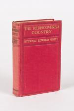
1. White, Stewart Edward.

The Rediscovered Country. Illustrated from Photographs.

London, New York, Toronto, Hodder and Stoughton, no year. 14 cm x 22 cm. Frontispiece, VIII, 358 pages. 100 illustrations. Fold-out map of region at rear. Hardcover [publisher’s original red cloth] with gilt lettering on spine and front board. The fold-out-map with tear. Otherwise in very good condition with only minor signs of external wear. Interior bright and clean and sharp-cornered.

EUR 128,-- 

Show details   Add to cart

[Telemaque] Fenelon, Les Aventures de Telémaque, fils d'Ulysse.

2. [Telemaque] Fenelon, François de Salginac de la Mothe.

Les Aventures de Telémaque, fils d’Ulysse. Avec un petit Dictionnaire Mythologique & Geographique : Nouvelle Edition. Revue exactement sur toutes les precedentes, corrigee avec soin, et Enrichie de Figures en taille-douce. [With 11 engravings and a larger fold-out-map: “Carte des Voyages de Telemaque”].

A Londres [London], Chez Nourse & Vaillant, 1756. Octavo (10.8 cm wide x 18 cm high). Pagination: Frontispiece, XXXII, 386 pages plus 22 unnumbered pages of a Dictionary for Mythology and Geography to the rear of the volume. With ten engravings plus one folded map throughout the Volume [resulting in 11 engravings including Frontispiece plus Map]. Hardcover / Original full leather with gilt lettering on spine-label. Edges of bookblock and binding slightly rubbed. Overall in very good and firm condition with only minor signs of wear. Few dogears. Front free endpaper partially torn, name of pre-owner, Reverend Richard Meade, verso the frontispiece. From the library of Richard Meade (Ballymartle), with his Exlibris / Bookplate loosely inserted.

EUR 780,-- 

Show details   Add to cart

Bellin / Senex / Ogilby - The Roads through England or Ogilby's Survey. Revised, improved and reduced by Senex. [Enlarged Edition of John Ogilby's 1675 published "Britannia"]

3. [Bellin, Jacques Nicholas / Senex, John / Ogilby, John]

The Roads through England or Ogilby’s Survey. Revised, improved and reduced by Senex. [Enlarged Edition of John Ogilby’s 1675 published “Britannia”] Distinctly laid down on onehundred & one Plates with the addition of some Roads newly drawn and several corrections of more general use to Travellers. [Including an Appendix with Cityplans of London (double-page), Plymouth, Shrewsbury, Yorck (York), Chester, [Scene of Carrick-Fergus (Ireland)], Waterford, Oxford, Leith [Edinburgh], Harwich, Scenery of Edinburgh / Itinéraire de toutes les routes de l ‘Angleterre. Revues corrigées, augmentées & réduites par Senex en 101 Cartes. [Titlepage bilingual in french and english].

Paris, Desnos, 1766. Quarto (30 cm x 22.5 cm). Collation complete: Bilingual titlepage, 12 double-page maps of England, partly beautifully border-coloured, 6 unnumbered pages of Index with distances in miles, one (1) General Map of England (″Carte Generale” of Engand by D’Ogilby), 101 full-page maps of routes/streets, Engraved titlepage for the Appendix, One (1) double-page of explanations for the London-City-Plan, 17 beautiful maps and engravings of a variety of english cities, also with a section on Ireland (Dublin, Waterford, Kinsale, Galway, Limerick). Original 18th-century contemporary calf with gilt lettering on spine and on five raised bands. The Volume is now protected in Collector’s Mylar. Very good+ condition with only minor signs of external wear. Some rubbing and corners slightly bumped but overall excellent. Interior near fine with only the slightest occasional spotting. Extremely Rare and even rarer in this condition !

EUR 2.400,-- 

Show details   Add to cart

Philip Luckombe, The Compleat Irish Traveller [Luxury Reprint with all of Charles Smith's Illustrations of 18th century Ireland (Munster / Kerry / Waterford) in separate Folder for Framing]

4. [Luckombe, Philip / Smith, Charles].

Luxury Reprint of “The Compleat Irish Traveller” [With high quality Reproductions of the 31 original Plates of detailed Maps of County Cork in the 18th century, County Kerry in the 18th century and Waterford in the 18th century, as well as some of the earliest engravings of Irish Towns here for the first time reproduced as beautiful Artworks for framing and housed in a special, handmade Folder. The publication was just recently enlarged with a detailed, Topographical Index (July 2023)]. Complete Title: “The Compleat Irish Traveller, containing A general Description of the most Noted Cities, Towns, Seats, Buildings, Loughs &c. in the Kingdom of Ireland, Interspersed with Observations on the Manners, Customs, Antiquities, Curiosities and Natural History of that Country. With Elegant Copper Plates”. [With 31 original Plates after Charles Smith, including Frontispiece, this Reprint / Facsimile is the result of 10 years of research and purchase of three (3) original versions of the First Edition from the year 1788. The first Editions known to Inanna Rare Books all had different quantities of Plates and Maps included. This Reprint by Inanna Rare Books has been produced from an extremely clean version of the original and shows the most complete set of illustrations and XL-Size Maps and Artworks we could find in any of the original editions. The publication shows not only Maps of County Cork, County Kerry and County Waterford but also Views of Irish Cities and Towns in these Counties of the Province of Munster and besides the wonderful Historical Plan of Cork City this set also includes the very rare Plan of the “Grand Canal from Dublin to the River Shannon” (see detailed list of all the illustrations present at the end of this description)].

Luxury Limited-Edition-Reprint of the First Edition by Luckombe in 1788. Two Volumes plus extra Folder with 31 Plates reprinted as Artworks for framing. Skibbereen (County Cork), Inanna Rare Books Publishing, 1788. Octavo (13.5 cm x 21 cm). Pagination: Volume I: Frontispiece, engraved Titlepage, XXX, 189 pages plus recently published Index (July, 2023) / Volume II: Engraved Titlepage, 263 pages plus recently published Index (July, 2023). Plus large, bespoke made Folder with thirtyone (31) Reproductions of the Maps, Plans and Illustrations which usually were folded inside this publication and now for the first time have been liberated from the book and were published as the beautiful works of art they are. Textvolume: Volume I and II of the text bound in one beautiful half-leather-volume with gilt lettering on spine, bound in the style of the 18th century / Illustrations-Folder with 31 reprinted illustrations of Towns and Maps of Ireland but mainly of Munster, bound in bespoke made half-cloth with paper-covered boards and pasted Reprint of the original titlepage. Excellent, new condition. One of only 300 printed. [Inanna Rare Books – Reprint & Facsimile – Series].

EUR 2.480,-- 

Show details   Add to cart

John Payne - Universal Geography - Formed Into A New And Entire System; Describing Asia, Africa, Europe And America

5. Payne, John / Zachariah Jackson [Dublin Printer].

Universal Geography – Formed Into A New And Entire System; Describing Asia, Africa, Europe And America ; With Their Subdivision Of Empires, Kingdoms, States And Republics : The Extend, Boundaries, and remarkable Appearances of each Country ; Cities, Towns, and Curiosities of Nature and Art. Also giving A general Account of the Fossil and Vegetable Production of the Earth, and of every Species of Animal : The History of Man, In all Climates, Regions, And Conditions ; Customs, Manners, Laws, Governments, And Religions : The State of Arts, Sciences, Commerce, Manufactures, And Knowledge : Sketches of the Ancient and Modern History of each Nation and People. To which is added, A Short View of Astronomy, As Connected With Geography ; Of The Planetary System to which the Earth belongs ; And of the Universe in General. With a Set of Maps, drawn from the best Materials, every one of which is very neatly coloured ; And a great Variety of Copper-Plates ; Descriptive of the most Remarkable Curiosities in the World. [This Edition with all three Volumes but only with 14 Maps, 3 Colour-Engravings and 5 Black-and-White Engravings (see detailed listing of these Maps and Engravings at the end of this Bibliography)].

Two Volumes in Three Parts (bound in Two Volumes). Dublin, Printed by Zachariah Jackson, 1793 – 1794 Quarto (23 cm wide x 28 cm high). Pagination: Volume I: Hand-coloured Frontispiece, VI [Subscribers], XIII, 894 pages [page 555 misprinted as 454] [Stating “The End” at the end of the Volume] with Four Maps and Three engravings (including Frontispiece) / Volume II: Hand-coloured Frontispiece, 792 pages [Stating “End Of The Second Volume” at the end of Volume II] with Ten Maps and One Engraving (Frontispiece) / [Volume III] is Bound to the rear of Volume II and is falsely ending with “End of The Second Volume” even though it is the “Continuation of Book IV” and in all other listings of this book internationally is accepted to be Volume III. Pagination of [Volume III]: Hand-coloured Frontispiece, [No separate titlepage], 416 pages, XXXIII pages of an Index, 1 page “Directions to the Binder”, 10 pages “A Chronological Table of Remarkable Events, Discoveries and Inventions”, with Four Engravings (including Frontispiece). Hardcover / Modern Binding in the style of the 18th century. Full leather with gilt lettering on spine. Very minor signs of neglectable, minimal wormhole-damage. Obviously this work was robbed of many of the maps but those which remain have the original hand-colouring in stunning condition (see description). Overall near Fine condiiton of this extremely rare set, with only minor signs of wear. Page 199/200 of Volume II with longer cut (Text not effected). All the engravings and maps without defects.

EUR 2.800,-- 

Show details   Add to cart

Shaw, The History and Antiquities of Staffordshire.

6. [Earliest Illustraton of Kings Bromley Manor] Shaw, Rev. Stebbing.

The History and Antiquities of Staffordshire. Complete Set of two Volumes (all published/fully restored). With an original Plan of Wolverhampton, A large map of Staffordshire, Engravings of Boscobel House, The Pedigree of Turton, Etchings of Kings Bromley, Pipe Ridware House, Lichfield, Site of Blythbury Priory, Mavesyn Ridware, Cathedral of Lichfield, View of Freeford, etc. etc. Volume I – Containing the Ancient and Modern History of Thirty Parishes in the Hundred of Offlow, arranged Geographically, with an Appendix of the most curious Charters &c. Illustrated with sixty-two copper plates and a copious Index / Volume II – Part1 (all published) – Containing the Prefatory Introduction, commencing with a Series of Original Letters from Plot’s time to the present; General and Natural History &c. Ancient and Modern History of the remaining Parishes in the Hundred of Offlow and the Whole of Seisdon, arranged Geographically with an Appendix of curious Charters and other additions and Corrections &c. Illustrated with fifty copper plates and a copious Index. Compiled from the Manuscripts of Huntbach, Loxdale, Bishop Lyttelton, and other Collections of Dr.Wilkes, the Rev. T.Reilde. Including Erdeswicke’s Survey of the County and the approved parts of Dr. Plot’s Natural History. The whole brought down to the present time. Interspersed with Pedigrees and Anecdotes of Families, Observations on Agriculture, Commerce, Mines and Manufactories and illustrated with a very full and correct new map of the County, “Agri Staffordiensis Icon” and numerous other plates.

London, J.Nichols and Son, 1798-1801. Large-Folio. Volume I: Folded Map of Staffordshire by W.Faden, Portrait of Rev. Shaw (detached), XXIV, (2), 125, XXXVIII, 434, 38 pages / Volume II, Part I: A Plan of Wolverhampton, XXXII, 290, 20 pages. With a double-page plan, a large, folded county map (coloured), 82 engraved plates, numerous vignettes within the text and 3 folded pedigree – tables. Modern Hardcover. Exceptionally restored. This work is difficult to handle if not in a sturdy binding ! Original Edition in professionally rebound halfleather with gilt lettering on spine and extra-strong boards, suited for this heavy set. This masterpiece of underestimated english local history is of great interest because of its fold out maps and numerous large folio etchings.


EUR 3.500,-- 

Show details   Add to cart

[Millar, A Survey of the Province of Moray; Historical, Geographical, and Political.

7. Handcoloured Map Art of 18th century Scotland – [Millar, William] / [Grant, John] / [Leslie, William] Forsyth, Isaac / [Hugh Houstoun].

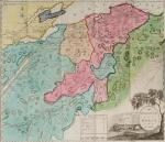
A Survey of the Province of Moray; Historical, Geographical, and Political. [Inscribed and dedicated by scottish Mapmaker William Millar / Including the amazing, large Map of Moray and the Nairn Shires by William Millar (51 cm x 49 cm) and the engraving of “Elgin Cathedral” (also by William Millar)].

First Edition. Aberdeen, Printed for Isaac Forsyth, Bookseller, Elgin, 1798. Octavo (14 cm x 21,5 cm). Folded, hand-coloured Frontispiece-Map by William Millar, Frotispiece-Engraving of the “Elgin Cathedral” , VIII, 353 pages. Original Hardcover / Original 18th or early 19th century leather with original spinelabel. The large, hand-coloured Map with a minor tear only. Corners slightly bumped. Spine slightly starting but overall in excellent condition with some minor signs of wear only. Interesting Provenance and signed manuscript dedication by the Cartographer and Mapmaker William Millar: From the library of Aberdeen Highlander, Major Hugh Houstoun, with a dedication: “April 27th, 1798 – To Major Hugh Houstoun – from his Much obliged and Humble Servant William Millar”.

EUR 1.000,-- 

Show details   Add to cart

Baert-Duholant, Tableau de la Grande-Bretagne, De L'Irlande et des Possessions Angloises dans les quatre parties du Monde.

8. Baert-Duholant, Charles-Alexandre-Balthazar-François de Paule baron de / Jean-Denis Barbié du Bocage.

Tableau de la Grande-Bretagne, De L’Irlande et des Possessions Angloises dans les quatre parties du Monde. [With five (5) large, folded Maps by Jean-Denis Barbié du Bocage: Large, oblong folded Map/Plan of Gibraltar / England / Scotland / Ireland / India] / [With four (4) stunning copper-engravings: Grotte de Fingal, Chaussée des Géants / Plan et vue de Gibraltar / Combat de Boxe (Pugilists)] / [With two (2) portraits: 1.Portrait of William Pitt (after William Owen) and 2. Portrait of Charles Jacques Fox (after Karl Anton Hickel)].

Four Volumes (complete set). Paris, Chez H.J.Jansen, L’An 8me [1800]. Octavo (20 cm x 13.5 cm). Collation: Volume I: (8), 459, (1), 11 pages with Eleven (11) copper-engravings of which are: 5 Maps / Plans and 4 Engravings: The folded view of Fingals Cave (″Grotte de Fingal dans l’Ile de Staffa” – (19.5 cm x 31 cm) / “Folded Plate of the Giants Causeway (″Vue occidentale de la Chaussee des Geans et des Caps voisins” (19.5 cm x 31 cm)) / Fantastic, large Map/Plan of Gibraltar by Jean-Denis Barbié du Bocage, with a Birds-Eye-View of the Ville de Gibraltar (19.5 cm x 63.5 cm) [also showing the Ville Irlandaise on Gibraltar] / Scenic View of Gibraltar (″Vue de Gibraltar, prise du cote de l’Espagne” (19.5 cm x 32 cm) / Large Fold-Out-Map of England by Jean-Denis Barbié du Bocage with an Inset-View of Stonehenge (43 cm x 48.5 cm) / Large Fold-Out-Map of Scotland by Jean-Denis Barbié du Bocage, including the Western Isles and Shetland, with a stunning Inset-View of the irish pilgrimage-mountain Croagh Patrick [Craig-Phadrick] in Westport, Ireland (33 cm x 39 cm)/ Large Fold-Out-Map of Ireland with an Inset-View of the Lakes of Killarney (36 cm x 40.5 cm) / Volume II: 532, (1), 12 pages with Large Fold-Out-Map of India (″Possessions Anglaises”) by Jean-Denis Barbié du Bocage – the large India-Map showing areas as far as Tibet, Siam, Sumatra and the Andaman Islands, Ceylon, Burma (53.5 cm x 40.5 cm) / Volume III: 502, 48, (2) pages with two portraits: Guillaume Pitt [William Pitt] & Charles Jacques Fox (each 19.5 cm x 12 cm)/ Volume IV: 486, 22, (2) pages with the very famous Fold-out-Illustration of Pugilists / Boxers at Odiham in Hampshire [″Combats de Boxers a Odiham”] showing a boxing-match between Humphrey and Mendoza (29.5 cm x 19.5 cm). Hardcover / Original, very decorative original half leather bindings with gilt lettering and ornament on spine. All four Volumes in protective Collector’s Mylar. Very good condition with only minor signs of external wear. Very minor wormhole-damage to a few pages.

EUR 1.280,-- 

Show details   Add to cart

Barrow, Voyage dans la partie meridionale de l'Afrique

9. Barrow, John.

Voyage dans la partie meridionale de l’Afrique; fait dans les années 1797 et 1798; par John Barrow, Ex-Secretaire de Lord Macartney…Contenant des observations sur la géologie, la géographie, l’histoire naturelle de ce continent, et une esquisse du caractère physique et moral des diverses races d’habitans qui environnent l’Etablissement du Cap de Bonne-Espérance. / Accompagné: Nouveau Voyage dans la partie méridionale de l’Afrique; Où l’on examine quelle est l’importance du Cap de Bonne-Espérance pour les différentes puissances de l’Europe, considéré comme station militaire et navale; comme boulevart du commerce et de la domination des Anglais dans l’Inde; comme centre des établissemens pour la pêche de la baleine dans les mers Australes; comme acquisition territoriale, et comme entrepôt commercial en tems de paix. Accompagné d’une description statistique de la colonie rédigée sur les documens les plus hautentiques, enrichi de huit belles cartes, contenat celle de la Côte d’Afrique depuis la baie de la Table jusqu’a la baie de Saldanha, des cartes de la baie de Pletenberg, d’Algola, de Mossel et de False bay; du plan militaire de la péninsule du Cap, et de ceux de la baie de la Table et du Knisna. (2 Volumes).

First French Edition. 4 Volumes [complete set of two works with 2 Volumes each]. Paris, Dentu, 1801-1806. 35.5 cm x 55.8 cm. Collation: complete. Pagination: Volume I: XVI, 403, (1) pages / Volume II: 326, (2) pages including Errata-leaf / Volume III: X, 310 pages / Volume IV: 312 pages. Original contemporary red calf with gilt lettering and ornament to lacquer-polished-spine. The Volumes are numbered consecutively, even though these are two separate works. Excellent condition of the binding and interior of this important publication with very minor signs of foxing only ! All the maps in wonderful condition ! First french edition of “Travels into the Interior of Southern Africa” (Barrow’s journey with Lord Macartney in 1797 to the Cape of Good Hope) plus two further Volumes which describe the second journey in 1801 / 1802 to Saldanha Bay [Saldanhabaai] with an early image of Robben Island. The survey of the Dutch colonies was not only a seminal work on South Africa but the beautifully engraved, large folding map of South Africa was a turning point of african cartography and geographical illustration.

EUR 1.200,-- 

Show details   Add to cart

Cary's New Itinerary: Or an Accurate Delineation of the Great Roads, Both Direct and Cross throughout England and Wales: With Many of the Principal Roads in Scotland.

10. Cary, John.

Cary’s New Itinerary: Or an Accurate Delineation of the Great Roads, Both Direct and Cross throughout England and Wales: With Many of the Principal Roads in Scotland. From an Actual Admeasurement by John Cary: Made by Command of his Majesty’s Postmaster General for official purposes: Under the Direction and Inspection of Thomas Hasker Esq., Surveyor and Superintendant of the Mail Coaches. [Including an advertising for Cary’s New Celestial and Terrestrial Globes (with Illustrations of Globes)]. [Subtitle:] This work shows the immediate Route from the Metropolis [London] to all parts of England and Wales: And from Town to Town in every direction, distinguishing also the Cities, Market, Borough and Corporate Towns: And those at which the Assizes are held and gives the time of the Mails, Arrival and Departure from each, Describes the Line of the Navigable Canals and the Course of the Rivers passed over, The Number of Houses and Inhabitants contained in each Town, And those Inns which supply Post Horses and Carriages. Also The Inn’s throughout the Metropolis [London] from which the Mail and Stagecoaches go, their time of departure & the Route they seveerally take. The Noblemen and Gentlemen’s Seats situate near the Roads, A List of the Packet Boats and their time of sailing. Copious Indexes. Maps of the Lot Wight Environs of London, Bath, Brighton, Margate & Cheltenham & a Large Map of England and Wales peculiarly adapted to the Work. – [An Advertisement juxtaposed to the titlepage reads: “This Edition contains the Routes to upwards of Nine Thousand Places, which have never been given in any work of a similar Description; being a complete Directory to every Parish situate out of the Line of the Direct and Cross Roads throughout England and Wales”].

Seventh Edition, with Improvements [complete with all maps as called for]. London, Printed for J. Cary, 1817. Octavo. Pagination: [1], 647 pages plus 7 maps / Detailed pagination see here: [1], Title, Large Folding Map, [121], 6 folded Maps, [526] pages. Modern, recent Hardcover / Very decorative half-leather with marbled-paper-covered boards. Gilt lettering on new sppine-label. New endpapers. Protective Mylar. Only the large folding map with a inor tear (one part of the map deliberately bound separate (geniously folding out to meet th erest of the map). Interior text and maps all in excellent, unusually clean condition !!

EUR 480,-- 

Show details   Add to cart

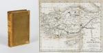
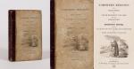
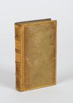
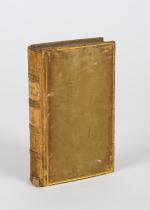
[Conder, Palestine / [in: The Modern Traveller- A Popular Description, Geographi

11. [Conder, Josiah].

Palestine / [in: The Modern Traveller- A Popular Description, Geographical, Historical, and Topographical, of the Various Countries of the Globe].

London, Printed for James Duncan, 1824. Duodecimo / 9 cm x 14.5 cm. IV, 368 pages. With fold-out map and 3 black and white engravings showing: 1. Map of Palestine / 2. View of Jerusalem / 3. View of Bethlehem / 4. Plan of Jerusalem. Original Hardcover, decorative full leather. Full leather with gilted ornaments to outer margins of interior boards. Marbled endpapers and edges. Gilt ornament and raised bands on spine. Very good condition with only minor signs of external wear. Binding rubbed but firm. Spinelabel slightly loose. Minor foxing.

EUR 220,-- 

Show details   Add to cart

[Conder, Syria and Asia Minor (including Lebanon) / [in: The Modern Traveller -

12. [Conder, Josiah].

Syria and Asia Minor (including Lebanon and Anatolia) / [in: The Modern Traveller – A Popular Description, Geographical, Historical and Topographical of the various Countries of the Globe].

Two Volumes (Complete Set). London, Printed for James Duncan, 1824. Duodecimo / 9 cm x 14.5 cm. Volume I: IV, 354 pages / Volume II: IV, 356 pages. Including two folded Maps and 6 engravings: 1. Folded Map of Syria / 2. Folded Map of Asia Minor / 3. Hassan Pasha / 4. Ruins of Palmyra / 5. Arabian Banditti / 6. View of Smyrna / 7. Turkish Burying-Ground / 8. Karamanian Waiwode. Original Hardcover, decorative full leather. Marbled endpapers and edges. Binding rubbed but firm. Spinelabel missing. Very good condition with only minor signs of external wear. Front cover loose on Volume II. The usual, minor signs of foxing only. [The Modern Traveller – Volume 2 – 3].

EUR 128,-- 

Show details   Add to cart

Northern Regions, or a Relation of Uncle Richard's Voyages for the Discovery of a North-West Passage

13. Anonymus [Roorbach, Orville A.]

Northern Regions, or a Relation of Uncle Richard’s Voyages for the Discovery of a North-West Passage and an Account of the Overland Journies of other Enterprizing Travellers.

London, J. Harris, 1825. 17.4cm x 11.1cm. XII, 315 pages. With 11 [of 12] beautiful full-page-plates, (each with two engravings) and a fold-out map of the arctic regions from 1825. Original, illustrated Hardcover. Binding a little distorted. The cover-illustration faded. Otherwise in very good condition with only minor signs of external wear. The fold-out map is cleanly torn (now in two parts).

EUR 128,-- 

Show details   Add to cart

[Conder, Columbia, Peru-Chile / [in: The Modern Traveller- A Popular Description

14. [Conder, Josiah].

Columbia, Peru-Chile / [in: The Modern Traveller- A Popular Description, Geographical, Historical, and Topographical, of the Various Countries of the Globe].

Two Volumes. London, Printed for James Duncan, 1825 / 1829. Duodecimo / 9 cm x 14.5 cm. Volume I: IV, 356 pages / Volume II: IV, 360 pages. With two fold-out maps and 6 black and white engravings showing: 1. Map of Columbia / 2. Map of Peru / 3. Chimborazo / 4. Passage of the Quindiu / 5. Raft on the River Guayaquil / 6. Lima / 7. View from L’Angostura De Paine / 8. Crossing The Cordillera. Original Hardcover, decorative full leather. Full leather with gilted ornaments to outer margins of interior boards. Marbled endpapers and edges. Gilt ornament and raised bands on spine. Very good condition with only minor signs of external wear. Binding rubbed but firm. Minor foxing. [The Modern Traveller- Volume 27-28].

EUR 128,-- 

Show details   Add to cart

[Conder, Mexico and Guatemala [Guatimala] [in: The Modern Traveller - A Popular

15. [Conder, Josiah].

Mexico and Guatemala [Guatimala] [in: The Modern Traveller – A Popular Description, Geographical, Historical and Topographical of the various Countries of the Globe].

Two Volumes (Complete Set). London, Printed for James Duncan, 1825. Duodecimo / 9 cm x 14.5 cm. Volume I: VI, 371 pages / IV, 320 pages. With a folded Map of Mexico and 6 steel engravings: 1. Pyramid of Cholula / 2. The Great Square at Mexico / 3. Basaltic Rocks at Regla / 4. Suburbs of Guanaxuato / 5. Indians of Mechoacan / 6. Volcano of Jorullo. Hardcover / Original, decorative full leather. Marbled endpapers and edges. Binding rubbed but firm. Very good condition with only minor signs of external wear. [The Modern Traveller – Volume 25 – 26].

EUR 128,-- 

Show details   Add to cart

[Conder, Birmah, Siam and Anam [in: The Modern Traveller - A Popular Description

16. [Conder, Josiah].

Birmah, Siam and Anam [Burma (Myanmar) / Thailand / Vietnam – in: The Modern Traveller – A Popular Description, Geographical, Historical and Topographical of the various Countries of the Globe.

London, Printed for James Duncan, 1826. Duodecimo / 9 cm x 14.5 cm. IV, 367 pages. With a folded black-and-white map of Indo-China and three black-and-white steel engravings showing: 1. The Imperial Court Ummerapoora / 2. A Woongee & His Wife / A Rhahan or Priest / 3. Cochin (Kochi) – Chinese shipping on the River Taifo (Fai-foo). Original Hardcover. Full leather with gilted ornaments to outer margins of interior boards. Marbled endpapers and edges. Gilt ornament to spine. Spinelabel missing. Binding firm but rubbed. Lower spine with minor damage only. Very good condition of the map and etchings. The rarest Volume in the series. [The Modern Traveller – Volume 11].

EUR 128,-- 

Show details   Add to cart

[Conder, Greece / [in: The Modern Traveller- A Popular Description, Geographical

17. [Conder, Josiah].

Greece / [in: The Modern Traveller- A Popular Description, Geographical, Historical, and Topographical, of the Various Countries of the Globe].

In Two Volumes (Complete Set). London, Printed for James Duncan, 1826. Duodecimo / 9 cm x 14.5 cm. Volume I: IV, 375 pages / Volume II: IV, 336 pages. With a fold-out map of Greece and 7 black and white illustrations showing: 1. Mistra / 2. Argos / 3. Corinth / 4. Patras / 5. Eleutherai / 6. Athens / 7. Aegina. Original Hardcover, decorative full leather. Full leather with gilted ornaments to outer margins of interior boards. Marbled endpapers and edges. Gilt ornament to spine. Poor condition with signs of external wear. Binding rubbed but firm. Spinelabel and front board detached on Volume I. Minor foxing. [The Modern Traveller- Volume 15-16].

EUR 175,-- 

Show details   Add to cart

[Conder, Arabia, Egypt, Nubia and Abyssinia / [in: The Modern Traveller- A Popul

18. [Conder, Josiah].

Arabia, Egypt, Nubia and Abyssinia / [in: The Modern Traveller- A Popular Description, Geographical, Historical, and Topographical, of the Various Countries of the Globe].

Three Volumes. London, Printed for James Duncan, 1827. Duodecimo / 9 cm x 14.5 cm. Arabia-Volume: IV, 362 pages / Egypt/Abyssinia-Volume I: IV, 366 pages / Egypt/Abyssinia-Volume II: IV, 364 pages. Includes three folded maps and nine black and white illustrations showing: 1. Map of Arabia / 2. Map of Egypt / 3. Map of Nubia and Abyssinia / 4. View of Mount Sinai / 5. Mosques at Mekka and Medinah / 6. View of Moosa / 7. Temple of Apollinopolis / 8. Cataracts of the Nile / 9. View on the River Tacazze / 10. Obelisk and King’s Seat at Axum / 11. View of Cairo / 12. The Pyramids from Old Cairo. Original Hardcover, decorative full leather. Full leather with gilted ornaments to outer margins of interior boards. Marbled endpapers and edges. Gilt ornament to spine. Very good condition with only minor signs of external wear. Binding rubbed but firm. Minor foxing only. [The Modern Traveller- Volume 4-6].

EUR 128,-- 

Show details   Add to cart

[Conder, Persia and China / [in: The Modern Traveller- A Popular Description, Ge

19. [Conder, Josiah].

Persia and China / [in: The Modern Traveller- A Popular Description, Geographical, Historical, and Topographical, of the Various Countries of the Globe.]

Two Volumes (Complete Set). London, Printed for James Duncan, 1827. Duodecimo / 9 cm x 14.5 cm. Volume I: IV, 372 pages. / Volume II: IV, 340 pages. Including two folded maps and 6 black and white illustrations: 1. Folded map of Persia / 2. Folded map of China / 3. Isfahan / 4. Teheran / 5. View of the Golden Island / 6. Chinese Military Post / 7. Western Gate of Peking / 8. Persian Lady. Original Hardcover, decorative full leather. Full leather with gilted ornaments to outer margins of interior boards. Marbled endpapers and edges. Gilt ornament to spine. Very good condition with only minor signs of external wear. Binding rubbed but firm. Spinelabel and cover of Volume I detached. Minor signs of foxing. [The Modern Traveller- Volume 12-13].

EUR 128,-- 

Show details   Add to cart

[Conder, Turkey / [in: The Modern Traveller- A Popular Description, Geographical

20. [Conder, Josiah].

Turkey / [in: The Modern Traveller- A Popular Description, Geographical, Historical, and Topographical, of the Various Countries of the Globe].

London, Printed for James Duncan, 1827. Duodecimo / 9 cm x 14.5 cm. IV, 356 pages. With 4 black and white engravings showing: 1. View of Constantinople / 2. Plan of Ditto / 3. Monastery of Meteora / 4. Ioannina. Original Hardcover, decorative full leather. Full leather with gilted ornaments to outer margins of interior boards. Marbled endpapers and edges. Gilt ornament and raised bands on spine. Very good condition with only minor signs of external wear. Binding rubbed but firm. Minor foxing. [Volume 14 of the Series “The Modern Traveller”].

EUR 128,-- 

Show details   Add to cart

[Conder, India / [in: The Modern Traveller- A Popular Description, Geographical,

21. [Conder, Josiah].

India / [in: The Modern Traveller- A Popular Description, Geographical, Historical, and Topographical, of the Various Countries of the Globe].

Volume III and IV (of a Set of IV). London, Printed for James Duncan, 1828. Duodecimo / 9 cm x 14.5 cm. Volume III: IV, 390 pages / Volume IV: IV, 376 pages. With 12 black and white illustrations showing: 1. Government House at Calcutta / 2. Bishop’s College / 3. Old Tress at Gya, Bahar / 4. Patna / 5. Palace at Lucknow / 6. Jumma Mesjeed at Delhi / 7. Palace at Jeypoor / 8. Bombay / 9. Cave at Ellora / 10. Sculptured Rocks at Mavalipuram / 11. Pagoda of the Great Bull, Tanjore / 12. Palace of the King of Ceylon. Original Hardcover, decorative full leather. Full leather with gilted ornaments to outer margins of interior boards. Marbled endpapers and edges. Gilt ornament to spine. Very good condition with only minor signs of external wear. Binding rubbed but firm. Spinelabel and front board loose on Volume II. Minor foxing. Volume II contains previous owner name in ink to half-title page. [The Modern Traveller- Volume 9-10].

EUR 128,-- 

Show details   Add to cart

[Conder, Africa / [in: The Modern Traveller- A Popular Description, Geographical

22. [Conder, Josiah].

Africa / [in: The Modern Traveller- A Popular Description, Geographical, Historical, and Topographical, of the Various Countries of the Globe].

Volume II (of II). London, Printed for James Duncan, 1829. Duodecimo / 9 cm x 14.5 cm. IV, 348 pages. With 6 black and white engravings showing: 1. City of Morocco / 2. Sand-storm on the Desert / 3. Castle of Mourzouk / 4. Tuaricks / 5. Tibboos / 6. Mora, The Capital of Mandara. Original Hardcover, decorative full leather. Full leather with gilted ornaments to outer margins of interior boards. Marbled endpapers and edges. Gilt ornament and raised bands on spine. Very good condition with only minor signs of external wear. Binding rubbed but firm. Upper spine missing. Minor foxing. [The Modern Traveller- Volume 21].

EUR 128,-- 

Show details   Add to cart

[Conder, North America /  Brainerd Mission

23. [Conder, Josiah].

North America [and Canada] – Volume II / [this being Volume The Twenty-Fourth of “The Modern Traveller”– A Popular Description, Geographical, Historical, and Topographical, of the Various Countries of the Globe – United States of America and Canada – Vol. II].

London, Printed for James Duncan, 1830. Duodecimo / 9 cm x 14.5 cm. IV, 335 pages. With a fold-out map of the United States and 4 black and white engravings showing: 1. Philadelphia / 2. The President’s House, Washington / 3. The Capitol, Washington / 4. Quebec. Original Hardcover, decorative full leather. Full leather with gilted ornaments to outer margins of interior boards. Marbled endpapers and edges. Gilt ornament and raised bands on spine. Very good condition with only minor signs of external wear. Binding rubbed but firm. Spinelabel slightly loose. Minor foxing. Contains small ink stamp of previous owners name to front endpaper.

EUR 128,-- 

Show details   Add to cart

Daniel Paterson & Edward Mogg - Paterson's Roads [1831/1832 Edition (18th Edition) with 12 Maps]

24. [Paterson, Daniel] Mogg, Edward.

Paterson’s Roads [1831/1832 Edition (18th Edition)] – Being an entirely original and accurate Description of all the direct and Principal Cross Roads in England and Wales, with part of the roads of Scotland. [Including an “Appendix to the Eighteenth Edition of Paterson’s Roads; being An Accurate Description of the Direct and Principal Cross roads communicating with the Improved Old Passage Ferry, across the River Severn, between Aust and Beachley, near Chepstow. Accompanied by a Map of the Banks of the Wye. To which are added, Course of the Chepstow Steam Packets; and An arranged Tour through Wales, with References to the pages in the Body of the Work, where connection with various lines of Road takes place.”]. The Eighteenth Edition. To which are added Topographical Sketches of the several Cities, Market Towns and remarkable Villages and descriptive accounts of the principal seats of the Nobility and Gentry, the Antiquities, Natural Curiosities and other Remarkable Objects throughout the Kingdom. The whole Remodelled, Augmented and Improved by the Addition of Numerous New Roads and New Admeasurements, and Arranged upon A Plan at once Novel, clear and intelligible, is deduced from the latest and best Authorities: Including a Table of the Heights of Mountains from the Grand Trigonometrical Survey of the Kingdom; Also a Table of the Population, From the Census of 1831; To which is annexed the Arrival and Departure of the Mail, together with the Rates of Postage and An Entirely New Set of Maps.

London, Printed for Longman, Rees, Orme, Brown, Green and Longman, 1831/1832. Octavo (15 cm x 21,5 cm). Fontispiece – Fold-out-Map, 715 pages plus 44 pages of an Appendix. With twelve (12) Maps, including the frontipiece-map and full-page maps throughout the publication. Hardcover / Private half-leather of the early 20th century with gilt lettering on the spine. Some of the maps with visible reapirs but complete. Very good condition with only minor signs of wear. This being the so-called “Best Edition”.

EUR 480,-- 

Show details   Add to cart

Russell, History and Present Condition of The Barbary States: Comprehending a Vi

25. Russell, Michael.

History and Present Condition of The Barbary States: Comprehending a View of Their Civil Institutions, Antiquities, Arts, Religion, Literature, Commerce, Agriculture, and Natural Productions. With a Map, and Eleven Engravings by Jackson.

Edinburgh / London, Oliver & Boyd / Simkin, Marshall, & Co., 1835. 11 cm x 16.5 cm. 453 pages. Hardcover [publisher’s original brown cloth] with spine label. Very good condition with only minor signs of external wear. Minor bumps at corner of boards. Name and address of preowner entered in ink on endpaper (1948).

EUR 128,-- 

Show details   Add to cart

Daubeny, Sketch of the Geology of North America

26. Daubeny, Charles.

Sketch of the Geology of North America, being the Substance of a Memoir read before the Ashmolean Society Nov. 26, 1838.

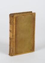
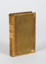
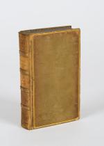
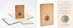
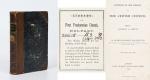
First Edition. Oxford, Printed by T. Combe / The Ashmolean Society, 1839. Octavo. Frontispiece [Folded map of the eastern half of North America], XVIII, 73 pages. Original Softcover / Original printed wrappers in custom made cloth-case (see images). Content-Page detached and loosely inserted. Otherwise this publication is in its very rare original state and in excellent condition with only minor signs of external wear.

EUR 475,-- 

Show details   Add to cart

[Roberts, Géographie Physique, Historique et Politique de la France

27. [Roberts, William] [Exlibris Gulielme (sic) Roberts] Bonnechose, Émile de / L.Dussieux (cartographer).

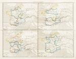
Géographie Physique, Historique et Politique de la France avec dix-huit cartes coloriées représentant la formation successive du Royaume.

Paris, Firmin Didot Frères, 1847. Octavo (14 cm x 23 cm). V, (2), 104 pages, suivies de 18 cartes aux contours colorisés, de la France dans ses états successifs (104 pages plus 18 hand-coloured maps of France by L.Dussieux showing France through its History, with special maps showing historical military events with England etc. Original Softcover. Spine rubbed and slightly damaged. Otherwise in very good condition with only minor signs of wear. Name of preowner William Roberts in pencil on titlepage [being William Roberts of the irish family Westropp-Roberts].

EUR 220,-- 

Show details   Add to cart

Petherick, Egypt, The Soudan and Central Africa. With Explorations from Khartoum

28. Petherick, John.

Egypt, The Soudan and Central Africa. With Explorations from Khartoum on the White Nile to the Regions of the Equator Being Sketches from Sixteen Years’ Travel.

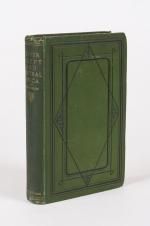
Edinburgh and London, William Blackwood and Sons, 1861. 15 cm x 23 cm. XII, 482 pages. With large, fold-out ‘Sketch Map of John Petherick’s Travels in the years 1853-1858’. Hardcover / Original green publisher’s cloth with gilt lettering on spine. Design to front board. One corner stronger bumped. Otherwise in very good+ condition with only minor signs of external wear. The map in excellent condition. Very Rare !

EUR 375,-- 

Show details   Add to cart

Arthur Penrhyn Stanley - Lectures on the History of the Jewish Church. Part I: Abraham to Samuel - With Maps and Plans of the Mosque at Hebron / Palestine before the Conquest / Migration of Abraham

29. Stanley, Arthur Penrhyn.

Lectures on the History of the Jewish Church. Part I: Abraham to Samuel – With Maps and Plans (Plan of the Mosque at Hebron / Palestine before the Conquest / Migration of Abraham).

London, John Murray, 1863. Octavo. XLI, 523 pages with folded maps and plans. Hardcover / Original Half-leather with gilt lettering on spine. Upper spine slightly damaged. Otherwise in very good condition with some minor signs of wear only.

EUR 128,-- 

Show details   Add to cart

The Harvard University Catalogue 1880 - 1881 & The Harvard University Catalogue 1899-1900.

30. Harvard University.

The Harvard University Catalogue 1880 – 1881 & The Harvard University Catalogue 1899-1900.

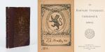
Two Volumes. Cambridge, University Press, 1880-1900. 8°. Pagination: 1880 – Catalogue: 230 pages / Pagination: 1899-1900-Catalogue: Folded “Map of Cambridge as the Vicinity of Harvard College 1899-1900” as Frontispiece, VII, 716 pages. Hardcover / Original half leather bindings. Slightly rubbed only. Titlepage cleanly detached. Wonderful publication. Exlibris / Bookplate of the Harvard University “ALPHA – DELTA – PHI – CLUB” with manuscript name of “J.G.Bradley 1902”. Two of these bookplates present on the pastedowns of the Volumes. RARE !

EUR 200,-- 

Show details   Add to cart

Norris-Newman, In Zululand With The British Throughout the War of 1879.

31. Norris-Newman, Charles L.

In Zululand With The British Throughout the War of 1879.

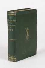
London, W. H. Allen 1880. 14.5 cm x 23 cm. Frontispiece, XV, 343 pages. Illustrated throughout with portraits. Includes the vintage photograph of Sir Henry Bartle Edward Frere (including tissue-guard), 3 fold-out plans. With the often missing large fold-out Military Map of Zulu Land and Adjacent Parts of Natal and Transvaal. Hardcover [publisher’s original green cloth] with gilt lettering on spine. Design on front board. First layer, with frontispiece, slightly detached. Otherwise in very good+ condition with only minor signs of external wear. Interior bright and clean, with very minor spotting near front. Ink markings to first page of first chapter. Bookplate / Exlibris of Davenport House (Bridgnorth) to front pastedown with the printed motto “Audentes Fortuna Junat”. Extremely rare, rather scarce and even scarcer with the large folding-map included !

EUR 680,-- 

Show details   Add to cart

Norris-Newman, With the Boers in the Transvaal and the Orange Free State in 1880

32. Norris-Newman, Charles L.

With the Boers in the Transvaal and the Orange Free State in 1880-1 / With A New Map of the South African Republic and Text of the Convention of 1884. [Including an extensive Appendix with a Glossary of Local Terms used in South Africa – The Transvaal Volksraad – Convention Between Her Majesty the Queen of the United Kingdom of Great Britain and Ireland and the South African Republic – Notices of the Boer Leaders etc.].

Second Edition. London, Abbott, Jones & Co., Limited, (1881). 15 cm x 22.5 cm. XVI, 392 pages. Fold-out map near front showing South African Republic. Hardcover [publisher’s original khaki cloth] with gilt lettering and tooling on spine. Blind ruling on boards. Very good condition with only minor signs of external wear. Appendix unopened (uncut). Binding firm and strong. Interior is bright and clean with sharp corners. Preowner’s name on half-title: “Miss McCracken – 19th Dec.1899”.

EUR 275,-- 

Show details   Add to cart

Johannes Justus Rein, Japan nach Reisen und Studien im Auftrage der Königlich Preussischen Regierung dargestellt

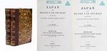
33. Rein, J.J. [Johannes Justus] / [Provenienz / Provenance: Max von Baden / Bibliothek Schloss Salem].

Japan nach Reisen und Studien im Auftrage der Königlich Preussischen Regierung dargestellt von J.J. Rein [Johannes Justus Rein], Professor der Geographie in Marburg [an der Lahn]. Erster Band: Natur und Volk des Mikadoreiches. Mit 5 Lichtdruckbildern [Photographien], 12 Holzschnitten, 3 Lithographischen Tafeln und 2 Karten. / Zweiter Band: Land- und Forstwirthschaft, Industrie und Handel. Mit zum Theil farbigen Tafeln, 20 Holzschnitten im Text und 3 Kaertchen.

Erste Ausgabe [First Edition]. Two Volumes. Leipzig, Verlag von Wilhelm Engelmann, 1881 – 1886. Gross-Oktav. Band I: XII, [1], 630 Seiten mit allen Abbildungen und insbesondere der Original-Photographie von Nagasaki aber ohne die “Orographish-hydrographische Karte [Japans]” am Schluss des Bandes. / Band II: XII, 678 Seiten mit den drei Falt-Karten von Japan am Schluss des Bandes . Hardcover / Original 19th century half-leather with gilt lettering and ornament to spine. / Originale Verlags-Leinenbaende. Ehemalige Exemplare der “Bibliothek Salem” und ehemaliges “Eigenthum des Prinzen Wilhelm”, mit zwei dezenten Bibliotheksschildchen der Bibliothek Salem im Innendeckel und dem Stempel des Prinzen Max von Baden [″MB” mit Krone] auf den Titelseiten. Very good condition with only minor signs of wear and only the two folded Maps missing / Sehr guter Zustand des seltenen Werks und mit nur wenigen Stockfleckchen, wie ueblich auf den Rueckseiten des Photo-papiers und Abklatsch auf den Seiten verso. Aus dem Vorwort: “Saemtliche Illustrationen dieses Buchs sind Originale – Bonn, im September 1886 – Der Verfasser”.

EUR 1.000,-- 

Show details   Add to cart

Drummond, Tropical Africa.

34. Drummond, Henry.

Tropical Africa. With Maps and Illustrations.

First Edition. London, Hodder and Stoughton, 1888. 13 cm x 19.5 cm. Frontispiece, XI, 228 pages. 6 maps (on five fold-out-sheets). At front 2 fold-out colour maps of East Central Africa and Equatorial. At rear fold-out colour maps of ‘European Possessions and Claims in Central and Southern Africa’. One fold-out colour map of east central Africa within contents. Hardcover / contemporary half leather with marbled paper-covered-boards. Gilt lettering and tooling on spine. Very good condition with only minor signs of external wear. Minor damage to heel of spine. Binding still firm and strong. Foxing to endpapers. Interior and maps in bright and clean condition.

EUR 220,-- 

Show details   Add to cart

Barneby, The New Far West and The Old Far East

35. Barneby, W. Henry.

The New Far West and The Old Far East – Being Notes of a Tour in North America, Japan, China, Ceylon, Etc. With Maps and Illustrations. [Including an Appendix on the Supplementary Treaty of Commerce between the United States and Japan].

London, Edward Stanford, 1889. Quarto. Frontispiece, X, 316 pages with three large fold-out-maps in colour and eight illustrations in black-and-white. Hardcover / Stunning 19th century prize-binding in beautiful full tan calf bearing the Arms of Monmouth Grammar School [with their Motto “Serve and Obey”]. Inscription and embossed stamp of Monmouth – Grammar School to endpaper. Dedicated by Headmaster C.M.Roberts to former pupil W.A.Lamb in July 1890. Excellent condition with only minor signs of wear.

EUR 480,-- 

Show details   Add to cart

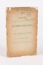
Sawyer, Coal-Mining in South Africa.

36. Sawyer, A.R. / [G.F.Gresley / W.S.Gresley].

Coal-Mining in South Africa.

Newcastle, G.T. Bagguley, no year (c.1890). 15.5 cm x 24.5 cm. 44 pages. Excellent, larger fold-out-map (coloured) at rear of the publication, showing the South African coalfields. Several fold-out tables and diagrams at rear related to the coalfields. Softcover / Publisher’s original, printed wrappers. Poor condition of this very scarce pamphlet with strong signs of external wear and chipping to boards. Occasional annotations within the publication. Interior bright and clean. Private gift-inscription in ink on the frontcover: “To W.S.Gresley from his brother G.F.G. [G.F.Gresley]– Capetwon – May – 1890”. [G.F.Gresley was author of e.g.: “The Early History of Robben Island”].

EUR 275,-- 

Show details   Add to cart

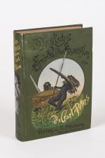
Peters, Die Deutsche Emin Pascha-Expedition.

37. Peters, Carl.

Peters, Die Deutsche Emin Pascha-Expedition. Mit 32 Vollbildern und 66 Textabbildungen von Rudolf Hellgrewe in Berlin, dem Portrait des Verfassers nach Franz von Lenbach und einer Karte in Farbendruck.

Zweites Tausend. München und Leipzig, Druck und Verlag von R. Oldenbourg, 1891. 16 cm x 23 cm. Frontispiece, VI, 560 pages. Large fold-out map within sleeve of rear pastedown showing the “Emin Pascha Expedition.” / Mit der grossformatigen Faltkarte in Kartentasche (im hinteren Einbanddeckel). Hardcover [publisher’s original green cloth] with gilt lettering and pictorial on spine. Large pictorial on front board. Beautifully illustrated pastedowns and endpapers. Maroon coloured text-block edges. / Originaler, illustrierter Verlagsleinenband mit sehr dekorativer Einbanddeckel- und Einband-Ruecken-Illustration. Very good+ condition with only minor signs of external wear. Ex libris of Mark Walder on front pastedown. University stamp on p.IV. Discreet bookseller’s label of ‘R. Oldenbourg, München’, at bottom corner of rear pastedown. Some browning to reverse of fold-out map. Interior is bright and clean with sharp corners. / Sehr guter Zustand mit nur geringen Gebrauchsspuren. Ganz kleiner Einriss am Vorsatzpapier.

EUR 220,-- 

Show details   Add to cart

Goodman More, Contributions towards a Cybele Hibernica

38. Goodman More, Alexander / Colgan, Nathaniel / Scully, Reginald W.

Contributions towards a Cybele Hibernica, being Outlines of the Geographical Distribution of Plants in Ireland [Including: “A List of the Principal Books, Papers, MSS. and Herbaria relating to the Flora of Ireland].

Second Edition – Founded on the Papers of the Late Alexander Goodman More. Dublin, Edward Ponsonby, 1898. Large Octavo (16 cm x 22,5 cm). Frontispiece-Map (folded), XCVI, 538 pages. Original Hardcover / Original publisher’s green cloth with gilt lettering on spine. Excellent condition with some minor signs of wear only. Unusual in this condition ! The second edition is the definitive, enlarged and revised version of this book.

EUR 128,-- 

Show details   Add to cart

Rae, Malaboch - or Notes from my Diary on the Boer Campaign of 1894 against the

39. Rae, Colin.

Malaboch – or Notes from my Diary on the Boer Campaign of 1894 against the Chief Malaboch of Blaauwberg, District Zoutpansberg, South African Republic – To which is appended a synopsis of the Johannesburg crisis of 1896.

London / South Africa, Sampson Low, Marston and Company / J.C. Juta & Co, 1898. 15.5 cm x 23.2 cm. XIX, 248 pages. 53 illustrations. Fold-out map showing ‘the scene of war in Zoutpansberg.’ Modern, recent Hardcover [maroon cloth] with gilt lettering on spine. Parts of the original binding (spine and illustrated cover) pasted to pastedown and endpaper. Excellent condition besides the paper being a little brittle at the deckled edges and a minor tear to halftitle. Interior bright and unmarked. Binding firm and strong.

EUR 128,-- 

Show details   Add to cart

Sir George Douglas, A History of The Border Counties - Roxburgh, Selkirk, Peebles [with Maps]

40. Douglas, Sir George.

A History of The Border Counties – Roxburgh, Selkirk, Peebles.

Edinburgh / London, William Blackwood and Sons, 1899. 8°. XVII, 482 pages. Original Hardcover (red blind-stamped-cloth with gilt lettering on spine and front-board). Very good condition with only minor signs of external wear. Including the often missing maps (3 large, folded maps in pockets attached to the inner boards of the binding). Map I: Teviotia Vulgo Tivedail – (Map by Joan Blaeu of Teviotdale,Tweedale& Liddsdale) / Map II: Tvedia cum vicecomitatu Etterico Forestae etiam Selkirkae dictus (Twee-dail with the Sherifdome of Ettrick-Forrest called also Selkirk) by Joan Blaeu / Map III: Ordnance Survey Map of “The Counties of Roxburgh, Peebles and Selkirk”. The Blaeu – Maps with very minor damages only. [The County Histories of Scotland]

EUR 128,-- 

Show details   Add to cart

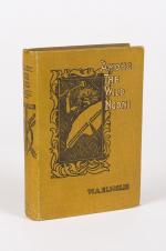
Elmsie, Among The Wild Ngoni.

41. Elmslie, W.A.

Among The Wild Ngoni – Being Some Chapters in the History of the Livingstonia Mission in British Central Africa.

Edinburgh and London, Oliphant Anderson & Ferrier, 1899. 13.5 cm x 19.5 cm. Frontispiece, 319 pages. 14 illustrations including frontispiece. Folded Map at rear showing ‘Livingstonia Mission.’ Hardcover [publisher’s original tanned cloth] with gilt lettering and pictorial illustration on spine and board. Very good+ condition with only minor signs of external wear. Interior bright and clean.

EUR 128,-- 

Show details   Add to cart

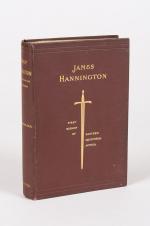
Dawson, James Hannington - First Bishop of Eastern Equatorial Africa.

42. [Hannington, James] Dawson, E.C.

James Hannington – First Bishop of Eastern Equatorial Africa. A History of his Life and Work, 1847-1885.

London, Seeley and Co. Limited, 1899. 13.5 cm x 19.5 cm. Frontispiece, VIII, 392 pages. Fold-out map at rear of “Eastern Central Africa”. Hardcover [publisher’s original brown cloth] with gilt lettering and blind tooling on spine and front board. Gilt design on front board. Deckled edges. Very good condition with only minor signs of external wear. Tissue guard shows foxing. Interior is bright and clean.

EUR 128,-- 

Show details   Add to cart

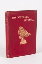
Kollmann, The Victoria Nyanza - The Land, the Races and their Customs, with Spec

43. Kollmann, Paul [trans. Nesbitt, H.A. / Hole, Hugh Marshall ].

The Victoria Nyanza – The Land, the Races and their Customs, with Specimens of some of the Dialects. With a Map and 372 Illustrations from Native Objects in the Author’s Own Collections.

London, Swan Sonnenschein & Co., 1899. 17 cm x 24 cm. IX, 254 pages. Large fold-out map of region near front. Hardcover [publisher’s original maroon cloth] with gilt lettering on spine and front board. Gilt design and blind tooling to front board. Deckled edges. Excellent condition with only minor signs of external wear. Some signs of foxing to edges and throughout. Binding strong and firm. Interior unmarked. From the library of Hugh Marshall Hole, with his bookplate to front pastedown. Hole’s name also in form of a name-stamp on front endpaper and titlepage. Rare ! But rather scarce in this excellent condition !

EUR 450,-- 

Show details   Add to cart

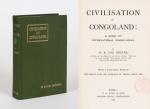
Bourne, Civilisation in Congoland - A Story of International Wrong-Doing.

44. Bourne, H. R. Fox.

Civilisation in Congoland – A Story of International Wrong-Doing. With a prefatory Note by the Right Hon. Sir Charles W. Dilke.

London, P.S.King & Son, 1903. Octavo. XVI, 311 pages with large, coloured, folded map of the Congo: “Congo Land or The Conventional Basin of the Congo”. Original Hardcover with dustjacket in protective Mylar. Endpaper detached. Otherwise in very good condition with only minor signs of external wear. Faint old library stamp of the “Reichsgericht in Berlin” to titlepage.

EUR 128,-- 

Show details   Add to cart

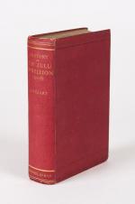
Stuart, A History of the Zulu Rebellion 1906, and of Dinuzulu's arrest, trial an

45. Stuart, J.

A History of the Zulu Rebellion 1906, and of Dinuzulu’s arrest, Trial and Expatriation. With Five Maps, Six Plans and Twenty Five Illustrations.

London, Macmillan and Co. Ltd, 1913. 14.5 cm x 22.5 cm. Frontispiece, XVI, 581 pages. Large fold-out map sheet at rear, showing a Key Map of Natal and Area of Operations. Hardcover [publisher’s original red cloth] with gilt lettering on spine. Gilt top edge. Very good condition with only minor signs of external wear. Minor foxing to edges and tissue-guards, as usual with this publication. Interior bright and clean besides very minor signs of foxing.

EUR 220,-- 

Show details   Add to cart

Johnston, Pioneers in South Africa.

46. Johnston, Harry.

Pioneers in South Africa. With Eight Coloured Illustrations by Wal Paget.

London, Glasgow, Bombay, Blackie and Son Limited, no year (c.1915). 13.5 cm x 19.5 cm. Frontispiece, 316 pages. 16 illustrations total – 8 in colour, 8 in black and white. Including three fold-out maps (Central and South Africa / Africa before Livingstone’s Journeys / Africa by discovery or report after Livingstone’s last researches were published 1874). Hardcover [publisher’s original navy cloth] with lettering and design on spine and front board. Frontispiece and one illustration cleanly detached but loosely inserted. Otherwise in very good- condition with only minor signs of external wear. Occasional spotting to edges and foxing throughout. [ “Pioneer” Library ]

EUR 78,-- 

Show details   Add to cart

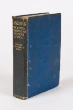
Pearce, Zanzibar - The Island Metropolis of Eastern Africa.

47. Pearce, F.B.

Zanzibar – The Island Metropolis of Eastern Africa. With Illustrations and Maps.

First Edition. London, T. Fisher Unwin, 1920. 17.5 cm x 25.5 cm. Frontispiece, XI, 421 pages. 50 illustrations. Two maps near front and also including the often missing large fold-out map of Zanzibar and Pemba Islands at rear. Hardcover [publisher’s original blue cloth] with gilt lettering on spine. Embossment to front board. A little rough but still in Good+ condition with only minor signs of external wear. Minor bumps to corners of boards. Spine cloth frayed at head and tail. Binding is still firm and strong. Some spotting throughout to an otherwise clean interior. With tissue guard in good condition. New endpapers !

EUR 128,-- 

Show details   Add to cart

Dugmore, The Vast Sudan.

48. Dugmore, A. Radclyffe,

The Vast Sudan [With Notes on the Distribution, Appearance, Peculiarities and Habits of the Game of the Sudan (Water-buck, Black Rhinoceros, Buffalo, Reedbuck, Hartebeest etc.) / With a List of the More important Animals found in the Sudan – Some of the More Important Birds Found in the Sudan].

London, Arrowsmith, 1924. 16.5 cm x 24 cm. Frontispiece, 312 pages. 19 excellent photographic illustrations including frontispiece. One fold-out map showing ‘Anglo-Egyptian Sudan’. Hardcover [publisher’s original green cloth] with gilt lettering on spine. Blind tooling and design to front board. Very good condition with only minor signs of external wear. Only one of two fold-out-maps present (the small Africa-Map-missing). Interior bright and clean and sharp cornered. Binding firm and strong.

EUR 128,-- 

Show details   Add to cart

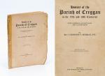
Murray, History of the parish of Creggan in the 17th and 18th centuries.

49. Murray, Laurence P.

History of the Parish of Creggan in the 17th and 18th centuries. With numerous Ancient Maps and Illustrations.

Dundalk, The Dundalgan Press, 1940. 92 pages. Original Softcover. Repaired and frayed but overall still in good condition with signs of external wear. Several annotations in the maps and within the text.

EUR 128,-- 

Show details   Add to cart

Hill, Permanent Way - The Story of the Kenya and Uganda.

50. Hill, F.M.

Permanent Way – The Story of the Kenya and Uganda Railway – Being the Official History of the Development of the Transport System in Kenya and Uganda. Foreword by Sir Reginald Robins, the Commissioner for Transport, East Africa High Commission.

Nairobi / Kenya, East African Railways and Harbours, [1949]. 20.5 cm x 25.5 cm. XII, 582 pages. 18 plates with fantastic monochrome photographs. 2 beautifully coloured fold-out maps within, showing 1. East Africa in 1892 with the proposed Railway / 2. East Africa in 1949 showing the Principal Land & Water Communications with finished Railways and Railways under construction. Hardcover [publisher’s original green cloth] with gilt lettering on spine and gilt design on front board. Very good condition with only minor signs of external wear. Minor stain to front board lower corner. Binding is firm and strong. Foxing and tanning to edges. Some occasional pencil-markings. Interior is otherwise tight, bright and clean.

EUR 128,-- 

Show details   Add to cart

Page: 1
:

Order by: Author · Title · Keyword · Year · Price (up) · Price (down) · Inventory Number · Recent Changes · Relevance

Books per page: 10 · 20 · 50 · 100

Contact

Inanna Rare Books Ltd.
Woodley House
Castletownshend Road
P81 D262 Skibbereen, County Cork
Ireland
Phone: ++353 - (0) 87 - 102 5412
E-Mail: info@inannararebooks.com
Internet: https://www.inannararebooks.com

Online Bookshop specialized in rare
and secondhand books.

Newsletter and E-Catalogue Sign Up

Enter your name and e-mail address to sign up for
our regular newsletter and catalogue service.

Payment Options

Paypal   Master Card   VISA   American Express

Legal Info

  • Terms & Conditions
  • Contract Withdrawal
  • Cancellation Policy
  • Privacy Policy
  • Shipping Information
  • Imprint

© 2026 Inanna Rare Books Ltd. | Powered by HESCOM-Software

Follow Us