Complete Catalog (8231 items)

[Cumberbatch, Large Family Archive of the Benwell Rees - Family, including William Benwell Rees

6308. [Cumberbatch, Benedict] Cumberbatch, Henry Arnold / Rees, Helen / Basil Benwell Rees / William Benwell Rees / Etheldreda Blanche Barker / [Sir Winston Churchill / Sir Anthony Arthur Duncan Montague Browne [Private Secretary to Sir Winston Churchill]].

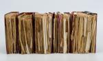
Large Family Archive of the Benwell Rees – Family, including William Benwell Rees (brother to actor Benedict Cumberbatch’s grandmother Helen Rees, by marriage to British Diplomat Henry Arnold Cumberbatch, who was Consul in Romania, Turkey and Lebanon ). The archive includes at least one manuscript letter by Henry Arnold Cumberbatch and around one thousand documents chronicling the lives of the ex-patriate Benwell Rees family from 1890-1970 in Alexandria and Monaco, including William Benwell Rees, whose marriage to Etheldreda Blanche Barker cemented the family’s role in the highest circles of Alexandria life. The archive also charts their son Basil Rees’ decade in Monaco under Princess Grace and Prince Rainer III where he served as President of the British Association in the 1950’s-‘60s and solicited a letter written by Sir Anthony Arthur Duncan Montague Browne, on Winston Churchill’s behalf on Chartwell headed paper in which the former Prime Minister declined to attend an event in Monaco [signed by Montague Browne]. The archive is held in five heavy volumes, bursting with a plethora of amazing and wonderful historical letters, ephemera, emotional messages and telegrams, old images, theatre-programmes, and especially also includes programmes of plays in which ancestors of Benedict played (J.M.Barrie, Shakespeare etc.). The original letters and documents paint an interesting picture of Benedict Cumberbatch’s grandmother’s side of the family history in the Levant, their service in the Middle East and their social lives. The five volumes are bound in bespoke red morocco over textured paper-covered-boards and they contain at least one reference to Helen Rees next to a newspaper-clipping and dozens of wonderful handwritten letters and cards. Each volume about four inches across spine with title in gilt to upper cover and around 100 leaves in each with documents mounted recto and verso throughout, with photographs, invitations, business materials and clippings that chart the family’s life in their service for the British Colonial Office. The five Volumes include for example: Volume 1: The Benwell Rees’: begins with Egyptian Gazette, 1890 and a programme for a performance c1900 at the Port Theatre, Marina, Alexandria of Rumpelstilkskin; visiting cards and contemporary reports of the marriage of W B Rees and Etheldreda Blanche Barker in Alexandria, February 1901; Windsor Hotels prospectus and flyer (a WBR enterprise); 1913 Casino de Monte Carlo ticket for Ethel Rees; Kings School Canterbury ephemera and St Johns’ College, Cambridge for Basil Rees from 1920’s, graduated June 1924. Volume 2: The Benwell Rees’ Vol II, 1920’s-1990’s: includes J M Barrie, Quality Street programme for English Girls’ School, Alexandria, 1941; invitations from Princess Grace of Monaco etc Volume 3: Basil Rees Vol III, cover nearly detached, 1953- Basil Rees living at 2 Rue Origene, Alexandria, and covering period of move to Palais Majestic, Monaco after which he served as President of the British Association and his sudden death in 1967. Invitations to dinner and place settings with the Prince and Princess of Monaco. Birthday greetings; international stamp collecting societies. Photographic ‘Permis de Sejour’ for William Benwell Rees in Monaco, October 1918. Volume 4: Basil Rees Vol. IV Begins with telegram from Rees to the Queen; mostly very extensive formal correspondence concerned with Rees’ Presidency of he British Association in Monaco; invitations, notes, printed volume of Statutes of association from 1950, royal correspondence with Monaco and Britain. Volume 5 and 6 (two large Volumes): Basil Rees 4-5-1902 AND Basil Rees 4-5 1902 [William Basil Benwell Rees ; Birth: 4 May 1902. Alexandria, Al Iskandariyah, Egypt ; Death: 10 Feb 1967 (aged 64). Monaco]. Volume I covers the early days of the Alexandria – Period and beautiful ephemera of a Rees-wedding (Miss Elaine Trevitt Briggs to Charles Owen Benwell Rees, social life in Alexandria, Theatre and Dinners etc. as well as the many Freemason – Engagements of the “Alexandria Lodge No.4184” in the year 1942 and also a rare Volume of Bye-Laws for the District Grand Lodge of Egypt and the Sudan Volume II covers William Basil Benwell Rees; Royal Navy ID card, British Forces, September 1943 – other material relating to Rees’ work as Duty Defence Officer at the Royal Navy Defence Base in Alexandria, HMS Nice. Volume begins in 1902 and includes Alexandria Dog Show, W B B Rees at Jesus College, Cambridge; Egypt NAAFI permits; lock of Basil Rees’ hair, aged 2 etc.

Alexandria / Monaco / etc., c. 1902 – 1967. Octavo. Six Volumes with hundreds of pieces of Ephemera, an original Theatre Couplet, photographs, newspaper-clippings, Theatre Programmes etc. Half Morocco. Bindings stronger rubbed and slightly damaged.


EUR 12.800,-- 

Show details   Add to cart

Philip Luckombe, The Compleat Irish Traveller [Luxury Reprint with all of Charles Smith's Illustrations of 18th century Ireland (Munster / Kerry / Waterford) in separate Folder for Framing]

6313. [Luckombe, Philip / Smith, Charles].

Luxury Reprint of “The Compleat Irish Traveller” [With high quality Reproductions of the 31 original Plates of detailed Maps of County Cork in the 18th century, County Kerry in the 18th century and Waterford in the 18th century, as well as some of the earliest engravings of Irish Towns here for the first time reproduced as beautiful Artworks for framing and housed in a special, handmade Folder. The publication was just recently enlarged with a detailed, Topographical Index (July 2023)]. Complete Title: “The Compleat Irish Traveller, containing A general Description of the most Noted Cities, Towns, Seats, Buildings, Loughs &c. in the Kingdom of Ireland, Interspersed with Observations on the Manners, Customs, Antiquities, Curiosities and Natural History of that Country. With Elegant Copper Plates”. [With 31 original Plates after Charles Smith, including Frontispiece, this Reprint / Facsimile is the result of 10 years of research and purchase of three (3) original versions of the First Edition from the year 1788. The first Editions known to Inanna Rare Books all had different quantities of Plates and Maps included. This Reprint by Inanna Rare Books has been produced from an extremely clean version of the original and shows the most complete set of illustrations and XL-Size Maps and Artworks we could find in any of the original editions. The publication shows not only Maps of County Cork, County Kerry and County Waterford but also Views of Irish Cities and Towns in these Counties of the Province of Munster and besides the wonderful Historical Plan of Cork City this set also includes the very rare Plan of the “Grand Canal from Dublin to the River Shannon” (see detailed list of all the illustrations present at the end of this description)].

Luxury Limited-Edition-Reprint of the First Edition by Luckombe in 1788. Two Volumes plus extra Folder with 31 Plates reprinted as Artworks for framing. Skibbereen (County Cork), Inanna Rare Books Publishing, 1788. Octavo (13.5 cm x 21 cm). Pagination: Volume I: Frontispiece, engraved Titlepage, XXX, 189 pages plus recently published Index (July, 2023) / Volume II: Engraved Titlepage, 263 pages plus recently published Index (July, 2023). Plus large, bespoke made Folder with thirtyone (31) Reproductions of the Maps, Plans and Illustrations which usually were folded inside this publication and now for the first time have been liberated from the book and were published as the beautiful works of art they are. Textvolume: Volume I and II of the text bound in one beautiful half-leather-volume with gilt lettering on spine, bound in the style of the 18th century / Illustrations-Folder with 31 reprinted illustrations of Towns and Maps of Ireland but mainly of Munster, bound in bespoke made half-cloth with paper-covered boards and pasted Reprint of the original titlepage. Excellent, new condition. One of only 300 printed. [Inanna Rare Books – Reprint & Facsimile – Series].

EUR 2.480,-- 

Show details   Add to cart

Jean-Denis Barbié du Bocage - Tableau de la Grande-Bretagne, De L'Irlande et des Possessions Angloises dans les quatre parties du Monde. [Large Paper Copy / Better Paper Copy / Exemplaire de Luxe]

6316. Pugilism (Boxing) – Baert-Duholant, Charles-Alexandre-Balthazar-François de Paule baron de / Jean-Denis Barbié du Bocage.

Tableau de la Grande-Bretagne, De L’Irlande et des Possessions Angloises dans les quatre parties du Monde. [Large Paper Copy / Better Paper Copy / Exemplaire de Luxe] [With five (5) large, folded Maps by Jean-Denis Barbié du Bocage: Large, oblong folded Map/Plan of Gibraltar / England / Scotland / Ireland / India] / [With four (4) stunning copper-engravings: Grotte de Fingal, Chaussée des Géants / Plan et vue de Gibraltar / Combat de Boxe (Pugilists)] / [With two (2) portraits: 1.Portrait of William Pitt (after William Owen) and 2. Portrait of Charles Jacques Fox (after Karl Anton Hickel)].

Four Volumes (complete set). Paris, Chez H.J.Jansen, L’An 8me [1800]. Octavo (21.5 cm x 14 cm). Collation: Volume I: (8), 459, (1), 11 pages with Eleven (11) copper-engravings of which are: 5 Maps / Plans and 4 Engravings: The folded view of Fingals Cave (″Grotte de Fingal dans l’Ile de Staffa” – (20.5 cm x 31.5 cm) / “Folded Plate of the Giants Causeway (″Vue occidentale de la Chaussee des Geans et des Caps voisins” (20.5 cm x 39 cm)) / Fantastic, large Map/Plan of Gibraltar by Jean-Denis Barbié du Bocage, with a Birds-Eye-View of the Ville de Gibraltar (20.5 cm x 65.5 cm) [also showing the Ville Irlandaise on Gibraltar] / Scenic View of Gibraltar (″Vue de Gibraltar, prise du cote de l’Espagne” (20.5 cm x 33 cm) / Large Fold-Out-Map of England by Jean-Denis Barbié du Bocage with an Inset-View of Stonehenge (47 cm x 51 cm) / Large Fold-Out-Map of Scotland by Jean-Denis Barbié du Bocage, including the Western Isles and Shetland, with a stunning Inset-View of the irish pilgrimage-mountain Croagh Patrick [Craig-Phadrick] in Westport, Ireland (37 cm x 50 cm)/ Large Fold-Out-Map of Ireland with an Inset-View of the Lakes of Killarney (39 cm x 44.5 cm) / Volume II: 532, (1), 12 pages with Large Fold-Out-Map of India (″Possessions Anglaises”) by Jean-Denis Barbié du Bocage – the large India-Map showing areas as far as Tibet, Siam, Sumatra and the Andaman Islands, Ceylon, Burma (48 cm x 43 cm) / Volume III: 502, 48, (2) pages with two portraits: Guillaume Pitt [William Pitt] & Charles Jacques Fox (each 20.5 cm x 12.5 cm)/ Volume IV: 486, 22, (2) pages with the very famous Fold-out-Illustration of Pugilists / Boxers at Odiham in Hampshire [″Combats de Boxers a Odiham”] showing a boxing-match between Humphrey and Mendoza (32 cm x 20.5 cm). Hardcover / Original, very decorative original half leather bindings with gilt lettering and ornament on spine. Volume One professionally rebacked by an english master bookbinder. All four Volumes in protective Collector’s Mylar. Excellent condition with only minor signs of external wear. From the library of François-Xavier de Valenzi with his bookplate / exlibris to the pastedowns of each Volume. Maps in this de Luxe Edition are all considerably larger than in the normal-paper-edition and all the maps and illustrations are in superb condition. An underestimated collectable.

EUR 1.280,-- 

Show details   Add to cart

Ireland (Carrick-A-Rede / Giant's Causeway

6317. 19th century European Travel – Ireland (Carrick-A-Rede / Giant’s Causeway / Bideford (Devon) / Torrington (Devon) / Lynton (Devon) / Lynmouth (Devon) / Watersmeet (Devon) / Ilfracombe (Devon) / Carnarvon Castle (Wales) / Forth Bridge – (Wales)/

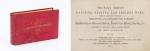
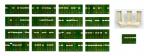
Original Photoalbum from ca. 1870 / 1880 with 37 original Albumen Print / Albumen Silver Print – Photographs of a Tour through Europe. With very interesting photographs of Ireland’s favourite attractions in County Antrim , a large section of the Devon Region in England (The DEVON – Section includes 15 photographs alone), and some beautiful and rare early colour photographs of Luzern in Switzerland: Examples of images: 8. Bideford in Devon (Promenade with ships and people) / 9. Torrington – Devon (Town Mill Bridge) / 10. Torrington – Devon (Northern Bridge) / Two smaller photographs on one board: 11. Torrington – Devon (Castle Ruins) / 12. Torrington – Devon – (Near Railway Station) / Two smaller photographs on board: 13. Torrington – Devon – (The Avenue) / 14. Torrington – Devon (Valley of Rocks / Castle Rock) / 15. Lynton – North Devon / 16. Lynton – North Devon (Castle Rock) / 17. Lynmouth – Watersmeet / 18. Lynmouth (Bridge /Watersmeet near Lynmouth) / 19. Lynmouth (Picturesque Harbourscene with old fisherhuts on left) / 20. Ilfracombe – North Devon (from the Tours Walk – Top of the Hill) / 21. Ilfracombe – Tour Walk / 22. Ilfracombe – View from Capstone Hill /

Devon, ca.1870/1880/1890. Oblong – Quarto. 37 plates. Hardcover. Recently, professionally rebound in half leather with gilt lettering on spine. The large photographs in very good condition.

EUR 380,-- 

Show details   Add to cart

Daniel Paterson & Edward Mogg - Paterson's Roads [1831/1832 Edition (18th Edition) with 12 Maps]

6318. [Paterson, Daniel] Mogg, Edward.

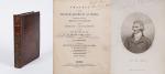
Paterson’s Roads [1831/1832 Edition (18th Edition)] – Being an entirely original and accurate Description of all the direct and Principal Cross Roads in England and Wales, with part of the roads of Scotland. [Including an “Appendix to the Eighteenth Edition of Paterson’s Roads; being An Accurate Description of the Direct and Principal Cross roads communicating with the Improved Old Passage Ferry, across the River Severn, between Aust and Beachley, near Chepstow. Accompanied by a Map of the Banks of the Wye. To which are added, Course of the Chepstow Steam Packets; and An arranged Tour through Wales, with References to the pages in the Body of the Work, where connection with various lines of Road takes place.”]. The Eighteenth Edition. To which are added Topographical Sketches of the several Cities, Market Towns and remarkable Villages and descriptive accounts of the principal seats of the Nobility and Gentry, the Antiquities, Natural Curiosities and other Remarkable Objects throughout the Kingdom. The whole Remodelled, Augmented and Improved by the Addition of Numerous New Roads and New Admeasurements, and Arranged upon A Plan at once Novel, clear and intelligible, is deduced from the latest and best Authorities: Including a Table of the Heights of Mountains from the Grand Trigonometrical Survey of the Kingdom; Also a Table of the Population, From the Census of 1831; To which is annexed the Arrival and Departure of the Mail, together with the Rates of Postage and An Entirely New Set of Maps.

London, Printed for Longman, Rees, Orme, Brown, Green and Longman, 1831/1832. Octavo (15 cm x 21,5 cm). Fontispiece – Fold-out-Map, 715 pages plus 44 pages of an Appendix. With twelve (12) Maps, including the frontipiece-map and full-page maps throughout the publication. Hardcover / Private half-leather of the early 20th century with gilt lettering on the spine. Some of the maps with visible reapirs but complete. Very good condition with only minor signs of wear. This being the so-called “Best Edition”.

EUR 480,-- 

Show details   Add to cart

Page: 1 2 ... 313 314 315 316 317 318 319 ... 411 412
: