


Tallis, Southern India - With Vignettes of Shuhur, Jeypoor, The Government Hous
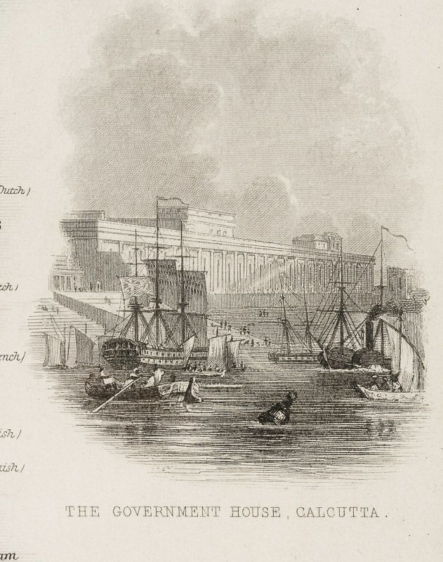
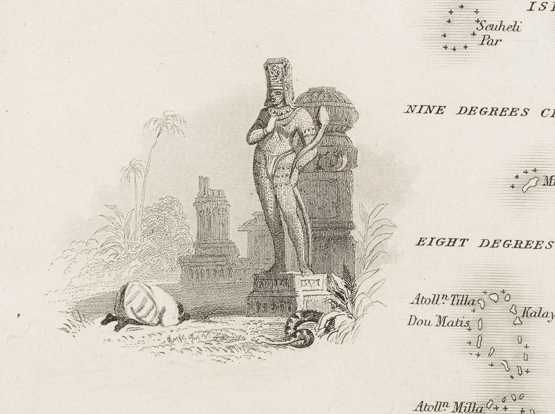
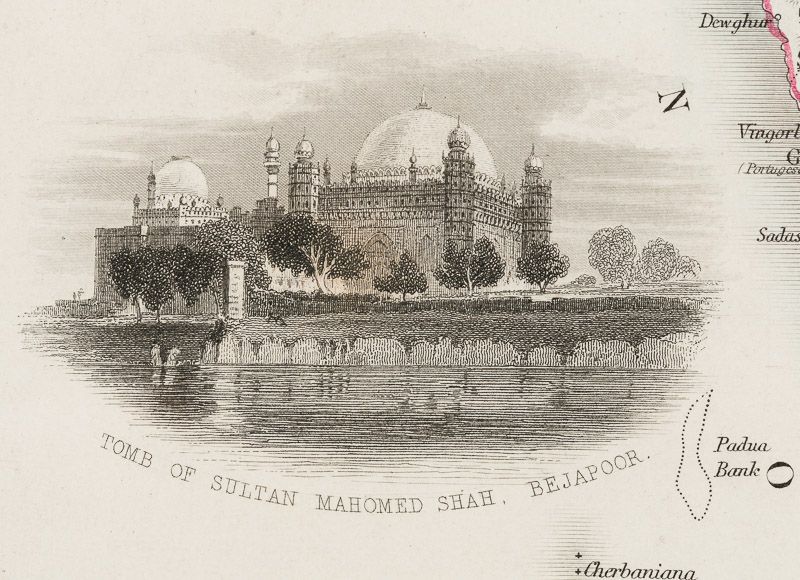
Southern India – Including the Presidencies of Bombay and Madras. With Vignettes of Shuhur, Jeypoor, The Government House, Calcutta, and Tomb of Sultan Mahomed Shah, Bejapoor. Also included are Depictions of European soldiers, natives at prayer and the Seal of the East India Company.
Original steel engraving / Vintage map. Drawn and engraved by John Rapkin. Partly hand-coloured. Illustrations by A.H. Wray and Engraved by J.H. Kernot. London, & New York, John Tallis & Company, 1851. Plate Size: 31.8 cm x 25.5 cm. Sheet Size: 37.2 cm x 27.2 cm. Vintage 19th century map in very good condition.
Beautiful map of the southern Indian subcontinent, from Sinde at the mouth of the Indus Estuary in the north down through Gujerat, Bejapor and Mysore and down into the Carnatic region in the south. Hydrabad and Circars border the Bay of Bengal. Ceylon is also included in the map as are the Laccadive and Maldive islands in the Indian Ocean. Relief is depicting with hachuring. The major cities such as Bombay, Sernigapatam, and Madras are shown, as are the rivers – including the Godavery and Beema rivers.
This was an India dominated by the East India Company, the British joint-stock company that came to rule large areas of India with its private armies, exercising military power and seizing administrative functions. Formed in the early 1600s to compete with the Dutch for trade and commerce in the East, the company rose to account for half of the world’s trade at one point. Company rule in India lasted until 1858, when, following the Indian Rebellion of 1857, the Government of India Act 1858 led to the British Crown’s assuming direct control of the Indian subcontinent in the form of the new British Raj. The company was dissolved in 1874 as a result of the East India Stock Dividend Redemption Act passed one year earlier, as the Government of India Act had by then rendered it vestigial, powerless, and obsolete. The official government machinery of British India assumed the East India Company’s governmental functions and absorbed its navy and its armies in 1858. (Wikipedia)
John Tallis (7 November 1817 – 3 June 1876) was an English cartographic publisher. His company, John Tallis and Company, published views, maps and atlases in London from roughly 1838 to 1851.
Tallis set up as a publisher with Frederick Tallis in Cripplegate in 1842; the business moved to Smithfield in 1846, and was dissolved in 1849. From 1851 to 1854 Tallis operated as John Tallis and Company. He started The illustrated news of the world and national portrait gallery of eminent personages in 1858, selling it for £1,370 in 1861; it folded in 1863. (Wikipedia)
The most important project John Tallis undertook, was the ‘Illustrated Atlas’ from 1851. The original map we offer here, was part of this exceptional Atlas and all the maps it contained are still today considered as the last reminder of an era of lavish map production. Tallis worked the project together with John Rapkin (1815-1876) and it was Rapkin’s style and talent that we have to thank for when we marvel at these maps today. What makes these maps so special is the detail of engraved vignettes that surround the map and often show indigenous scenes, people in their environment and even more so, historical buildings or historical views of towns and cities, architecture and landscape.
The project of ‘The Illustrated Atlas’ was designed to be finished just in time for the anxiously awaited “Great Exhibition of the Works of Industry of All Nations” or The Great Exhibition, sometimes referred to as the Crystal Palace Exhibition in reference to the temporary structure in which it was held, was an international exhibition that took place in Hyde Park, London, from 1 May to 11 October 1851. It was the first in a series of World’s Fairs, exhibitions of culture and industry that became popular in the 19th century, and it was a much anticipated event.
The Great Exhibition was organized by Henry Cole and Prince Albert, husband of the reigning monarch, Queen Victoria. It was attended by numerous notable figures of the time, including Charles Darwin, Samuel Colt, members of the Orléanist Royal Family and the writers Charlotte Brontë, Charles Dickens, Lewis Carroll, George Eliot and Alfred Tennyson. Music for the opening was under the direction of Sir George Thomas Smart and the continuous music from the exhibited organs for the Queen’s procession was “under the superintendence of William Sterndale Bennett”. (Wikipedia)
- Keywords: 19.Jahrhundert · 19th Century · 19th Century Map · Asia · British Empire · British Imperialism · Cartography · Catalogue No.5 – Maps of the World · Ceylon · East India Company · India · Indien · Landkarten · Original Engraving · Original Map · Original Maps · Rare Map – India · Sri Lanka · Steel Engraving · Travel Asia – Rare · Travel India – Rare · Vintage Map
- Language: English
- Inventory Number: 200109AG
EUR 275,--
We ship per DHL Express


Contact
Inanna Rare Books Ltd.
Woodley House
Castletownshend Road
P81 D262 Skibbereen, County Cork
Ireland
Phone: ++353 - (0) 87 - 102 5412
E-Mail: info@inannararebooks.com
Internet: https://www.inannararebooks.com
Online Bookshop specialized in rare
and secondhand books.
Newsletter and E-Catalogue Sign Up
Payment Options


© 2026 Inanna Rare Books Ltd. | Powered by HESCOM-Software

