Varia (7923 items)

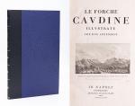
Le Forche Caudine - Illustrate con due Appendici. [Compreso "Prospetto Della Valle Caudina Dalla Parte Della Campania"

3011. [Daniele, Francesco / Johann Josef von Wilczek / Thomasius, Christian].

Le Forche Caudine – Illustrate con due Appendici. [Compreso “Prospetto Della Valle Caudina Dalla Parte Della Campania”]. Second edition, augmented and, according to Brunet, preferable to the original first edition, which was printed in Caserta in 1778.

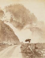
Seconda Edizione. Napoli, Appresso Angelo Trani, 1811. Folio (44.5 cm x29 cm). XIII, (3), 102 pages plus (6) pages advertising and Index (Indice). With 22 (twentytwo) illustrations overall. Including a large fold-out-plan (97 x 43 cm) of the Valle Caudine, several Vignettes, Allegorical/Historical Illustrations and four beautiful landscape engravings of the Valle Caudine by Alessandro d’Anna / XIII, (3), 102 pagine più (6) pagine pubblicitarie e Index (Indice). Con 22 (ventidue) illustrazioni in totale. Tra cui una grande illustrazione (97 x 43 cm) della Valle Caudine, diverse vignette, illustrazioni allegoriche / storiche e quattro bellissime incisioni paesaggistiche della Valle Caudine di Alessandro d’Anna. Hardcover / Fantastic modern, Nigerian goatskin with gilt lettering on spine and fine quality late 19th-century cloth over boards. New endpapers and all bound in style by english master-binders. Excellent condition of the binding. The stunning and most wonderful interior with only very occasional signs of an old dampstain to the outer margins and the beautiful, large fold-out-plan with some mild browning to one part of the center-fold. A typographical masterpiece of italian printmaking.

EUR 1.280,-- 

Show details   Add to cart

Wohlgemuth - Die österreichische Polarstation Jan Mayen - Ausgerüstet durch seine Excellenz Graf Hanns Wilczek

3012. First International Polar Year (1882-1883) – Wohlgemuth, Emil von.

Die österreichische Polarstation Jan Mayen – Ausgerüstet durch seine Excellenz Graf Hanns Wilczek. Geleitet von K.K. Corvetten-Capitän Emil Edlen von Wohlgemuth. Beobachtungs-Ergebnisse Herausgegeben von der Kaiserlichen Akademie der Wissenschaften. [Inklusive Ephemera] Band I – III (Komplett in vier Bänden mit dem eingebundenen Vorbericht zur Publikation welcher manchmal auch separat gebunden wurde: I. Band / II.Band 1. und 2. Abtheilung / III.Band).

Erste und einzige Ausgabe. Wien, K. und K. Hof-und Staatsdruckerei in Commission bei Karl Gerold’s Sohn, 1886. Quarto (24.5 cm x 31.5 cm). Collation: Band I: 118 Seiten mit vier Falttafeln (Beobachtungsstation im Wilczeck-Thale / Sternwarte / Helligkeitsgrad der Polarnacht / Kreuzung / [Route] des S.M.Dampfer “Pola” laengs der Eiskante bei der Insel Jan Mayen (farbig) / ), 26, 50, 202, 76, 16,18 Seiten / Band II,1: 232 Seiten / Band II,2: 175 Seiten / Band III: X, 132, 24, 20 Seiten [The set includes 85 text-illustrations, 61 plates (some folded) and four maps (original lithographs of which one is in colour)]. Original publisher’s Hardcover-Boards, now in protective collector’s Mylar. [Inclusive grossformatiger Werbung zu den Druckschriften der kaiserlichen Akademie der Wissenschaften in Wien vom Jahre 1885] The boards of the thicker Volume One, as often, cleanly detached. All other Volumes in very good condition with only minor signs of external wear. Minor signs of foxing only. Unopened, unread version of this rare publication !

EUR 680,-- 

Show details   Add to cart

Baert-Duholant, Tableau de la Grande-Bretagne, De L'Irlande et des Possessions Angloises dans les quatre parties du Monde.

3014. Baert-Duholant, Charles-Alexandre-Balthazar-François de Paule baron de / Jean-Denis Barbié du Bocage.

Tableau de la Grande-Bretagne, De L’Irlande et des Possessions Angloises dans les quatre parties du Monde. [With five (5) large, folded Maps by Jean-Denis Barbié du Bocage: Large, oblong folded Map/Plan of Gibraltar / England / Scotland / Ireland / India] / [With four (4) stunning copper-engravings: Grotte de Fingal, Chaussée des Géants / Plan et vue de Gibraltar / Combat de Boxe (Pugilists)] / [With two (2) portraits: 1.Portrait of William Pitt (after William Owen) and 2. Portrait of Charles Jacques Fox (after Karl Anton Hickel)].

Four Volumes (complete set). Paris, Chez H.J.Jansen, L’An 8me [1800]. Octavo (20 cm x 13.5 cm). Collation: Volume I: (8), 459, (1), 11 pages with Eleven (11) copper-engravings of which are: 5 Maps / Plans and 4 Engravings: The folded view of Fingals Cave (″Grotte de Fingal dans l’Ile de Staffa” – (19.5 cm x 31 cm) / “Folded Plate of the Giants Causeway (″Vue occidentale de la Chaussee des Geans et des Caps voisins” (19.5 cm x 31 cm)) / Fantastic, large Map/Plan of Gibraltar by Jean-Denis Barbié du Bocage, with a Birds-Eye-View of the Ville de Gibraltar (19.5 cm x 63.5 cm) [also showing the Ville Irlandaise on Gibraltar] / Scenic View of Gibraltar (″Vue de Gibraltar, prise du cote de l’Espagne” (19.5 cm x 32 cm) / Large Fold-Out-Map of England by Jean-Denis Barbié du Bocage with an Inset-View of Stonehenge (43 cm x 48.5 cm) / Large Fold-Out-Map of Scotland by Jean-Denis Barbié du Bocage, including the Western Isles and Shetland, with a stunning Inset-View of the irish pilgrimage-mountain Croagh Patrick [Craig-Phadrick] in Westport, Ireland (33 cm x 39 cm)/ Large Fold-Out-Map of Ireland with an Inset-View of the Lakes of Killarney (36 cm x 40.5 cm) / Volume II: 532, (1), 12 pages with Large Fold-Out-Map of India (″Possessions Anglaises”) by Jean-Denis Barbié du Bocage – the large India-Map showing areas as far as Tibet, Siam, Sumatra and the Andaman Islands, Ceylon, Burma (53.5 cm x 40.5 cm) / Volume III: 502, 48, (2) pages with two portraits: Guillaume Pitt [William Pitt] & Charles Jacques Fox (each 19.5 cm x 12 cm)/ Volume IV: 486, 22, (2) pages with the very famous Fold-out-Illustration of Pugilists / Boxers at Odiham in Hampshire [″Combats de Boxers a Odiham”] showing a boxing-match between Humphrey and Mendoza (29.5 cm x 19.5 cm). Hardcover / Original, very decorative original half leather bindings with gilt lettering and ornament on spine. All four Volumes in protective Collector’s Mylar. Very good condition with only minor signs of external wear. Very minor wormhole-damage to a few pages.

EUR 2.200,-- 

Show details   Add to cart

Jean-Denis Barbié du Bocage - Tableau de la Grande-Bretagne, De L'Irlande et des Possessions Angloises dans les quatre parties du Monde. [Large Paper Copy / Better Paper Copy / Exemplaire de Luxe]

3015. Pugilism (Boxing) – Baert-Duholant, Charles-Alexandre-Balthazar-François de Paule baron de / Jean-Denis Barbié du Bocage.

Tableau de la Grande-Bretagne, De L’Irlande et des Possessions Angloises dans les quatre parties du Monde. [Large Paper Copy / Better Paper Copy / Exemplaire de Luxe] [With five (5) large, folded Maps by Jean-Denis Barbié du Bocage: Large, oblong folded Map/Plan of Gibraltar / England / Scotland / Ireland / India] / [With four (4) stunning copper-engravings: Grotte de Fingal, Chaussée des Géants / Plan et vue de Gibraltar / Combat de Boxe (Pugilists)] / [With two (2) portraits: 1.Portrait of William Pitt (after William Owen) and 2. Portrait of Charles Jacques Fox (after Karl Anton Hickel)].

Four Volumes (complete set). Paris, Chez H.J.Jansen, L’An 8me [1800]. Octavo (21.5 cm x 14 cm). Collation: Volume I: (8), 459, (1), 11 pages with Eleven (11) copper-engravings of which are: 5 Maps / Plans and 4 Engravings: The folded view of Fingals Cave (″Grotte de Fingal dans l’Ile de Staffa” – (20.5 cm x 31.5 cm) / “Folded Plate of the Giants Causeway (″Vue occidentale de la Chaussee des Geans et des Caps voisins” (20.5 cm x 39 cm)) / Fantastic, large Map/Plan of Gibraltar by Jean-Denis Barbié du Bocage, with a Birds-Eye-View of the Ville de Gibraltar (20.5 cm x 65.5 cm) [also showing the Ville Irlandaise on Gibraltar] / Scenic View of Gibraltar (″Vue de Gibraltar, prise du cote de l’Espagne” (20.5 cm x 33 cm) / Large Fold-Out-Map of England by Jean-Denis Barbié du Bocage with an Inset-View of Stonehenge (47 cm x 51 cm) / Large Fold-Out-Map of Scotland by Jean-Denis Barbié du Bocage, including the Western Isles and Shetland, with a stunning Inset-View of the irish pilgrimage-mountain Croagh Patrick [Craig-Phadrick] in Westport, Ireland (37 cm x 50 cm)/ Large Fold-Out-Map of Ireland with an Inset-View of the Lakes of Killarney (39 cm x 44.5 cm) / Volume II: 532, (1), 12 pages with Large Fold-Out-Map of India (″Possessions Anglaises”) by Jean-Denis Barbié du Bocage – the large India-Map showing areas as far as Tibet, Siam, Sumatra and the Andaman Islands, Ceylon, Burma (48 cm x 43 cm) / Volume III: 502, 48, (2) pages with two portraits: Guillaume Pitt [William Pitt] & Charles Jacques Fox (each 20.5 cm x 12.5 cm)/ Volume IV: 486, 22, (2) pages with the very famous Fold-out-Illustration of Pugilists / Boxers at Odiham in Hampshire [″Combats de Boxers a Odiham”] showing a boxing-match between Humphrey and Mendoza (32 cm x 20.5 cm). Hardcover / Original, very decorative original half leather bindings with gilt lettering and ornament on spine. Volume One professionally rebacked by an english master bookbinder. All four Volumes in protective Collector’s Mylar. Excellent condition with only minor signs of external wear. From the library of François-Xavier de Valenzi with his bookplate / exlibris to the pastedowns of each Volume. Maps in this de Luxe Edition are all considerably larger than in the normal-paper-edition and all the maps and illustrations are in superb condition. An underestimated collectable.

EUR 1.200,-- 

Show details   Add to cart

Page: 1 2 ... 299 300 301 302 303 304 305 ... 792 793
: