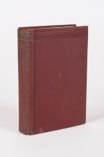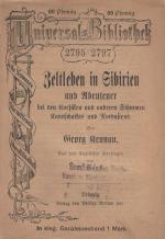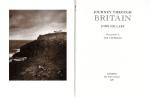


Travel & Expedition – Rare (124 items)

Richard Ligon, A True and Exact History of the Island of Barbadoes [sic].

29. Ligon, Richard.

A True and Exact History of the Island of Barbadoes [sic] / [Barbados]. Illustrated with a Map of the Island [missing], as also the Principal Trees and Plants there, set forth in their due Proportions and Shapes, drawn out by their several and respective Scales. Together with the Ingenio that makes the Sugar, with the Plots of the several Houses, Rooms, and other places, that are used in the whole process of Sugar-making; viz. the Grinding-house, Still-house, and Furnaces; All cut in Copper.

[Second Edition]. London, Printed, and are to be sold by Peter Parker, at his Shop at the Leg and Star over against the Royal Exchange, and Thomas Guy at the corner Shop of Little Lumbard-street and Cornhill, 1673. Small-Folio (19 cm x 29 cm). [II], 122 pages plus an unnumbered Index-page (bound, according to instructions for the bookbinder after page 84), lacking the Fold-out-Map of Barbados but including all six illustrations of Plants, as well as the three diagrams of Houses and Production-Rooms for Sugar. 19th-century Hardcover (half-leather with gilt lettering on spine). Condition of Binding: Very good condition with only minor signs of wear to the binding / Condition of bookblock: Original, front free endpaper was preserved and bound in. Rear endpaper missing. The original endpaper includes two historical ownership-signatures in ink (c.17th or early 18th century) as well as several annotations in ink and pencil. The previous owners seem to have been one Richard Gardner and there is an additional notation verso which reads: “E[x] Libris Richmondi Garnays [or Garneys]”. Some ink-annotations or corrections throughout the book. Signs of old bookworm – damage and very few abrasions due to fire-sparks (few pages effected only). Some plates with professional repairs, some tears. Some professional paper-repairs and re-enforcements to title-page and Content-Page. All the described flaws sound worse than they really appear. All plant-plates in strong impresion. A scarce publication ! From the library of Rev. William Andrew Lamb, Kilcoleman Park, County Cork.

EUR 1.480,-- 

Show details   Add to cart

Barrow, Voyage dans la partie meridionale de l'Afrique

30. Barrow, John.

Voyage dans la partie meridionale de l’Afrique; fait dans les années 1797 et 1798; par John Barrow, Ex-Secretaire de Lord Macartney…Contenant des observations sur la géologie, la géographie, l’histoire naturelle de ce continent, et une esquisse du caractère physique et moral des diverses races d’habitans qui environnent l’Etablissement du Cap de Bonne-Espérance. / Accompagné: Nouveau Voyage dans la partie méridionale de l’Afrique; Où l’on examine quelle est l’importance du Cap de Bonne-Espérance pour les différentes puissances de l’Europe, considéré comme station militaire et navale; comme boulevart du commerce et de la domination des Anglais dans l’Inde; comme centre des établissemens pour la pêche de la baleine dans les mers Australes; comme acquisition territoriale, et comme entrepôt commercial en tems de paix. Accompagné d’une description statistique de la colonie rédigée sur les documens les plus hautentiques, enrichi de huit belles cartes, contenat celle de la Côte d’Afrique depuis la baie de la Table jusqu’a la baie de Saldanha, des cartes de la baie de Pletenberg, d’Algola, de Mossel et de False bay; du plan militaire de la péninsule du Cap, et de ceux de la baie de la Table et du Knisna. (2 Volumes).

First French Edition. 4 Volumes [complete set of two works with 2 Volumes each]. Paris, Dentu, 1801-1806. 35.5 cm x 55.8 cm. Collation: complete. Pagination: Volume I: XVI, 403, (1) pages / Volume II: 326, (2) pages including Errata-leaf / Volume III: X, 310 pages / Volume IV: 312 pages. Original contemporary red calf with gilt lettering and ornament to lacquer-polished-spine. The Volumes are numbered consecutively, even though these are two separate works. Excellent condition of the binding and interior of this important publication with very minor signs of foxing only ! All the maps in wonderful condition ! First french edition of “Travels into the Interior of Southern Africa” (Barrow’s journey with Lord Macartney in 1797 to the Cape of Good Hope) plus two further Volumes which describe the second journey in 1801 / 1802 to Saldanha Bay [Saldanhabaai] with an early image of Robben Island. The survey of the Dutch colonies was not only a seminal work on South Africa but the beautifully engraved, large folding map of South Africa was a turning point of african cartography and geographical illustration.

EUR 1.200,-- 

Show details   Add to cart

[West Highland Line] / [Scottish Railway Line Glasgow to Mallaig]

31. [West Highland Line] / [Scottish Railway Line Glasgow to Mallaig] / [Rathad Iarainn nan Eilean – “Iron Road to the Isles”]

Massive Photographic Documentation of The Western Highland Line [Glasgow to Mallaig] in 900 [ninehundred] vintage Photographs, taken over a period of 30 Years by a Railway and Nature-Explorer and placed in four massive XXL Folders with extensive, beautiful and detaild annotations and explanations. The photographs range from smaller formats (10 cm wide x 15.2 cm high) to a huge amount of Extra-Large Vintage Photographs (39.2 cm wide x 29.4 cm high) and many even measure 40 cm x33 cm, filling entire leaves. Many of the photographs are impeccably applied inside these High-End-Archival-Folders with often numerous captions in the handwriting of the Photographer / Highland Explorer. An inexplicably stunning and absolutely unique documentation of the scottish landscape along the West Highland Line between the years 1974 – 2002. The images document Scottish rivers, Lochs and Roads, Mountains and Hills alongside the Railway-Lines but landscapes are also often shown without the Railway present. Besides the nature we also find photographs of architectural features like overpasses or industrial buildings and railway-track-imagery masterfully photographe, bordering on the abilities of a New Objectivity – photographer like Albert Renger-Patzsch. An important, maybe even singular photographic Impact-study of Railway to the Scottish Highlands. The anonymous photographer has injected himself occasionally in the images, beautifully showing his pitched tent and motorcycle in order let the viewer understand the dedication his travels have cost him. The masterful photographer also showcases his love for detail and artistry by ever so often partially and sparsely coloring Railway-Waggons or Locomotives within his black-and-white-photography, highlighting the technology in the vulnerable landscape, giving the whole collection an artistic and critical component of focusing the viewer on the object of his desire, yet contrasting how lost even a magnificent Locomotive and its carriages seems when vanishing in front of the majestic scottish landscape. The documentation is meticulous, often allowing for multiple vintage photographs on one page showing the same location during different times, exhausting all questions of functionality of the Railway opposed to the landscape with or without Railway in the shots. For the conservation-movement of the Scottish Highlands this collection is an unbelievable chance to preserve the memory of this landmark Railway-Line, connecting the extreme remote with the urban. For those who research the scottish landscape this is a unique opportunity to acquire the life’s work of one man’s obsession with “Railway and Landscape” in the Scottish Highland.

Scotland, 1974-2002. Oblong-Folio (44 cm wide x 36 cm high). Hardcover / Original Full-Leather Folders with stong, black cardboards and original tissue-guards. Excellent condition with only minor signs of wear. With hundreds of manuscript annotations on the photography, the photography-technique, film used and with extensive elaborations on each photograph in these albums. More images on request !

EUR 12.800,-- 

Show details   Add to cart

John Payne - Universal Geography - Formed Into A New And Entire System; Describing Asia, Africa, Europe And America

32. Payne, John / Zachariah Jackson [Dublin Printer].

Universal Geography – Formed Into A New And Entire System; Describing Asia, Africa, Europe And America ; With Their Subdivision Of Empires, Kingdoms, States And Republics : The Extend, Boundaries, and remarkable Appearances of each Country ; Cities, Towns, and Curiosities of Nature and Art. Also giving A general Account of the Fossil and Vegetable Production of the Earth, and of every Species of Animal : The History of Man, In all Climates, Regions, And Conditions ; Customs, Manners, Laws, Governments, And Religions : The State of Arts, Sciences, Commerce, Manufactures, And Knowledge : Sketches of the Ancient and Modern History of each Nation and People. To which is added, A Short View of Astronomy, As Connected With Geography ; Of The Planetary System to which the Earth belongs ; And of the Universe in General. With a Set of Maps, drawn from the best Materials, every one of which is very neatly coloured ; And a great Variety of Copper-Plates ; Descriptive of the most Remarkable Curiosities in the World. [This Edition with all three Volumes but only with 14 Maps, 3 Colour-Engravings and 5 Black-and-White Engravings (see detailed listing of these Maps and Engravings at the end of this Bibliography)].

Two Volumes in Three Parts (bound in Two Volumes). Dublin, Printed by Zachariah Jackson, 1793 – 1794 Quarto (23 cm wide x 28 cm high). Pagination: Volume I: Hand-coloured Frontispiece, VI [Subscribers], XIII, 894 pages [page 555 misprinted as 454] [Stating “The End” at the end of the Volume] with Four Maps and Three engravings (including Frontispiece) / Volume II: Hand-coloured Frontispiece, 792 pages [Stating “End Of The Second Volume” at the end of Volume II] with Ten Maps and One Engraving (Frontispiece) / [Volume III] is Bound to the rear of Volume II and is falsely ending with “End of The Second Volume” even though it is the “Continuation of Book IV” and in all other listings of this book internationally is accepted to be Volume III. Pagination of [Volume III]: Hand-coloured Frontispiece, [No separate titlepage], 416 pages, XXXIII pages of an Index, 1 page “Directions to the Binder”, 10 pages “A Chronological Table of Remarkable Events, Discoveries and Inventions”, with Four Engravings (including Frontispiece). Hardcover / Modern Binding in the style of the 18th century. Full leather with gilt lettering on spine. Very minor signs of neglectable, minimal wormhole-damage. Obviously this work was robbed of many of the maps but those which remain have the original hand-colouring in stunning condition (see description). Overall near Fine condiiton of this extremely rare set, with only minor signs of wear. Page 199/200 of Volume II with longer cut (Text not effected). All the engravings and maps without defects.

EUR 2.800,-- 

Show details   Add to cart

Cary's New Itinerary: Or an Accurate Delineation of the Great Roads, Both Direct and Cross throughout England and Wales: With Many of the Principal Roads in Scotland.

39. Cary, John.

Cary’s New Itinerary: Or an Accurate Delineation of the Great Roads, Both Direct and Cross throughout England and Wales: With Many of the Principal Roads in Scotland. From an Actual Admeasurement by John Cary: Made by Command of his Majesty’s Postmaster General for official purposes: Under the Direction and Inspection of Thomas Hasker Esq., Surveyor and Superintendant of the Mail Coaches. [Including an advertising for Cary’s New Celestial and Terrestrial Globes (with Illustrations of Globes)]. [Subtitle:] This work shows the immediate Route from the Metropolis [London] to all parts of England and Wales: And from Town to Town in every direction, distinguishing also the Cities, Market, Borough and Corporate Towns: And those at which the Assizes are held and gives the time of the Mails, Arrival and Departure from each, Describes the Line of the Navigable Canals and the Course of the Rivers passed over, The Number of Houses and Inhabitants contained in each Town, And those Inns which supply Post Horses and Carriages. Also The Inn’s throughout the Metropolis [London] from which the Mail and Stagecoaches go, their time of departure & the Route they seveerally take. The Noblemen and Gentlemen’s Seats situate near the Roads, A List of the Packet Boats and their time of sailing. Copious Indexes. Maps of the Lot Wight Environs of London, Bath, Brighton, Margate & Cheltenham & a Large Map of England and Wales peculiarly adapted to the Work. – [An Advertisement juxtaposed to the titlepage reads: “This Edition contains the Routes to upwards of Nine Thousand Places, which have never been given in any work of a similar Description; being a complete Directory to every Parish situate out of the Line of the Direct and Cross Roads throughout England and Wales”].

Seventh Edition, with Improvements [complete with all maps as called for]. London, Printed for J. Cary, 1817. Octavo. Pagination: [1], 647 pages plus 7 maps / Detailed pagination see here: [1], Title, Large Folding Map, [121], 6 folded Maps, [526] pages. Modern, recent Hardcover / Very decorative half-leather with marbled-paper-covered boards. Gilt lettering on new sppine-label. New endpapers. Protective Mylar. Only the large folding map with a inor tear (one part of the map deliberately bound separate (geniously folding out to meet th erest of the map). Interior text and maps all in excellent, unusually clean condition !!

EUR 480,-- 

Show details   Add to cart

Page: 1 2 3 4 5 6 7
: