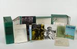
Personal Papers / Archive of Material Related to the Life and Career of Zoologist Sylvia Sikes, the Foremost African Elephant Specialist of her time. All materials from her personal collection / working copies and manuscript material. Including her extensive, two-volume-thesis: “Cardiovascular Disease in Freeliving Wild Animals with particular Reference to the African Elephant (Loxodonta africana)”. A collection of professional and academic papers, copies of Sikes’ monographs, zoological manuscripts and a plethora of photographs and personal newsletters, letters, pamphlets and manuscripts spanning seven decades of Sikes’ personal and professional life in Africa and the UK. The collection is composed of 92 specific pieces (some of which are comprised of one or more items). A detailed bibliography of the collection has been outlined in a Word Document (please request). The collection also includes personal copies of three monographs Sylvia Sikes has published, an original copy of her two-volume doctoral thesis, 37 academic articles and 5 unpublished draft manuscripts. There are also 7 booklets and a book by a third author among the collection. The collection is rounded off by a large number of vintage colour and monochrome photographs, letters, single-sheet newsletters, newspaper and magazine cuttings.
Africa and the UK, Various, 1937 – 2012. 21 cm x 26 cm – 24.5 cm x 31 cm. Circa 2,500+ pages. Numerous monochrome and colour photographs throughout the collection. Includes Hardcover book with dustjacket, softcover book, reprints of academic journal articles in paper wrappers and a variety of loose material in cellophane files. The archive, running from 1937 to 2012, is contained in two green (24.5 cm x 31 cm x 10.5 cm) boxes, four additional folders (32 cm x 24 cm) and two hardcover volumes (21.5 cm x 26cm). Very good condition.
EUR 2.800,--


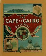
![[West Highland Line] / [Scottish Railway Line Glasgow to Mallaig]](/images/thumbnails/32483AB.jpg)