Travel Africa – Rare (148 items)

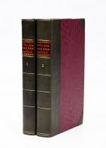
Barrow, Voyage dans la partie meridionale de l'Afrique

132. Barrow, John.

Voyage dans la partie meridionale de l’Afrique; fait dans les années 1797 et 1798; par John Barrow, Ex-Secretaire de Lord Macartney…Contenant des observations sur la géologie, la géographie, l’histoire naturelle de ce continent, et une esquisse du caractère physique et moral des diverses races d’habitans qui environnent l’Etablissement du Cap de Bonne-Espérance. / Accompagné: Nouveau Voyage dans la partie méridionale de l’Afrique; Où l’on examine quelle est l’importance du Cap de Bonne-Espérance pour les différentes puissances de l’Europe, considéré comme station militaire et navale; comme boulevart du commerce et de la domination des Anglais dans l’Inde; comme centre des établissemens pour la pêche de la baleine dans les mers Australes; comme acquisition territoriale, et comme entrepôt commercial en tems de paix. Accompagné d’une description statistique de la colonie rédigée sur les documens les plus hautentiques, enrichi de huit belles cartes, contenat celle de la Côte d’Afrique depuis la baie de la Table jusqu’a la baie de Saldanha, des cartes de la baie de Pletenberg, d’Algola, de Mossel et de False bay; du plan militaire de la péninsule du Cap, et de ceux de la baie de la Table et du Knisna. (2 Volumes).

First French Edition. 4 Volumes [complete set of two works with 2 Volumes each]. Paris, Dentu, 1801-1806. 35.5 cm x 55.8 cm. Collation: complete. Pagination: Volume I: XVI, 403, (1) pages / Volume II: 326, (2) pages including Errata-leaf / Volume III: X, 310 pages / Volume IV: 312 pages. Original contemporary red calf with gilt lettering and ornament to lacquer-polished-spine. The Volumes are numbered consecutively, even though these are two separate works. Excellent condition of the binding and interior of this important publication with very minor signs of foxing only ! All the maps in wonderful condition ! First french edition of “Travels into the Interior of Southern Africa” (Barrow’s journey with Lord Macartney in 1797 to the Cape of Good Hope) plus two further Volumes which describe the second journey in 1801 / 1802 to Saldanha Bay [Saldanhabaai] with an early image of Robben Island. The survey of the Dutch colonies was not only a seminal work on South Africa but the beautifully engraved, large folding map of South Africa was a turning point of african cartography and geographical illustration.

EUR 1.480,-- 

Show details   Add to cart

138. Payne, John / Hardie, James / Provenance I: Signature of J.J. Westervelt [Jacobus James Westervelt (1755 – 1826) – Schraalenberg and Provenance II: Charles Sydney Clark (1925) presented this set to Johnson Free Public Library at Hackensack, New Jersey].

A New and Complete System of Universal Geography [Complete with all 20 maps / illustrations] ; Describing Asia, Africa, Europe and America; with their Subdivisions of Republics, States, Empires and Kingdoms : The Extent, Boundaries and Remarkable Appearances of each Country; Cities, Towns and Curiosities of Nature and Art. Also giving a general account of The Fossil and Vegetable Productions [with hand-coloured plates] of the Earth. The History of Man, In all Climates, Regions and Conditions; Customs, Manners, Laws, Governments and Religions: The State of Arts, Sciences, Commerce, Manufactures and Knowledge. Sketches of the Ancient and Modern History of each Nation and People to the present time. To which is added, A View of Astronomy, As connected with Geography; Of the Planetary System to which the Earth belongs; And of the Universe in General. With a copious Index annexed to each Volume. Being a Large and Comprehensive Abridgement of Universal Geography. By John Payne. With additions, corrections and Improvements from the latest and best authors by James Hardie – Author of “The Principles of Latin Grammar”, “The American Remembrancer” and “Universal Tablet of Memory” &c. In Four Volumes.

First Abridged Edition. Volumes I [Asia] and II [Africa] (of IV). New York, Printed for and Sold by John Low, Book-Seller at The Shakespeare – Head, No.332 Water-Street, 1798 – 1799. Octavo – Edition. Pagination: Volume I [Asia]: Folded Frontispiece (Map of the World), XLVIII, 518 pages plus 10 unnumbered pages of an Index and one additional page with Directions for the Bookbinder for placing the maps and illustrations as well as Errata. Volume I includes all 10 Maps / Engravings as called for / Volume II [Africa]: Folded Frontispiece (Map of Africa), 578 pages plus 12 unnumbered pages of an Index plus one additional page with Directions for the Bookbinder for placing the maps and illustrations as well as Errata. Volume II includes all 10 Maps / Engravings as called for. Hardcover / Modern Library – Binding with the original 18th century – work bound in. Former library copy of Bergen County Historical Society (cancelled) and Johnson Free Public Library in Hackensack, New Jersey, with a very boring, modern library binding and library cards applied to the endpapers only, leaving the bookblock with text and maps and illustrations entirely untouched from any library-signs. Very good condition with some signs of external wear.

EUR 1.480,-- 

Show details   Add to cart

Page: 1 2 ... 11 12 13 14 15
: