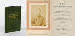


Catalogue Summer 2020 (38 items)

Ireland (Carrick-A-Rede / Giant's Causeway

21. 19th century European Travel – Ireland (Carrick-A-Rede / Giant’s Causeway / Bideford (Devon) / Torrington (Devon) / Lynton (Devon) / Lynmouth (Devon) / Watersmeet (Devon) / Ilfracombe (Devon) / Carnarvon Castle (Wales) / Forth Bridge – (Wales)/

Original Photoalbum from ca. 1870 / 1880 with 37 original Albumen Print / Albumen Silver Print – Photographs of a Tour through Europe. With very interesting photographs of Ireland’s favourite attractions in County Antrim , a large section of the Devon Region in England (The DEVON – Section includes 15 photographs alone), and some beautiful and rare early colour photographs of Luzern in Switzerland: Examples of images: 8. Bideford in Devon (Promenade with ships and people) / 9. Torrington – Devon (Town Mill Bridge) / 10. Torrington – Devon (Northern Bridge) / Two smaller photographs on one board: 11. Torrington – Devon (Castle Ruins) / 12. Torrington – Devon – (Near Railway Station) / Two smaller photographs on board: 13. Torrington – Devon – (The Avenue) / 14. Torrington – Devon (Valley of Rocks / Castle Rock) / 15. Lynton – North Devon / 16. Lynton – North Devon (Castle Rock) / 17. Lynmouth – Watersmeet / 18. Lynmouth (Bridge /Watersmeet near Lynmouth) / 19. Lynmouth (Picturesque Harbourscene with old fisherhuts on left) / 20. Ilfracombe – North Devon (from the Tours Walk – Top of the Hill) / 21. Ilfracombe – Tour Walk / 22. Ilfracombe – View from Capstone Hill /

Devon, ca.1870/1880/1890. Oblong – Quarto. 37 plates. Hardcover. Recently, professionally rebound in half leather with gilt lettering on spine. The large photographs in very good condition.

EUR 380,-- 
Show details   Add to cart

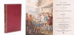
Couvée, Album mit 31 grossformatigen, originalen Photographien

22. Couvée, M. M.

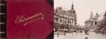
19th Century Album with 31 fantastic, large vintage photographs of Germany, Austria and Italy. Many of these early photographs are on Frankfurt am Main, but also Berlin, Heidelberg and classic travel – locations along the Rhine are included / Also interspersed are some other european destinations like Lugano, Venice and Salzburg (these all in colour). – All Photographs original Albumen Prints. / Album mit 31 grossformatigen, fantastischen, originalen Photographien von deutschen und europaeischen Stadtansichten des 19. Jahrhunderts, vorwiegend Frankfurt am Main [mit traumhaften und ungewoehnlichen Ansichten von Frankfurt und Sachsenhausen / Kaiserstrasse mit Strassenbahn / Rossmarkt / Goetheplatz / Alte Oper / Palmengarten / Wiesbaden – Kursaalplatz / Eschenheimer Turm / Kaiser-Wilhelm-Denkmal / Main mit Untermainbruecke und Angler mit zwei Jungen davor / aber auch Stadtansichten von Berlin (″Blick nach den Linden” in Farbe – in colour), Lugano (in Farbe – in colour), Boppard (in Farbe – in colour), Heidelberg (in Farbe – in colour), Salzburg, Königstein im Taunus (in Farbe – in colour), Remagen (in Farbe – in colour), Coblenz, Lahneck, Sooneck, Braubach und Marxburg, Wiesbaden, Bingen und Venedig (in Farbe – in colour)/

La Haye / Dresden, Couvée / Stengel & Co., c. 1895 – 1900. Quer Quart / Oblong Quarto. 31 large photographs mounted on cardboard. Original Hardcover / Exzellente Halblederausgabe mit vergoldetem Titel auf dem Vorderdeckel. / Album with gilt lettering. Ungewoehnlich gut erhaltenes Album mit phantastischen Aufnahmen die auch das buergerliche Leben mit eingefangen haben. / Excellent condition with only minor signs of external wear.

EUR 1.000,-- 

Show details   Add to cart

Barrow, Voyage dans la partie meridionale de l'Afrique

25. Barrow, John.

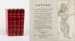
Voyage dans la partie meridionale de l’Afrique; fait dans les années 1797 et 1798; par John Barrow, Ex-Secretaire de Lord Macartney…Contenant des observations sur la géologie, la géographie, l’histoire naturelle de ce continent, et une esquisse du caractère physique et moral des diverses races d’habitans qui environnent l’Etablissement du Cap de Bonne-Espérance. / Accompagné: Nouveau Voyage dans la partie méridionale de l’Afrique; Où l’on examine quelle est l’importance du Cap de Bonne-Espérance pour les différentes puissances de l’Europe, considéré comme station militaire et navale; comme boulevart du commerce et de la domination des Anglais dans l’Inde; comme centre des établissemens pour la pêche de la baleine dans les mers Australes; comme acquisition territoriale, et comme entrepôt commercial en tems de paix. Accompagné d’une description statistique de la colonie rédigée sur les documens les plus hautentiques, enrichi de huit belles cartes, contenat celle de la Côte d’Afrique depuis la baie de la Table jusqu’a la baie de Saldanha, des cartes de la baie de Pletenberg, d’Algola, de Mossel et de False bay; du plan militaire de la péninsule du Cap, et de ceux de la baie de la Table et du Knisna. (2 Volumes).

First French Edition. 4 Volumes [complete set of two works with 2 Volumes each]. Paris, Dentu, 1801-1806. 35.5 cm x 55.8 cm. Collation: complete. Pagination: Volume I: XVI, 403, (1) pages / Volume II: 326, (2) pages including Errata-leaf / Volume III: X, 310 pages / Volume IV: 312 pages. Original contemporary red calf with gilt lettering and ornament to lacquer-polished-spine. The Volumes are numbered consecutively, even though these are two separate works. Excellent condition of the binding and interior of this important publication with very minor signs of foxing only ! All the maps in wonderful condition ! First french edition of “Travels into the Interior of Southern Africa” (Barrow’s journey with Lord Macartney in 1797 to the Cape of Good Hope) plus two further Volumes which describe the second journey in 1801 / 1802 to Saldanha Bay [Saldanhabaai] with an early image of Robben Island. The survey of the Dutch colonies was not only a seminal work on South Africa but the beautifully engraved, large folding map of South Africa was a turning point of african cartography and geographical illustration.

EUR 1.200,-- 

Show details   Add to cart

[Chiari, Giovanni] Vascellini, Gaetano - Statute di Firenze [Richard Meade - Ballymartle]

26. [Chiari, Giovanni] Vascellini, Gaetano.

Statue di Firenze [incluso: “Catalogo delle Statue del R. Giardino di Boboli colla Notizia dei Loro Autori”, “Catalogo delle Statue nel R. Palazzo de Pitti”, Catalogo delle Statue colla Notizia dei Loro Autori ec.” ec.]

Tres Parti (complete) [Tutto dichiarato come prima parte]. Firenze, Presso Giuseppe Volpini Cartolaro, no year [c. 1765]. Octavo. Collation complete. Pagination: Part I (Primo): Frontispiece copper-engraving with Florence in the background, 8 pages of text with introduction by Giovanni Chiari and the catalogue of statues in Boboli Garden, 25 plates each with 4 copper-engravings of Statues in Boboli Garden. Part II (Seconda): Frontispiece copper-engraving with Florence in the background, 8 pages of text with catalogue of Statues in Palazzo Pitti, 41 plates each with 4 copper-engravings of Statues in Pitti Palace. Part III (Terza): Frontispiece copper-engraving with Florence in the background, 8 pages of text with catalogue of Statues [″Catalogo delle Statue colla Notizia del Loro Autori ec. (incl. Michelangelo Buonarotti, Donatello etc.). Hardcover / Original bookblock rebound by Bayntun in Bath in a subtle and charming modern cloth with gilt lettering on new spine-label. Original endpapers preserved. Exceptional condition of this rare 18th century publication with only very faint signs of foxing. Provenance: Richard Meade, Ballymartle (with the Meade Family – crest as library stamp).

EUR 480,-- 

Show details   Add to cart

Gilpin / Castle Freke Library - Observations Relative Chiefly to Picturesque Beauty, Made in the Year 1776

27. Gilpin, William. [Castle-Freke Library Bookplates]

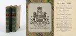
Collection of four Volumes (bound in two) by Gilpin – All from the historical library at Castle Freke (Castlefreke, West Cork / Ireland). The Volumes include: I. & II. Observations Relative Chiefly to Picturesque Beauty, Made in the Year 1776, on Several Parts of Great Britain; particularly the High-Lands of Scotland. [Second Edition, with an “Account of the Prints” bound to the rear] / III. Observations on the River Wye and several Parts of South Wales &c. relative chiefly to Picturesque Beauty; Made in the summer of the Year 1770 (Third Edition). / IV. An Essay on Prints – [″The chief intention of the following work was to put the elegant amusement of collecting prints, on a more rational footing; by giving the unexperienced collector a few principles and cautions to assist him”] (Fourth Edition with the printed dedication “To the Honorable Horace Walpole in Deference to his Taste in the Polite Arts; and the Valuable Researches he has made to improve them; the following work is inscribed by his most obedient and very humble servant, William Gilpin”). [Volumes I & II with 40 original illustrations and vintage 18th century maps [correctly 39 illustrations and one table], for example of Loch Lomond and the Firth of Forth/ all illustrations are vintage mezzotint-plates].

Mixed Editions. Four Volumes (bound in two). London, Printed for R. Blamire, Strand, 1792. Octavo. Pagination: Volume I: XI, [1], 221 pages with 24 mezzotints / Volume II: 195, XVI pages with 16 mezzotints and an “Account of the Prints” as well as “Translations of Latin Passages” / [Volume III]: [River Wye]: XVI, 152 pages with 16 (of 17) full – page mezzotints / [Volume IV]: [An Essay on Prints]: XIII, [3], 174 pages plus XI pages Index and 1 page Errata. Hardcover / Early 19th century quarter – morocco with gilt lettering and ornament on spine. Both volumes bound in unison. Very good + condition with only minor signs of external wear. Pages 185 – 191 of Volume I with some stronger browning. Otherwise the interior very clean. All mezzotints in very good or even better condition. This is the original copy from the historical Castle-Freke Library in West Cork (Ireland), with two armorial bookplates to front and rear pastedown with the family’s motto ‘Pro Patria’. With two pages of manuscript annotations by a contemporary hand with a reference between the common name “Tarbet” in Scotland and a place-name in County Kerry in Ireland” (pages 13 of Volume II) / another entry is on page 12 of Volume II regarding the name-sake “Loch-Loung” for a Lake of ships in Scotland and Ireland.

Show details

Bellin / Senex / Ogilby - The Roads through England or Ogilby's Survey. Revised, improved and reduced by Senex. [Enlarged Edition of John Ogilby's 1675 published "Britannia"]

29. [Bellin, Jacques Nicholas / Senex, John / Ogilby, John]

The Roads through England or Ogilby’s Survey. Revised, improved and reduced by Senex. [Enlarged Edition of John Ogilby’s 1675 published “Britannia”] Distinctly laid down on onehundred & one Plates with the addition of some Roads newly drawn and several corrections of more general use to Travellers. [Including an Appendix with Cityplans of London (double-page), Plymouth, Shrewsbury, Yorck (York), Chester, [Scene of Carrick-Fergus (Ireland)], Waterford, Oxford, Leith [Edinburgh], Harwich, Scenery of Edinburgh / Itinéraire de toutes les routes de l ‘Angleterre. Revues corrigées, augmentées & réduites par Senex en 101 Cartes. [Titlepage bilingual in french and english].

Paris, Desnos, 1766. Quarto (30 cm x 22.5 cm). Collation complete: Bilingual titlepage, 12 double-page maps of England, partly beautifully border-coloured, 6 unnumbered pages of Index with distances in miles, one (1) General Map of England (″Carte Generale” of Engand by D’Ogilby), 101 full-page maps of routes/streets, Engraved titlepage for the Appendix, One (1) double-page of explanations for the London-City-Plan, 17 beautiful maps and engravings of a variety of english cities, also with a section on Ireland (Dublin, Waterford, Kinsale, Galway, Limerick). Original 18th-century contemporary calf with gilt lettering on spine and on five raised bands. The Volume is now protected in Collector’s Mylar. Very good+ condition with only minor signs of external wear. Some rubbing and corners slightly bumped but overall excellent. Interior near fine with only the slightest occasional spotting. Extremely Rare and even rarer in this condition !

EUR 2.400,-- 

Show details   Add to cart

Wohlgemuth - Die österreichische Polarstation Jan Mayen - Ausgerüstet durch seine Excellenz Graf Hanns Wilczek

30. First International Polar Year (1882-1883) – Wohlgemuth, Emil von.

Die österreichische Polarstation Jan Mayen – Ausgerüstet durch seine Excellenz Graf Hanns Wilczek. Geleitet von K.K. Corvetten-Capitän Emil Edlen von Wohlgemuth. Beobachtungs-Ergebnisse Herausgegeben von der Kaiserlichen Akademie der Wissenschaften. [Inklusive Ephemera] Band I – III (Komplett in vier Bänden mit dem eingebundenen Vorbericht zur Publikation welcher manchmal auch separat gebunden wurde: I. Band / II.Band 1. und 2. Abtheilung / III.Band).

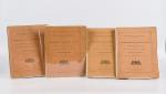
Erste und einzige Ausgabe. Wien, K. und K. Hof-und Staatsdruckerei in Commission bei Karl Gerold’s Sohn, 1886. Quarto (24.5 cm x 31.5 cm). Collation: Band I: 118 Seiten mit vier Falttafeln (Beobachtungsstation im Wilczeck-Thale / Sternwarte / Helligkeitsgrad der Polarnacht / Kreuzung / [Route] des S.M.Dampfer “Pola” laengs der Eiskante bei der Insel Jan Mayen (farbig) / ), 26, 50, 202, 76, 16,18 Seiten / Band II,1: 232 Seiten / Band II,2: 175 Seiten / Band III: X, 132, 24, 20 Seiten [The set includes 85 text-illustrations, 61 plates (some folded) and four maps (original lithographs of which one is in colour)]. Original publisher’s Hardcover-Boards, now in protective collector’s Mylar. [Inclusive grossformatiger Werbung zu den Druckschriften der kaiserlichen Akademie der Wissenschaften in Wien vom Jahre 1885] The boards of the thicker Volume One, as often, cleanly detached. All other Volumes in very good condition with only minor signs of external wear. Minor signs of foxing only. Unopened, unread version of this rare publication !

EUR 280,-- 

Show details   Add to cart

Page: 1 2 3 4
: