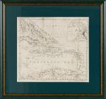
Collection of four Volumes (bound in two) by Gilpin – All from the historical library at Castle Freke (Castlefreke, West Cork / Ireland). The Volumes include: I. & II. Observations Relative Chiefly to Picturesque Beauty, Made in the Year 1776, on Several Parts of Great Britain; particularly the High-Lands of Scotland. [Second Edition, with an “Account of the Prints” bound to the rear] / III. Observations on the River Wye and several Parts of South Wales &c. relative chiefly to Picturesque Beauty; Made in the summer of the Year 1770 (Third Edition). / IV. An Essay on Prints – [″The chief intention of the following work was to put the elegant amusement of collecting prints, on a more rational footing; by giving the unexperienced collector a few principles and cautions to assist him”] (Fourth Edition with the printed dedication “To the Honorable Horace Walpole in Deference to his Taste in the Polite Arts; and the Valuable Researches he has made to improve them; the following work is inscribed by his most obedient and very humble servant, William Gilpin”). [Volumes I & II with 40 original illustrations and vintage 18th century maps [correctly 39 illustrations and one table], for example of Loch Lomond and the Firth of Forth/ all illustrations are vintage mezzotint-plates].
Mixed Editions. Four Volumes (bound in two). London, Printed for R. Blamire, Strand, 1792. Octavo. Pagination: Volume I: XI, [1], 221 pages with 24 mezzotints / Volume II: 195, XVI pages with 16 mezzotints and an “Account of the Prints” as well as “Translations of Latin Passages” / [Volume III]: [River Wye]: XVI, 152 pages with 16 (of 17) full – page mezzotints / [Volume IV]: [An Essay on Prints]: XIII, [3], 174 pages plus XI pages Index and 1 page Errata. Hardcover / Early 19th century quarter – morocco with gilt lettering and ornament on spine. Both volumes bound in unison. Very good + condition with only minor signs of external wear. Pages 185 – 191 of Volume I with some stronger browning. Otherwise the interior very clean. All mezzotints in very good or even better condition. This is the original copy from the historical Castle-Freke Library in West Cork (Ireland), with two armorial bookplates to front and rear pastedown with the family’s motto ‘Pro Patria’. With two pages of manuscript annotations by a contemporary hand with a reference between the common name “Tarbet” in Scotland and a place-name in County Kerry in Ireland” (pages 13 of Volume II) / another entry is on page 12 of Volume II regarding the name-sake “Loch-Loung” for a Lake of ships in Scotland and Ireland.
![Philip Luckombe, The Compleat Irish Traveller [Luxury Reprint with all of Charles Smith's Illustrations of 18th century Ireland (Munster / Kerry / Waterford) in separate Folder for Framing]](/images/thumbnails/31432AB.jpg)
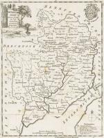
![Kitchin, Derbyshire drawn from the best authorities by T. Kitchin Geogr. [With an inset "The Arms of Derby"].](/images/thumbnails/394AG.jpg)