

19th Century (140 items)

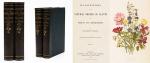
Baert-Duholant, Tableau de la Grande-Bretagne, De L'Irlande et des Possessions Angloises dans les quatre parties du Monde.

1. Baert-Duholant, Charles-Alexandre-Balthazar-François de Paule baron de / Jean-Denis Barbié du Bocage.

Tableau de la Grande-Bretagne, De L’Irlande et des Possessions Angloises dans les quatre parties du Monde. [With five (5) large, folded Maps by Jean-Denis Barbié du Bocage: Large, oblong folded Map/Plan of Gibraltar / England / Scotland / Ireland / India] / [With four (4) stunning copper-engravings: Grotte de Fingal, Chaussée des Géants / Plan et vue de Gibraltar / Combat de Boxe (Pugilists)] / [With two (2) portraits: 1.Portrait of William Pitt (after William Owen) and 2. Portrait of Charles Jacques Fox (after Karl Anton Hickel)].

Four Volumes (complete set). Paris, Chez H.J.Jansen, L’An 8me [1800]. Octavo (20 cm x 13.5 cm). Collation: Volume I: (8), 459, (1), 11 pages with Eleven (11) copper-engravings of which are: 5 Maps / Plans and 4 Engravings: The folded view of Fingals Cave (″Grotte de Fingal dans l’Ile de Staffa” – (19.5 cm x 31 cm) / “Folded Plate of the Giants Causeway (″Vue occidentale de la Chaussee des Geans et des Caps voisins” (19.5 cm x 31 cm)) / Fantastic, large Map/Plan of Gibraltar by Jean-Denis Barbié du Bocage, with a Birds-Eye-View of the Ville de Gibraltar (19.5 cm x 63.5 cm) [also showing the Ville Irlandaise on Gibraltar] / Scenic View of Gibraltar (″Vue de Gibraltar, prise du cote de l’Espagne” (19.5 cm x 32 cm) / Large Fold-Out-Map of England by Jean-Denis Barbié du Bocage with an Inset-View of Stonehenge (43 cm x 48.5 cm) / Large Fold-Out-Map of Scotland by Jean-Denis Barbié du Bocage, including the Western Isles and Shetland, with a stunning Inset-View of the irish pilgrimage-mountain Croagh Patrick [Craig-Phadrick] in Westport, Ireland (33 cm x 39 cm)/ Large Fold-Out-Map of Ireland with an Inset-View of the Lakes of Killarney (36 cm x 40.5 cm) / Volume II: 532, (1), 12 pages with Large Fold-Out-Map of India (″Possessions Anglaises”) by Jean-Denis Barbié du Bocage – the large India-Map showing areas as far as Tibet, Siam, Sumatra and the Andaman Islands, Ceylon, Burma (53.5 cm x 40.5 cm) / Volume III: 502, 48, (2) pages with two portraits: Guillaume Pitt [William Pitt] & Charles Jacques Fox (each 19.5 cm x 12 cm)/ Volume IV: 486, 22, (2) pages with the very famous Fold-out-Illustration of Pugilists / Boxers at Odiham in Hampshire [″Combats de Boxers a Odiham”] showing a boxing-match between Humphrey and Mendoza (29.5 cm x 19.5 cm). Hardcover / Original, very decorative original half leather bindings with gilt lettering and ornament on spine. All four Volumes in protective Collector’s Mylar. Very good condition with only minor signs of external wear. Very minor wormhole-damage to a few pages.

EUR 1.280,-- 

Show details   Add to cart

Taylor, Collection of six (6) items/original, vintage and personal materials

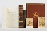
6. Taylor, Tom / [Abraham Lincoln].

Exquisite collection of six (6) items/original, vintage and personal materials by/of Tom Taylor. The collection includes a 2 1/2 page, signed manuscript letter [MLS] by Tom Taylor to an unknown recipient , discussing a memorial he sent to Robert Browning’s patron, John Kenyon and mentioning former Prime Minister Lord Aberdeen [George Hamilton-Gordon, 4th Earl of Aberdeen]. The collection also includes two vintage 19th century cabinet photographs [Carte de Visite’s] of Tom Taylor, a later edition of Ballads and Songs of Brittany and two beautifully inscribed and signed presentation copies of his major works: 1. The first edition of Ballads of Brittany – London/Cambridge, MacMillan and Co.,1865 with many illustrations by Tissot, Tenniel etc. (This first edition is signed and inscribed by Tom Taylor to Emilia Ventana at Xmas 1864, before the publication of the book commenced) and 2. Tom Taylor’s Historical Dramas. London, Chatto & Windus, 1877. Signed and inscribed by Tom Taylor to Marie de Beauvoisier in March 1879.

London / Cambridge etc., Chatto & Windus / Routledge & Sons / etc., c. 1850-1879. Octavo. Ballads and Songs of Brittany (1865 edition): Frontispice, XXII, 239 pages / Ballads and Songs of Brittany (Later Routledge edition): XVI, 176 pages / Tom Taylor’s Historical Dramas: VIII, 466, 32 pages. / Manuscript Letter: 2 1/2 pages. Original Hardcover / The manuscript letter in a Folder, it includes an A4 manuscript leaf from a 19th century autograph-collector describing the letter by Taylor. / The two vintage cabinet photographs of Taylor included in the Folder with the autograph. Very good condition with only minor signs of external wear.

EUR 1.480,-- 

Show details   Add to cart

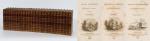
Jean-Denis Barbié du Bocage - Tableau de la Grande-Bretagne, De L'Irlande et des Possessions Angloises dans les quatre parties du Monde. [Large Paper Copy / Better Paper Copy / Exemplaire de Luxe]

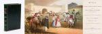
8. Pugilism (Boxing) – Baert-Duholant, Charles-Alexandre-Balthazar-François de Paule baron de / Jean-Denis Barbié du Bocage.

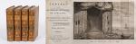
Tableau de la Grande-Bretagne, De L’Irlande et des Possessions Angloises dans les quatre parties du Monde. [Large Paper Copy / Better Paper Copy / Exemplaire de Luxe] [With five (5) large, folded Maps by Jean-Denis Barbié du Bocage: Large, oblong folded Map/Plan of Gibraltar / England / Scotland / Ireland / India] / [With four (4) stunning copper-engravings: Grotte de Fingal, Chaussée des Géants / Plan et vue de Gibraltar / Combat de Boxe (Pugilists)] / [With two (2) portraits: 1.Portrait of William Pitt (after William Owen) and 2. Portrait of Charles Jacques Fox (after Karl Anton Hickel)].

Four Volumes (complete set). Paris, Chez H.J.Jansen, L’An 8me [1800]. Octavo (21.5 cm x 14 cm). Collation: Volume I: (8), 459, (1), 11 pages with Eleven (11) copper-engravings of which are: 5 Maps / Plans and 4 Engravings: The folded view of Fingals Cave (″Grotte de Fingal dans l’Ile de Staffa” – (20.5 cm x 31.5 cm) / “Folded Plate of the Giants Causeway (″Vue occidentale de la Chaussee des Geans et des Caps voisins” (20.5 cm x 39 cm)) / Fantastic, large Map/Plan of Gibraltar by Jean-Denis Barbié du Bocage, with a Birds-Eye-View of the Ville de Gibraltar (20.5 cm x 65.5 cm) [also showing the Ville Irlandaise on Gibraltar] / Scenic View of Gibraltar (″Vue de Gibraltar, prise du cote de l’Espagne” (20.5 cm x 33 cm) / Large Fold-Out-Map of England by Jean-Denis Barbié du Bocage with an Inset-View of Stonehenge (47 cm x 51 cm) / Large Fold-Out-Map of Scotland by Jean-Denis Barbié du Bocage, including the Western Isles and Shetland, with a stunning Inset-View of the irish pilgrimage-mountain Croagh Patrick [Craig-Phadrick] in Westport, Ireland (37 cm x 50 cm)/ Large Fold-Out-Map of Ireland with an Inset-View of the Lakes of Killarney (39 cm x 44.5 cm) / Volume II: 532, (1), 12 pages with Large Fold-Out-Map of India (″Possessions Anglaises”) by Jean-Denis Barbié du Bocage – the large India-Map showing areas as far as Tibet, Siam, Sumatra and the Andaman Islands, Ceylon, Burma (48 cm x 43 cm) / Volume III: 502, 48, (2) pages with two portraits: Guillaume Pitt [William Pitt] & Charles Jacques Fox (each 20.5 cm x 12.5 cm)/ Volume IV: 486, 22, (2) pages with the very famous Fold-out-Illustration of Pugilists / Boxers at Odiham in Hampshire [″Combats de Boxers a Odiham”] showing a boxing-match between Humphrey and Mendoza (32 cm x 20.5 cm). Hardcover / Original, very decorative original half leather bindings with gilt lettering and ornament on spine. Volume One professionally rebacked by an english master bookbinder. All four Volumes in protective Collector’s Mylar. Excellent condition with only minor signs of external wear. From the library of François-Xavier de Valenzi with his bookplate / exlibris to the pastedowns of each Volume. Maps in this de Luxe Edition are all considerably larger than in the normal-paper-edition and all the maps and illustrations are in superb condition. An underestimated collectable.

EUR 1.280,-- 

Show details   Add to cart

Page: 1 2 3 4 ... 13 14
: