Persia and China / [in: The Modern Traveller- A Popular Description, Geographical, Historical, and Topographical, of the Various Countries of the Globe.]
Two Volumes (Complete Set). London, Printed for James Duncan, 1827. Duodecimo / 9 cm x 14.5 cm. Volume I: IV, 372 pages. / Volume II: IV, 340 pages. Including two folded maps and 6 black and white illustrations: 1. Folded map of Persia / 2. Folded map of China / 3. Isfahan / 4. Teheran / 5. View of the Golden Island / 6. Chinese Military Post / 7. Western Gate of Peking / 8. Persian Lady. Original Hardcover, decorative full leather. Full leather with gilted ornaments to outer margins of interior boards. Marbled endpapers and edges. Gilt ornament to spine. Very good condition with only minor signs of external wear. Binding rubbed but firm. Spinelabel and cover of Volume I detached. Minor signs of foxing. [The Modern Traveller- Volume 12-13].
EUR 128,--
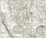
![Fer, Grande Tartarie [Central Asia] with Cazan [Kazan] , Turquestan](/images/thumbnails/398AG.jpg)