Inanna Rare Books

Inanna Rare Books

Inanna Rare Books

    • Home
    • About us
    • Shipping Information
    • Search File
    • Contact
    • Cart
    • Rare Book Room
      • Books on Books
      • History - Politics - Law
      • Literature
      • Philosophy & Religion
      • Social Sciences - Education
      • Medicine
      • The Arts
      • Travel & Exploration
      • Mathematics
      • Science & Technology
      • Farming - Fishing - Hunting
      • Natural History
      • Games - Sport
      • Complete Catalogue
    • Art & Map Gallery
      • Art Gallery
      • Rare Maps & Cartography
    • Manuscripts
      • Manuscripts - Literature
      • Manuscripts - History
      • Manuscripts - Travel
      • Manuscripts - Food
      • Manuscripts - Music
      • Manuscripts - Secret Knowledge
      • Manuscript Letters/Autographs
      • Manuscripts - Art
      • Manuscripts - Philosophy
    • Gift Ideas / New Arrivals
      • New Arrivals
      • Gift Ideas for Collectors
      • Gift Wrapping Available
      • Handmade Paper
      • Gift Wrapping Available
    • Inanna Publishing
    • Libraries & Collections
      • African Maps Collection
      • Henry David Aiken - Collection
      • Samuel Beckett - Collection
      • Walter Benjamin - Collection
      • Alexander Calder Collection
      • Castlefreke - Collection
      • Alice Curtayne Collection
      • Fly Fishing / Angling Collection
      • Vere Foster - Collection
      • William Daniel Gill Collection
      • John Minihan Collection
      • David (Dave) Naylor - Collection
      • Roger O'Connor Collection
      • David Puttnam Collection
      • Savigny Collection
      • Eric Ravilious Collection SOLD
    • Catalogues
    • News / Events
  • Advanced Search
  • List
    • Terms & Conditions
    • Contract Withdrawal
    • Cancellation Policy
    • Privacy Policy
    • Shipping Information
    • Imprint
INANNA MODERNWest Cork Reading Holidays
We ship per DHL Express

We ship per DHL Express

Advanced Search
  • Rare Book Room
    • Books on Books
    • History - Politics - Law
    • Literature
    • Philosophy & Religion
    • Social Sciences - Education
    • Medicine
    • The Arts
    • Travel & Exploration
    • Mathematics
    • Science & Technology
    • Farming - Fishing - Hunting
    • Natural History
    • Games - Sport
    • Complete Catalogue
  • Art & Map Gallery
    • Art Gallery
    • Rare Maps & Cartography
  • Manuscripts
    • Manuscripts - Literature
    • Manuscripts - History
    • Manuscripts - Travel
    • Manuscripts - Food
    • Manuscripts - Music
    • Manuscripts - Secret Knowledge
    • Manuscript Letters/Autographs
    • Manuscripts - Art
    • Manuscripts - Philosophy
  • Gift Ideas / New Arrivals
    • New Arrivals
    • Gift Ideas for Collectors
    • Gift Wrapping Available
    • Handmade Paper
    • Gift Wrapping Available
  • Inanna Publishing
  • Libraries & Collections
    • African Maps Collection
    • Henry David Aiken - Collection
    • Samuel Beckett - Collection
    • Walter Benjamin - Collection
    • Alexander Calder Collection
    • Castlefreke - Collection
    • Alice Curtayne Collection
    • Fly Fishing / Angling Collection
    • Vere Foster - Collection
    • William Daniel Gill Collection
    • John Minihan Collection
    • David (Dave) Naylor - Collection
    • Roger O'Connor Collection
    • David Puttnam Collection
    • Savigny Collection
    • Eric Ravilious Collection SOLD
  • Catalogues
  • News / Events

Books with Vintage Maps (48 items)

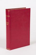
Rae, Malaboch - or Notes from my Diary on the Boer Campaign of 1894 against the

21. Rae, Colin.

Malaboch – or Notes from my Diary on the Boer Campaign of 1894 against the Chief Malaboch of Blaauwberg, District Zoutpansberg, South African Republic – To which is appended a synopsis of the Johannesburg crisis of 1896.

London / South Africa, Sampson Low, Marston and Company / J.C. Juta & Co, 1898. 15.5 cm x 23.2 cm. XIX, 248 pages. 53 illustrations. Fold-out map showing ‘the scene of war in Zoutpansberg.’ Modern, recent Hardcover [maroon cloth] with gilt lettering on spine. Parts of the original binding (spine and illustrated cover) pasted to pastedown and endpaper. Excellent condition besides the paper being a little brittle at the deckled edges and a minor tear to halftitle. Interior bright and unmarked. Binding firm and strong.

EUR 128,-- 

Show details   Add to cart

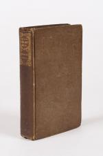
Russell, History and Present Condition of The Barbary States: Comprehending a Vi

22. Russell, Michael.

History and Present Condition of The Barbary States: Comprehending a View of Their Civil Institutions, Antiquities, Arts, Religion, Literature, Commerce, Agriculture, and Natural Productions. With a Map, and Eleven Engravings by Jackson.

Edinburgh / London, Oliver & Boyd / Simkin, Marshall, & Co., 1835. 11 cm x 16.5 cm. 453 pages. Hardcover [publisher’s original brown cloth] with spine label. Very good condition with only minor signs of external wear. Minor bumps at corner of boards. Name and address of preowner entered in ink on endpaper (1948).

EUR 128,-- 

Show details   Add to cart

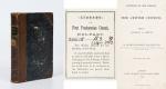
Arthur Penrhyn Stanley - Lectures on the History of the Jewish Church. Part I: Abraham to Samuel - With Maps and Plans of the Mosque at Hebron / Palestine before the Conquest / Migration of Abraham

23. Stanley, Arthur Penrhyn.

Lectures on the History of the Jewish Church. Part I: Abraham to Samuel – With Maps and Plans (Plan of the Mosque at Hebron / Palestine before the Conquest / Migration of Abraham).

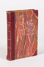
London, John Murray, 1863. Octavo. XLI, 523 pages with folded maps and plans. Hardcover / Original Half-leather with gilt lettering on spine. Upper spine slightly damaged. Otherwise in very good condition with some minor signs of wear only.

EUR 128,-- 

Show details   Add to cart

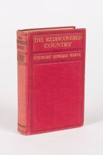
White, The Rediscovered Country.

24. White, Stewart Edward.

The Rediscovered Country. Illustrated from Photographs.

London, New York, Toronto, Hodder and Stoughton, no year. 14 cm x 22 cm. Frontispiece, VIII, 358 pages. 100 illustrations. Fold-out map of region at rear. Hardcover [publisher’s original red cloth] with gilt lettering on spine and front board. The fold-out-map with tear. Otherwise in very good condition with only minor signs of external wear. Interior bright and clean and sharp-cornered.

EUR 128,-- 

Show details   Add to cart

[Conder, Greece / [in: The Modern Traveller- A Popular Description, Geographical

25. [Conder, Josiah].

Greece / [in: The Modern Traveller- A Popular Description, Geographical, Historical, and Topographical, of the Various Countries of the Globe].

In Two Volumes (Complete Set). London, Printed for James Duncan, 1826. Duodecimo / 9 cm x 14.5 cm. Volume I: IV, 375 pages / Volume II: IV, 336 pages. With a fold-out map of Greece and 7 black and white illustrations showing: 1. Mistra / 2. Argos / 3. Corinth / 4. Patras / 5. Eleutherai / 6. Athens / 7. Aegina. Original Hardcover, decorative full leather. Full leather with gilted ornaments to outer margins of interior boards. Marbled endpapers and edges. Gilt ornament to spine. Poor condition with signs of external wear. Binding rubbed but firm. Spinelabel and front board detached on Volume I. Minor foxing. [The Modern Traveller- Volume 15-16].

EUR 175,-- 

Show details   Add to cart

The Harvard University Catalogue 1880 - 1881 & The Harvard University Catalogue 1899-1900.

26. Harvard University.

The Harvard University Catalogue 1880 – 1881 & The Harvard University Catalogue 1899-1900.

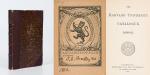
Two Volumes. Cambridge, University Press, 1880-1900. 8°. Pagination: 1880 – Catalogue: 230 pages / Pagination: 1899-1900-Catalogue: Folded “Map of Cambridge as the Vicinity of Harvard College 1899-1900” as Frontispiece, VII, 716 pages. Hardcover / Original half leather bindings. Slightly rubbed only. Titlepage cleanly detached. Wonderful publication. Exlibris / Bookplate of the Harvard University “ALPHA – DELTA – PHI – CLUB” with manuscript name of “J.G.Bradley 1902”. Two of these bookplates present on the pastedowns of the Volumes. RARE !

EUR 200,-- 

Show details   Add to cart

[Conder, Palestine / [in: The Modern Traveller- A Popular Description, Geographi

27. [Conder, Josiah].

Palestine / [in: The Modern Traveller- A Popular Description, Geographical, Historical, and Topographical, of the Various Countries of the Globe].

London, Printed for James Duncan, 1824. Duodecimo / 9 cm x 14.5 cm. IV, 368 pages. With fold-out map and 3 black and white engravings showing: 1. Map of Palestine / 2. View of Jerusalem / 3. View of Bethlehem / 4. Plan of Jerusalem. Original Hardcover, decorative full leather. Full leather with gilted ornaments to outer margins of interior boards. Marbled endpapers and edges. Gilt ornament and raised bands on spine. Very good condition with only minor signs of external wear. Binding rubbed but firm. Spinelabel slightly loose. Minor foxing.

EUR 220,-- 

Show details   Add to cart

Drummond, Tropical Africa.

28. Drummond, Henry.

Tropical Africa. With Maps and Illustrations.

First Edition. London, Hodder and Stoughton, 1888. 13 cm x 19.5 cm. Frontispiece, XI, 228 pages. 6 maps (on five fold-out-sheets). At front 2 fold-out colour maps of East Central Africa and Equatorial. At rear fold-out colour maps of ‘European Possessions and Claims in Central and Southern Africa’. One fold-out colour map of east central Africa within contents. Hardcover / contemporary half leather with marbled paper-covered-boards. Gilt lettering and tooling on spine. Very good condition with only minor signs of external wear. Minor damage to heel of spine. Binding still firm and strong. Foxing to endpapers. Interior and maps in bright and clean condition.

EUR 220,-- 

Show details   Add to cart

Peters, Die Deutsche Emin Pascha-Expedition.

29. Peters, Carl.

Peters, Die Deutsche Emin Pascha-Expedition. Mit 32 Vollbildern und 66 Textabbildungen von Rudolf Hellgrewe in Berlin, dem Portrait des Verfassers nach Franz von Lenbach und einer Karte in Farbendruck.

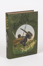
Zweites Tausend. München und Leipzig, Druck und Verlag von R. Oldenbourg, 1891. 16 cm x 23 cm. Frontispiece, VI, 560 pages. Large fold-out map within sleeve of rear pastedown showing the “Emin Pascha Expedition.” / Mit der grossformatigen Faltkarte in Kartentasche (im hinteren Einbanddeckel). Hardcover [publisher’s original green cloth] with gilt lettering and pictorial on spine. Large pictorial on front board. Beautifully illustrated pastedowns and endpapers. Maroon coloured text-block edges. / Originaler, illustrierter Verlagsleinenband mit sehr dekorativer Einbanddeckel- und Einband-Ruecken-Illustration. Very good+ condition with only minor signs of external wear. Ex libris of Mark Walder on front pastedown. University stamp on p.IV. Discreet bookseller’s label of ‘R. Oldenbourg, München’, at bottom corner of rear pastedown. Some browning to reverse of fold-out map. Interior is bright and clean with sharp corners. / Sehr guter Zustand mit nur geringen Gebrauchsspuren. Ganz kleiner Einriss am Vorsatzpapier.

EUR 220,-- 

Show details   Add to cart

[Roberts, Géographie Physique, Historique et Politique de la France

30. [Roberts, William] [Exlibris Gulielme (sic) Roberts] Bonnechose, Émile de / L.Dussieux (cartographer).

Géographie Physique, Historique et Politique de la France avec dix-huit cartes coloriées représentant la formation successive du Royaume.

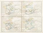
Paris, Firmin Didot Frères, 1847. Octavo (14 cm x 23 cm). V, (2), 104 pages, suivies de 18 cartes aux contours colorisés, de la France dans ses états successifs (104 pages plus 18 hand-coloured maps of France by L.Dussieux showing France through its History, with special maps showing historical military events with England etc. Original Softcover. Spine rubbed and slightly damaged. Otherwise in very good condition with only minor signs of wear. Name of preowner William Roberts in pencil on titlepage [being William Roberts of the irish family Westropp-Roberts].

EUR 220,-- 

Show details   Add to cart

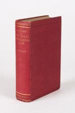
Stuart, A History of the Zulu Rebellion 1906, and of Dinuzulu's arrest, trial an

31. Stuart, J.

A History of the Zulu Rebellion 1906, and of Dinuzulu’s arrest, Trial and Expatriation. With Five Maps, Six Plans and Twenty Five Illustrations.

London, Macmillan and Co. Ltd, 1913. 14.5 cm x 22.5 cm. Frontispiece, XVI, 581 pages. Large fold-out map sheet at rear, showing a Key Map of Natal and Area of Operations. Hardcover [publisher’s original red cloth] with gilt lettering on spine. Gilt top edge. Very good condition with only minor signs of external wear. Minor foxing to edges and tissue-guards, as usual with this publication. Interior bright and clean besides very minor signs of foxing.

EUR 220,-- 

Show details   Add to cart

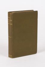
Norris-Newman, With the Boers in the Transvaal and the Orange Free State in 1880

32. Norris-Newman, Charles L.

With the Boers in the Transvaal and the Orange Free State in 1880-1 / With A New Map of the South African Republic and Text of the Convention of 1884. [Including an extensive Appendix with a Glossary of Local Terms used in South Africa – The Transvaal Volksraad – Convention Between Her Majesty the Queen of the United Kingdom of Great Britain and Ireland and the South African Republic – Notices of the Boer Leaders etc.].

Second Edition. London, Abbott, Jones & Co., Limited, (1881). 15 cm x 22.5 cm. XVI, 392 pages. Fold-out map near front showing South African Republic. Hardcover [publisher’s original khaki cloth] with gilt lettering and tooling on spine. Blind ruling on boards. Very good condition with only minor signs of external wear. Appendix unopened (uncut). Binding firm and strong. Interior is bright and clean with sharp corners. Preowner’s name on half-title: “Miss McCracken – 19th Dec.1899”.

EUR 275,-- 

Show details   Add to cart

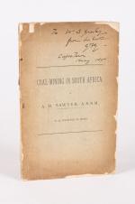
Sawyer, Coal-Mining in South Africa.

33. Sawyer, A.R. / [G.F.Gresley / W.S.Gresley].

Coal-Mining in South Africa.

Newcastle, G.T. Bagguley, no year (c.1890). 15.5 cm x 24.5 cm. 44 pages. Excellent, larger fold-out-map (coloured) at rear of the publication, showing the South African coalfields. Several fold-out tables and diagrams at rear related to the coalfields. Softcover / Publisher’s original, printed wrappers. Poor condition of this very scarce pamphlet with strong signs of external wear and chipping to boards. Occasional annotations within the publication. Interior bright and clean. Private gift-inscription in ink on the frontcover: “To W.S.Gresley from his brother G.F.G. [G.F.Gresley]– Capetwon – May – 1890”. [G.F.Gresley was author of e.g.: “The Early History of Robben Island”].

EUR 275,-- 

Show details   Add to cart

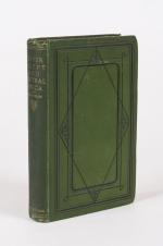
Petherick, Egypt, The Soudan and Central Africa. With Explorations from Khartoum

34. Petherick, John.

Egypt, The Soudan and Central Africa. With Explorations from Khartoum on the White Nile to the Regions of the Equator Being Sketches from Sixteen Years’ Travel.

Edinburgh and London, William Blackwood and Sons, 1861. 15 cm x 23 cm. XII, 482 pages. With large, fold-out ‘Sketch Map of John Petherick’s Travels in the years 1853-1858’. Hardcover / Original green publisher’s cloth with gilt lettering on spine. Design to front board. One corner stronger bumped. Otherwise in very good+ condition with only minor signs of external wear. The map in excellent condition. Very Rare !

EUR 375,-- 

Show details   Add to cart

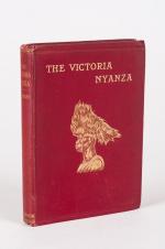
Kollmann, The Victoria Nyanza - The Land, the Races and their Customs, with Spec

35. Kollmann, Paul [trans. Nesbitt, H.A. / Hole, Hugh Marshall ].

The Victoria Nyanza – The Land, the Races and their Customs, with Specimens of some of the Dialects. With a Map and 372 Illustrations from Native Objects in the Author’s Own Collections.

London, Swan Sonnenschein & Co., 1899. 17 cm x 24 cm. IX, 254 pages. Large fold-out map of region near front. Hardcover [publisher’s original maroon cloth] with gilt lettering on spine and front board. Gilt design and blind tooling to front board. Deckled edges. Excellent condition with only minor signs of external wear. Some signs of foxing to edges and throughout. Binding strong and firm. Interior unmarked. From the library of Hugh Marshall Hole, with his bookplate to front pastedown. Hole’s name also in form of a name-stamp on front endpaper and titlepage. Rare ! But rather scarce in this excellent condition !

EUR 450,-- 

Show details   Add to cart

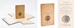
Daubeny, Sketch of the Geology of North America

36. Daubeny, Charles.

Sketch of the Geology of North America, being the Substance of a Memoir read before the Ashmolean Society Nov. 26, 1838.

First Edition. Oxford, Printed by T. Combe / The Ashmolean Society, 1839. Octavo. Frontispiece [Folded map of the eastern half of North America], XVIII, 73 pages. Original Softcover / Original printed wrappers in custom made cloth-case (see images). Content-Page detached and loosely inserted. Otherwise this publication is in its very rare original state and in excellent condition with only minor signs of external wear.

EUR 475,-- 

Show details   Add to cart

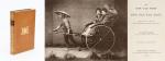
Barneby, The New Far West and The Old Far East

37. Barneby, W. Henry.

The New Far West and The Old Far East – Being Notes of a Tour in North America, Japan, China, Ceylon, Etc. With Maps and Illustrations. [Including an Appendix on the Supplementary Treaty of Commerce between the United States and Japan].

London, Edward Stanford, 1889. Quarto. Frontispiece, X, 316 pages with three large fold-out-maps in colour and eight illustrations in black-and-white. Hardcover / Stunning 19th century prize-binding in beautiful full tan calf bearing the Arms of Monmouth Grammar School [with their Motto “Serve and Obey”]. Inscription and embossed stamp of Monmouth – Grammar School to endpaper. Dedicated by Headmaster C.M.Roberts to former pupil W.A.Lamb in July 1890. Excellent condition with only minor signs of wear.

EUR 480,-- 

Show details   Add to cart

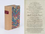
Cary's New Itinerary: Or an Accurate Delineation of the Great Roads, Both Direct and Cross throughout England and Wales: With Many of the Principal Roads in Scotland.

38. Cary, John.

Cary’s New Itinerary: Or an Accurate Delineation of the Great Roads, Both Direct and Cross throughout England and Wales: With Many of the Principal Roads in Scotland. From an Actual Admeasurement by John Cary: Made by Command of his Majesty’s Postmaster General for official purposes: Under the Direction and Inspection of Thomas Hasker Esq., Surveyor and Superintendant of the Mail Coaches. [Including an advertising for Cary’s New Celestial and Terrestrial Globes (with Illustrations of Globes)]. [Subtitle:] This work shows the immediate Route from the Metropolis [London] to all parts of England and Wales: And from Town to Town in every direction, distinguishing also the Cities, Market, Borough and Corporate Towns: And those at which the Assizes are held and gives the time of the Mails, Arrival and Departure from each, Describes the Line of the Navigable Canals and the Course of the Rivers passed over, The Number of Houses and Inhabitants contained in each Town, And those Inns which supply Post Horses and Carriages. Also The Inn’s throughout the Metropolis [London] from which the Mail and Stagecoaches go, their time of departure & the Route they seveerally take. The Noblemen and Gentlemen’s Seats situate near the Roads, A List of the Packet Boats and their time of sailing. Copious Indexes. Maps of the Lot Wight Environs of London, Bath, Brighton, Margate & Cheltenham & a Large Map of England and Wales peculiarly adapted to the Work. – [An Advertisement juxtaposed to the titlepage reads: “This Edition contains the Routes to upwards of Nine Thousand Places, which have never been given in any work of a similar Description; being a complete Directory to every Parish situate out of the Line of the Direct and Cross Roads throughout England and Wales”].

Seventh Edition, with Improvements [complete with all maps as called for]. London, Printed for J. Cary, 1817. Octavo. Pagination: [1], 647 pages plus 7 maps / Detailed pagination see here: [1], Title, Large Folding Map, [121], 6 folded Maps, [526] pages. Modern, recent Hardcover / Very decorative half-leather with marbled-paper-covered boards. Gilt lettering on new sppine-label. New endpapers. Protective Mylar. Only the large folding map with a inor tear (one part of the map deliberately bound separate (geniously folding out to meet th erest of the map). Interior text and maps all in excellent, unusually clean condition !!

EUR 480,-- 

Show details   Add to cart

Daniel Paterson & Edward Mogg - Paterson's Roads [1831/1832 Edition (18th Edition) with 12 Maps]

39. [Paterson, Daniel] Mogg, Edward.

Paterson’s Roads [1831/1832 Edition (18th Edition)] – Being an entirely original and accurate Description of all the direct and Principal Cross Roads in England and Wales, with part of the roads of Scotland. [Including an “Appendix to the Eighteenth Edition of Paterson’s Roads; being An Accurate Description of the Direct and Principal Cross roads communicating with the Improved Old Passage Ferry, across the River Severn, between Aust and Beachley, near Chepstow. Accompanied by a Map of the Banks of the Wye. To which are added, Course of the Chepstow Steam Packets; and An arranged Tour through Wales, with References to the pages in the Body of the Work, where connection with various lines of Road takes place.”]. The Eighteenth Edition. To which are added Topographical Sketches of the several Cities, Market Towns and remarkable Villages and descriptive accounts of the principal seats of the Nobility and Gentry, the Antiquities, Natural Curiosities and other Remarkable Objects throughout the Kingdom. The whole Remodelled, Augmented and Improved by the Addition of Numerous New Roads and New Admeasurements, and Arranged upon A Plan at once Novel, clear and intelligible, is deduced from the latest and best Authorities: Including a Table of the Heights of Mountains from the Grand Trigonometrical Survey of the Kingdom; Also a Table of the Population, From the Census of 1831; To which is annexed the Arrival and Departure of the Mail, together with the Rates of Postage and An Entirely New Set of Maps.

London, Printed for Longman, Rees, Orme, Brown, Green and Longman, 1831/1832. Octavo (15 cm x 21,5 cm). Fontispiece – Fold-out-Map, 715 pages plus 44 pages of an Appendix. With twelve (12) Maps, including the frontipiece-map and full-page maps throughout the publication. Hardcover / Private half-leather of the early 20th century with gilt lettering on the spine. Some of the maps with visible reapirs but complete. Very good condition with only minor signs of wear. This being the so-called “Best Edition”.


EUR 480,-- 

Show details   Add to cart

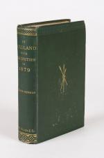
Norris-Newman, In Zululand With The British Throughout the War of 1879.

40. Norris-Newman, Charles L.

In Zululand With The British Throughout the War of 1879.

London, W. H. Allen 1880. 14.5 cm x 23 cm. Frontispiece, XV, 343 pages. Illustrated throughout with portraits. Includes the vintage photograph of Sir Henry Bartle Edward Frere (including tissue-guard), 3 fold-out plans. With the often missing large fold-out Military Map of Zulu Land and Adjacent Parts of Natal and Transvaal. Hardcover [publisher’s original green cloth] with gilt lettering on spine. Design on front board. First layer, with frontispiece, slightly detached. Otherwise in very good+ condition with only minor signs of external wear. Interior bright and clean, with very minor spotting near front. Ink markings to first page of first chapter. Bookplate / Exlibris of Davenport House (Bridgnorth) to front pastedown with the printed motto “Audentes Fortuna Junat”. Extremely rare, rather scarce and even scarcer with the large folding-map included !

EUR 680,-- 

Show details   Add to cart

Page: 1 2 3
:

Order by: Author · Title · Keyword · Year · Price (up) · Price (down) · Inventory Number · Recent Changes · Relevance

Books per page: 10 · 20 · 50 · 100

Contact

Inanna Rare Books Ltd.
Woodley House
Castletownshend Road
P81 D262 Skibbereen, County Cork
Ireland
Phone: ++353 - (0) 87 - 102 5412
E-Mail: info@inannararebooks.com
Internet: https://www.inannararebooks.com

Online Bookshop specialized in rare
and secondhand books.

Newsletter and E-Catalogue Sign Up

Enter your name and e-mail address to sign up for
our regular newsletter and catalogue service.

Payment Options

Paypal   Master Card   VISA   American Express

Legal Info

  • Terms & Conditions
  • Contract Withdrawal
  • Cancellation Policy
  • Privacy Policy
  • Shipping Information
  • Imprint

© 2026 Inanna Rare Books Ltd. | Powered by HESCOM-Software

Follow Us