The Philosophy of the Human Voice: Embracing its Physiological History; Together with a System of Principles, by which Criticism in the Art of Elocution may be Rendered Intelligible and Instruction, definite and comprehensive – To which is added a brief Analysis of Song and Recitative.
Second edition, enlarged. Philadelphia, Grigg & Elliott, 1833. 8°. 432 pages. Original Hardcover with new spinelabel. Now in protective collector’s mylar. Binding rubbed, some foxing to the interior but the Volume tight and firm. Rare !
EUR 128,--


![[Song of Solomon] Book of Wisdom. The Song of Songs.](/images/thumbnails/44570AB.jpg)


![[George Crockett Strong] - U.S. Infantry Tactics, for the Instruction, Exercise and Manoeuvres of the United States Infantry](/images/thumbnails/29388AB.jpg)
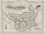
![Tallis, United States [of America]](/images/thumbnails/2012AG.jpg)
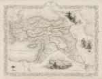
![Tallis, Venezuela, New Granada, Equador [Ecuador] and the Guayanas](/images/thumbnails/2008AG.jpg)