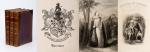
Vallancey, Charles / Piers, Sir Henry [Provenance: Abraham Abell (Cork City)].
Collectanea de Rebus Hibernicis – Five-Volume-Set with thirteen (13) Numbers (I – XIII) plus “A Vindication of the Ancient History of Ireland” and “Anecdotes of Chess in Ireland”. [See full list of Numbers, Chapters and Illustrations below and detailed images on our website].
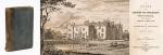
Dublin, Thomas Ewing, 1770 – 1790. Octavo (13,5 cm wide x 21,5 cm high). Pagination: Volume I (contains Numbers I, II, III, IV): Frontispiece-Portrait, XIV, [6 unnumbered pages of “Contents”], 636 pages, [2] pages with the contents-page misbound [2], and 24 pages on “The Brehon Laws of Ireland” to the rear of the Volume. Volume I includes three illustrations (including the Large Folding-Map of Meath)/ Volume II (contains Numbers V, VI, VII, VIII, IX): 562 pages and 10 illustrations (including the Large Folding-Plan of the City of Kilkenny) / Volume III (contains Numbers X, XI, XII): LXX, 682 pages with one illustration (being the Large Fold-Out-Map of “Antient Ireland” by William Beauford) and VI Tables on two large sheets in the rear of the Volume (containing Orthography/Names of Numbers in different Languages, Names of Numbers of some of the Indians of America etc. etc. compared to the antient Irish) / Volume IV (contains Number XIII of Collectanea de Rebus Hibernicis and “A Vindication of the Ancient History of Ireland” by Charles Vallancey”): LX, 161 pages (being the end of Number XIII), plus Pagination for “The Vindication of the Ancient History of Ireland”: Frontispiece-Map of Europe and Asia, XLVIII, 551 pages, followed by 16 unnumbered pages of an Index for “The Ancient History of Ireland”, followed by X (10) Plates (mainly fold-out plates with numerous illustrations for the “Ancient History of Ireland”, aslo included is a text-illustration “Inscription in the Cave of New Grange (page 212). / Volume V of Collectanea de Rebus Hibernicis: 368 pages plus Hardcover / Original 19th century full-leather with gilt lettering and ornament to spine. Very good condition with only minor signs of wear. Spine of Volume Three is coming apart. From the library of Cork Antiquarian Abraham Abell, with an inscription and original manuscript letter by his friend and “Brother Antiquarian”, John Bennett, 9 Academy St., 18th September, 1841.


![Christoph Weigel - Insulae Britannicae Antiquae [with Ireland and Scotland] ex collatione veterum Geographorum](/images/thumbnails/100077AG.jpg)
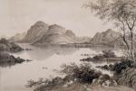
![[Anonymous], Views of Picturesque Locations in the British and Irish Isles](/images/thumbnails/200089AG.jpg)
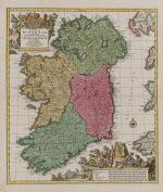
![Vallancey, Collectanea de Rebus Hibernicis [Five Volume - Set]](/images/thumbnails/31502AB.jpg)
![Philip Luckombe, The Compleat Irish Traveller [Luxury Reprint with all of Charles Smith's Illustrations of 18th century Ireland (Munster / Kerry / Waterford) in separate Folder for Framing]](/images/thumbnails/31432AB.jpg)

![Jean-Denis Barbié du Bocage - Tableau de la Grande-Bretagne, De L'Irlande et des Possessions Angloises dans les quatre parties du Monde. [Large Paper Copy / Better Paper Copy / Exemplaire de Luxe]](/images/thumbnails/28935AB.jpg)
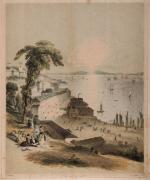
![Finden, Glenmire Bridge - Near Cork [Glanmire].](/images/thumbnails/100095AG.jpg)
![[Ireland] The Romantic Scenery of England, Ireland and Scotland.](/images/thumbnails/28636AB.jpg)
![[Anonymous]. Guide to Killarney and Glengariff. With a Map and Six Plates.](/images/thumbnails/29433AB.jpg)