


Travels through Germany. Containing observations on Customs, Manners, Religion, Government, Commerce, Arts, and Antiquities. With a particular account of the courts of Mecklenburg. Embellished with elegant Cuts of the Palaces and Gardens of the Dukes of Mecklenburg.
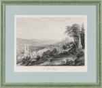
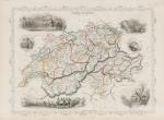
First Edition. Two Volumes (complete set). London, Printed for Edward and Charles Dilly, 1768. Octavo. Collation complete. Volume I: Frontispice: “View of the Palace of Strelitz”, (8), 391 pages with View of the “City of Hamburg”, “A Map of the Duchy of Mecklenburg – including the Island of Rugen” / Volume II: Frontispice: “View of the Palace of Ludwigslust”, (2), 395, (1) pages with “The Grand Cascade & Water Clock before the Palace Ludwigslust”, “The Cascade in the Wood, near the Summer House of Ludwigslust”, “The Two Cascades in the Wood near the little Summer House of Ludewigslust”, “The 2 Cascades with the Jet d’Eau at the Entrance of the Grand Avenue in the Gardens of Ludwigslust” , “The Caesar Grove”, “The Circle Cascade in the Gardens of Ludwigslust”, “Prospect of a Sluice in the Gardens of Ludwigslust which by the weight of the stream opens itself, lets off the water & shuts again”. With the Directions for the Binder and Errata to the rear of Volume II. Hardcover / Original 18th century half leather with gilt lettering and ornament on spine-labels. Front board of Volume one starting to separate. Otherwise in very good condition with all the illustrations and the often missing map in excellent condition. Rare and early work on Garden Architecture, Lustgarten, Wasserspiele (Water Games) etc. Armorial bookplate of Daniel Conner to pastedown of each Volume.
EUR 1.400,--
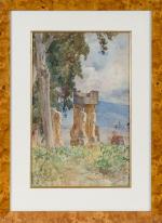
![[Anonymous], A View of the Royal Palace of the Fontainbleau.](/images/thumbnails/200088AG.jpg)
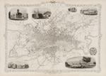
![Daniel Paterson & Edward Mogg - Paterson's Roads [1831/1832 Edition (18th Edition) with 12 Maps]](/images/thumbnails/31251AB.jpg)
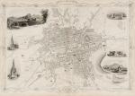
![Jean-Denis Barbié du Bocage - Tableau de la Grande-Bretagne, De L'Irlande et des Possessions Angloises dans les quatre parties du Monde. [Large Paper Copy / Better Paper Copy / Exemplaire de Luxe]](/images/thumbnails/28935AB.jpg)
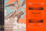
![Charles Lever / George Cruikshank - Arthur O'Leary - His Wanderings and Ponderings in Many Lands. [William Rees-Mogg's personal copy with Bookplate from Cholwell House]](/images/thumbnails/29886AB.jpg)


![Amsterdam in Beeld. [From the library of Frederic Zelnik]](/images/thumbnails/24480AB.jpg)


