


The Travels of Mirza Abu Taleb Khan in Asia, Africa, and Europe, during the years 1799, 1800, 1801, 1802, and 1803. Written by himself, in the Persian language. [With an Appendix: ‘Author’s Vindication of the Liberties of the Asiatic Women’]. Translated by Charles Stewart, Esq.
First and only Edition. Two Volumes (complete set). London, Longman, Hurst, Rees, and Orme, 1810. Octavo. Frontispice-Portrait with original tissue-guard, VIII, (8), 320, 418 pages. Hardcover / Beautifully restored bindings by english master binders in stunning modern half-morocco with the original spine-labels applied. Original endpapers and pastedowns with the original bookplates / Exlibris preserved. Excellent condition with some browing and ghosting to the pages, as usual with this set. Name of historical preowner Richard Meade in ink on titlepages. Rare in this very amazing restored condition.
EUR 1.400,--
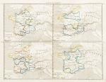
![[Anacharsis the Younger] Barthélemy, Travels of Anacharsis the Younger in Greece (1795 Edition with 31 Plans and Maps)](/images/thumbnails/31414AB.jpg)


![[Chiari, Giovanni] Vascellini, Gaetano - Statute di Firenze [Richard Meade - Ballymartle]](/images/thumbnails/28858AB.jpg)
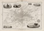
![Tallis, Channel Islands [Guernsey and Jersey]](/images/thumbnails/200116AG.jpg)


![Alpine Chronik des Oesterreichischen Touristen-Club [Angebunden: Heinrich Kempf - Die Flora des Schneeberges in Nieder-Oesterreich (1882)]](/images/thumbnails/120268AB.jpg)

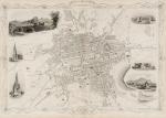
![David Henry, An historical account of the curiosities of London and Westminster [and The Tower and St.Paul's Cathedral]](/images/thumbnails/31196AB.jpg)
![Livy / Titus Livius. Historiarum quod exstat, cum integris Joannis Freinshemii [Johann Freinsheim] Supplementis.](/images/thumbnails/29165AB.jpg)
![[Newbery & Carnan]. A Description of England and Wales](/images/thumbnails/28931AB.jpg)
![[Anonymous], A View of the Royal Palace of the Fontainbleau.](/images/thumbnails/200088AG.jpg)
![Daniel Paterson & Edward Mogg - Paterson's Roads [1831/1832 Edition (18th Edition) with 12 Maps]](/images/thumbnails/31251AB.jpg)
![Jean-Denis Barbié du Bocage - Tableau de la Grande-Bretagne, De L'Irlande et des Possessions Angloises dans les quatre parties du Monde. [Large Paper Copy / Better Paper Copy / Exemplaire de Luxe]](/images/thumbnails/28935AB.jpg)
![Charles Lever / George Cruikshank - Arthur O'Leary - His Wanderings and Ponderings in Many Lands. [William Rees-Mogg's personal copy with Bookplate from Cholwell House]](/images/thumbnails/29886AB.jpg)


![Amsterdam in Beeld. [From the library of Frederic Zelnik]](/images/thumbnails/24480AB.jpg)


